The Uffe has its source on the Großer Bockstalskopf in Lower Saxony, a subpeak of the Ravensberg mountain, and flows through the town of Bad Sachsa down to the village of Neuhof[de; nl] (belongs to Bad Sachsa). From there the Uffe is known as the Sachsengraben ("Saxon Ditch") and continues to the village of Branderode[de; nl] (belongs to Hohenstein).
The stream then sinks into the gypsum karst, before reaching the River Wieda beyond the village of Obersachswerfen[de; nl] (belongs to Hohenstein). The Wieda, too, regularly dries up behind the hamlet of Wiedigshof.
Until the middle of the last century the Uffe divided in the village of Neuhof. The main stream flowed towards Klettenberg and Holbach where its water power was used in several mills. This stream is still called the Uffe today. The branch running towards Branderode is called the Sachsengraben and passes the villages of Branderode and Obersachswerfen before discharging below Schwinden into the Wieda, which flows into the Zorge downstream of Schwinden. The waters of the Zorge pass down the Helme, Unstrut and Saale into the Elbe.
Today the Uffe has no direct route beyond Neuhof (a sewage farm intervenes) and it now begins in front of a bridge (Branderode - Klettenberg road) about 5 metres above the Sachsengraben. Due to the lack of a link to the 'main' Uffe, it is usually dry there, is filled by springs and flows through the villages of Klettenberg and Holbach, by the B 243 federal road, onto the Ichte.
Vogtland is a region spanning the German federal states of Bavaria, Saxony and Thuringia and north-western Bohemia in the Czech Republic. It overlaps with and is largely contained within Euregio Egrensis. The name alludes to the former leadership by the Vögte of Weida, Gera and Plauen.
Bad Sachsa is a town in the district of Göttingen, in Lower Saxony, Germany. The town was one of the few municipalities in West Germany that imported electric power from former East Germany. This was done via Neuhof Substation.
Walkenried Abbey was a Cistercian abbey located in the village of Walkenried in Lower Saxony, Germany. Founded in 1127 on the southern rim of the Harz mountain range, the remnants of the monastic complex since 2010 are part of the Upper Harz Water Regale World Heritage Site.
The South Harz Railway is a railway line through the German states of Lower Saxony and Thuringia. It runs from Northeim to Nordhausen, via Herzberg am Harz, Bad Lauterberg-Barbis, Bad Sachsa, Walkenried and Ellrich. The line is 69 kilometres (43 mi) long.
Osterhagen is a village near the town of Bad Lauterberg in the district of Göttingen in Lower Saxony, Germany. The village lies between Bad Lauterberg and Bad Sachsa. Not far from Osterhagen is the Weingartenloch, a supposed treasure cave. The Karstwanderweg passes nearby.
Neuhof Substation is a 110 kV substation in Neuhof, an urban part of Bad Sachsa, Lower Saxony. The Neuhof substation went in service in 1985 and was connected with a 110 kV-powerline for three phase alternating current with the Wolkramshausen substation in former East Germany. It was therefore one of the few substations in former West Germany, into which electricity from GDR was fed. Through the Neuhof substation up to 40 MVA could be imported. Up to 25 MVA of the imported power could be fed via 5 rotary motor-generators, which were manufactured by Siemens and used for the compensation of frequency fluctuations of the East German power grid, into the power grid of West Germany. Additionally power was fed directly from the East German power grid into the grids of Bad Sachsa, Walkenried, Zorge and Wieda. The converters consisted of a three-phase asynchronous motor with a short circuited rotor on the driving side and an asynchronous generator with a slip-ring fed rotor, whereby the frequency adjustment was made by a static frequency inverter, which feeds the rotor. Startup of a converter took place using the slip-ring rotor with a conventional starter circuit. After the converter had reached its nominal speed, the short circuited rotor was connected, which then took over the drive. In April 1990 the plant was shut down and between 2003 and 2005 the machines were dismantled. The machine halls stand still today and are used by Harzenergie for internal purposes.
The Bramwald is a range of hills up to 408.1 m above sea level (NN) in the Weser Uplands in Lower Saxony (Germany). It is a unique, natural, wild, hill and forest landscape. This is particularly so in the north around the Totenberg.
Wietze is a river in the South Lüneburg Heath, in Lower Saxony, Germany, 25 kilometres (16 mi) long, a tributary of the Örtze.
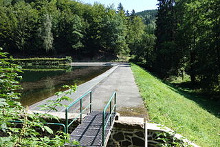
Wieda is a river in the German states of Lower Saxony and Thuringia.
The Alter Stolberg is a wooded karst plateau, up to 357.7 m above sea level (NN), in the South Harz in Central Germany. It lies in the districts of Nordhausen in the state of Thuringia and Mansfeld-Südharz in the state of Saxony-Anhalt.
The Kaiser Way, literally "Emperor Way", is a thematic long distance footpath in the Harz mountains of Germany, which is about 110 km long and crosses both the Harz and the Kyffhäuser hills. From Goslar and Bad Harzburg on the northern edge of the Harz it runs across the Harz to Walkenried in the south; and then via Nordhausen to Tilleda on the Kyffhäuser.
The Helme is river in central Germany that is about 65 kilometres (40 mi) long and which forms a left-hand, western tributary of the Unstrut in the states of Thuringia and Saxony-Anhalt.
The Rappbode is a right-hand, southwestern tributary of the River Bode in the Harz mountains in the German state of Saxony-Anhalt. In its lower reaches it is impounded by the Rappbode Dam, the largest dam in the Harz.
The B 243 runs from Hildesheim over Seesen and Herzberg am Harz to Nordhausen.
The Zorge is a tributary of the Helme in central Germany. It is about 40 km (25 mi) long and flows from the state of Lower Saxony into Thuringia. In many sources the name Zorge is translated as "wild river".
Hohegeiss is a health resort and winter sports village in the Harz mountains range in Lower Saxony, Germany. Since 1 July 1972 Hohegeiss has been part of the town of Braunlage, in the district of Goslar.
The Erms is a river of the karstified Swabian Alb, Baden-Württemberg, Germany. It flows into the Neckar in Neckartenzlingen. On its way from the Karst spring to the next large municipality Bad Urach, a former Erms sedimented, especially during floods, no less than 8 valley cataracts, where chemically precipitated travertine repeatedly drops ca. 2–5 m.
Rüdigsdorf Switzerland is a range of hills up to 350.1 m above sea level (NN) near the village of Rüdigsdorf in the district of Nordhausen in the German state of Thuringia.
The Steina Dam in the Harz Mountains of central Germany is a dam system comprising a dam, reservoir and waterworks near the village of Steina and belongs to the unincorporated area of Harz in the county of Osterode am Harz in Lower Saxony.
This page is based on this Wikipedia article Text is available under the CC BY-SA 4.0 license; additional terms may apply. Images, videos and audio are available under their respective licenses.