Gmina Kamionka Wielka is a rural gmina in Nowy Sącz County, Lesser Poland Voivodeship, in southern Poland. Its seat is the village of Kamionka Wielka, which lies approximately 9 kilometres (6 mi) south-east of Nowy Sącz and 82 km (51 mi) south-east of the regional capital Kraków.
Gmina Muszyna is an urban-rural gmina in Nowy Sącz County, Lesser Poland Voivodeship, in southern Poland, on the Slovak border. Its seat is the town of Muszyna, which lies approximately 33 kilometres (21 mi) south-east of Nowy Sącz and 105 km (65 mi) south-east of the regional capital Kraków.
Gmina Nawojowa is a rural gmina in Nowy Sącz County, Lesser Poland Voivodeship, in southern Poland. Its seat is the village of Nawojowa, which lies approximately 8 kilometres (5 mi) south-east of Nowy Sącz and 81 km (50 mi) south-east of the regional capital Kraków.
Czyrna is a village in the administrative district of Gmina Krynica-Zdrój, within Nowy Sącz County, Lesser Poland Voivodeship, in southern Poland, close to the border with Slovakia. It lies approximately 10 kilometres (6 mi) north-east of Krynica-Zdrój, 29 km (18 mi) south-east of Nowy Sącz, and 102 km (63 mi) south-east of the regional capital Kraków.

Piorunka is a village in the administrative district of Gmina Krynica-Zdrój, within Nowy Sącz County, Lesser Poland Voivodeship, in southern Poland, close to the border with Slovakia. It lies approximately 9 kilometres (6 mi) north of Krynica-Zdrój, 27 km (17 mi) south-east of Nowy Sącz, and 100 km (62 mi) south-east of the regional capital Kraków.

Barnowiec is a village in the administrative district of Gmina Łabowa, within Nowy Sącz County, Lesser Poland Voivodeship, in southern Poland. It lies approximately 7 kilometres (4 mi) west of Łabowa, 14 km (9 mi) south-east of Nowy Sącz, and 86 km (53 mi) south-east of the regional capital Kraków.
Czaczów is a village in the administrative district of Gmina Łabowa, within Nowy Sącz County, Lesser Poland Voivodeship, in southern Poland. It lies approximately 5 kilometres (3 mi) west of Łabowa, 13 km (8 mi) south-east of Nowy Sącz, and 86 km (53 mi) south-east of the regional capital Kraków.
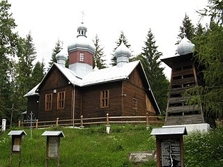
Kamianna is a village in the administrative district of Gmina Łabowa, within Nowy Sącz County, Lesser Poland Voivodeship, in southern Poland. It lies approximately 6 kilometres (4 mi) east of Łabowa, 21 km (13 mi) south-east of Nowy Sącz, and 94 km (58 mi) south-east of the regional capital Kraków.
Kotów is a village in the administrative district of Gmina Łabowa, within Nowy Sącz County, Lesser Poland Voivodeship, in southern Poland. It lies approximately 3 kilometres (2 mi) south-east of Łabowa, 18 km (11 mi) south-east of Nowy Sącz, and 91 km (57 mi) south-east of the regional capital Kraków.
Krzyżówka is a village in the administrative district of Gmina Łabowa, within Nowy Sącz County, Lesser Poland Voivodeship, in southern Poland. It lies approximately 9 kilometres (6 mi) south-east of Łabowa, 25 km (16 mi) south-east of Nowy Sącz, and 97 km (60 mi) south-east of the regional capital Kraków.

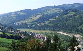
Łabowa is a village in Nowy Sącz County, Lesser Poland Voivodeship, in southern Poland. It is the seat of the gmina called Gmina Łabowa. It lies approximately 16 kilometres (10 mi) south-east of Nowy Sącz and 90 km (56 mi) south-east of the regional capital Kraków.
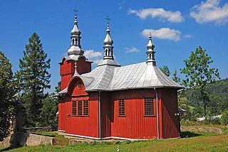
Łosie is a village in the administrative district of Gmina Łabowa, within Nowy Sącz County, Lesser Poland Voivodeship, in southern Poland. It lies approximately 9 kilometres (6 mi) south-east of Łabowa, 24 km (15 mi) south-east of Nowy Sącz, and 97 km (60 mi) south-east of the regional capital Kraków.
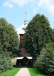
Maciejowa is a village in the administrative district of Gmina Łabowa, within Nowy Sącz County, Lesser Poland Voivodeship, in southern Poland. It lies approximately 16 kilometres (10 mi) south-east of Nowy Sącz and 89 km (55 mi) south-east of the regional capital Kraków.
Nowa Wieś is a village in the administrative district of Gmina Łabowa, within Nowy Sącz County, Lesser Poland Voivodeship, in southern Poland. It lies approximately 4 kilometres (2 mi) south-east of Łabowa, 19 km (12 mi) south-east of Nowy Sącz, and 92 km (57 mi) south-east of the regional capital Kraków.
Roztoka Wielka is a village in the administrative district of Gmina Łabowa, within Nowy Sącz County, Lesser Poland Voivodeship, in southern Poland. It lies approximately 9 kilometres (6 mi) south-east of Łabowa, 25 km (16 mi) south-east of Nowy Sącz, and 98 km (61 mi) south-east of the regional capital Kraków.
Składziste is a village in the administrative district of Gmina Łabowa, within Nowy Sącz County, Lesser Poland Voivodeship, in southern Poland. It lies approximately 5 kilometres (3 mi) south-west of Łabowa, 15 km (9 mi) south-east of Nowy Sącz, and 88 km (55 mi) south-east of the regional capital Kraków.
Szczawnik is a village in the administrative district of Gmina Muszyna, within Nowy Sącz County, Lesser Poland Voivodeship, in southern Poland, close to the border with Slovakia. It lies approximately 4 kilometres (2 mi) north-west of Muszyna, 30 km (19 mi) south-east of Nowy Sącz, and 101 km (63 mi) south-east of the regional capital Kraków.
Nawojowa is a village in Nowy Sącz County, Lesser Poland Voivodeship, in southern Poland. It is the seat of the gmina called Gmina Nawojowa. It lies approximately 8 kilometres (5 mi) south-east of Nowy Sącz and 81 km (50 mi) south-east of the regional capital Kraków.
Sucha Struga is a village in the administrative district of Gmina Rytro, within Nowy Sącz County, Lesser Poland Voivodeship, in southern Poland. It lies approximately 2 kilometres (1 mi) south-east of Rytro, 16 km (10 mi) south of Nowy Sącz, and 84 km (52 mi) south-east of the regional capital Kraków.


