This article needs additional citations for verification .(May 2025) |
Ujire | |
|---|---|
Town | |
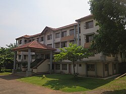 Sidhavana Gurukula, Ujire | |
 Ujire Location in Karnataka, India | |
| Coordinates: 12°59′31″N75°19′55″E / 12.992°N 75.332°E | |
| Country | India |
| State | Karnataka |
| District | Dakshina Kannada |
| Area | |
• Total | 26.57 km2 (10.26 sq mi) |
| Population (2011) | |
• Total | 13,429 |
| • Density | 510/km2 (1,300/sq mi) |
| Languages | |
| • Official | Kannada |
| • Regional | Konkani, Tulu, Kannada, Beary |
| Time zone | UTC+5:30 (IST) |
| PIN | 574 240 |
| Telephone code | 08256 |
| Vehicle registration | KA-21(Puttur RTO). KA-19(Mangaluru RTO).KA-70(Bantwal ARTO) |
Ujire is a town near Dharmasthala in Karnataka, India. It is in Belthangady taluk of Dakshina Kannada district. [1] Ujire is an important junction for travelers in this region. The road at Ujire deviates to Dharmasthala (towards Hassan, Bengaluru), Kottigehara (towards Horanadu, Chikkamagaluru) and Belthangady (towards Mangaluru).

