
Anticona, also called Ticlio, is a mountain in the Andes of Peru, about 5,150 metres (16,896 ft) high. It is located in the Lima Region, Huarochiri Province, Chicla District, and in the Junín Region, Yauli Province, Morococha District. Anticona lies between the Ticlio mountain pass in the southwest and Yanashinga in the northeast, northwest of a lake named Huacracocha.
Wachwaqucha is a lake in Peru located in the Lima Region, Huarochiri Province, Carampoma District. It lies northwest of Millpu and Wachwa and southwest of Wamp'arqucha.

Tiktiqucha is a lake in Peru located in the Lima Region, Huarochirí Province, Chicla District. Tiktiqucha lies near the Antikuna mountain pass, southwest of a lake named Waqraqucha and southeast of the peak of Tikti Mach'ay.

Putka is a mountain in the Cordillera Central in the Andes of Peru, about 5,100 metres (16,732 ft) high. It is slocated in the Lima Region, Huarochirí Province, Chicla District.

Tawlli Urqu is a mountain in the Andes of Peru, about 4,000 metres (13,123 ft) high. It is situated in the Ayacucho Region, Víctor Fajardo Province, Huamanquiquia District, southeast of Sarhua.
Mulli is a mountain in the Cordillera Central in the Andes of Peru, about 5,000-metre (16,404 ft) high. It lies in the Lima Region, Huarochirí Province, San Damian District. It is situated on a ridge southwest of Utush Mikhunan is situated northwest of Uqhu and Suyruqucha.
Wamp'ar is a mountain in the Andes of Peru, about 4,800 m (15,748 ft) high. It is situated in the Lima Region, Huarochirí Province, Carampoma District. Wamp'ar lies west of Ukrupata and northeast and east of the two lakes named Wachwaqucha and Wamp'arqucha.
Wamp'arqucha is a lake in Peru located in the Lima Region, Huarochiri Province, Carampoma District. It lies northeast of Wachwaqucha at a mountain named Wamp'ar.
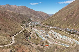
Chuqi Chukchu is a 5,154-metre-high (16,909 ft) mountain in the Cordillera Central in the Andes of Peru. It is situated in the Lima Region, Huarochiri Province, Chicla District. Chuqi Chukchu lies near the Antikuna mountain pass, northwest of Wayrakancha and northeast of Quñuq P'ukru. The mining village of Q'asa P'allqa (Casapalca) lies at its feet.
Nina Ukru is a mountain in the Paryaqaqa or Waruchiri mountain range in the Andes of Peru, about 5,400 metres (17,717 ft) high. It is situated in the Lima Region, Huarochirí Province, Quinti District. Nina Ukru lies southwest of Qullqip'ukru and west of Paryaqaqa.
Hatun Ukru is a mountain in the Cordillera Central in the Andes of Peru, about 4,800 m (15,748 ft) high. It is situated in the Lima Region, Huarochirí Province, Quinti District. Hatun Ukru lies southwest of a lake named P'itiqucha.
Wiqu is a mountain in the Paryaqaqa or Waruchiri mountain range in the Andes of Peru, about 5,200 m (17,060 ft) high. It is located in the Lima Region, Huarochirí Province, Quinti District, and in the Yauyos Province, Tanta District. Wiqu lies southwest of Paryaqaqa and northeast of Parya Chaka.
Qarwa Ranra is a mountain in the La Viuda mountain range in the Andes of Peru, about 5,000 metres (16,404 ft) high. It is situated in the Lima Region, Huarochirí Province, on the border of the districts of Carampoma and Matucana. It lies northwest of Yana Yana.
Rukutu is a mountain in the Cordillera Central in the Andes of Peru, about 4,800 metres (15,748 ft) high. It is situated in the Lima Region, Huarochirí Province, on the border of the districts of Huarochirí and San Damian. It lies south of Suyruqucha and Suqlla, and northeast of Wamanripa.
Kinwa Ukru is a 5,006-metre-high (16,424 ft) mountain in the Andes of Peru. It is located in the Lima Region, Oyón Province, Oyón District. Kinwa Ukru lies west of a mountain named Aququcha.
Hatun Ukru is a 4,650-metre-high (15,260 ft) mountain in the Andes of Peru. It is located in the Pasco Region, Pasco Province, Ticlacayan District, northwest of the Waqurunchu mountain range.
Kunkus Yantaq is a 5,354-metre-high (17,566 ft) mountain in the Paryaqaqa mountain range in the Andes of Peru. It is located in the Lima Region, Huarochirí Province, San Mateo District. Kunkus Yantaq lies southeast of Qullqayuq.
Wank'a Ukru Punta is a 4,410-metre-high (14,470 ft) mountain in the Andes of Peru. It is located in the Huánuco Region, Dos de Mayo Province, Marías District. Wank'a Ukru Punta lies northwest of Tikti Punta and north of a lake named Saqsaqucha.
Sankha Ukru is a mountain in the Cordillera Central in the Andes of Peru which reaches a height of approximately 4,600 metres (15,092 ft). It is located in the Lima Region, Yauyos Province, Huancaya District.
Tawlli Qaqa is a mountain in the Cordillera Blanca in the Andes of Peru which reaches a height of approximately 4,800 m (15,700 ft). It is located in the Ancash Region, Huaylas Province, Santa Cruz District. Tawlli Qaqa lies at the Yuraqmayu valley south of Kitarahu, southwest of Kitaqucha and northwest of Hatunqucha.


