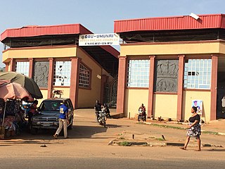
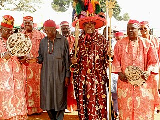
Eziowelle is a town in Idemili North local government area of Anambra State, Nigeria. Eziowelle translates into English as 'a good place'. It is an agrarian community lying about twenty-three kilometers east of Onitsha. The Vatican Cardinal Francis Arinze is a native of Ezoiwelle. Eziowelle is in Idemili North Local Government Area. It has boundaries with Abatete, Abacha, Nimo, Abagana, Ogidi, and Umunachi. Eziowelle is made up of five villages which are Umuikwele, Umunnama, Ezinimo, Okpaliko, and Ubulu. According to Peter Emelumgini, in his book, A Compendium Knowledge of Eziowelle, "the first people to settle in Eziowelle were the Uruojukwu and Uruogbuefi of Umuikwelle ... before Umuikwelle Etiti migrated from Ifite-Ikwele and settled, with the originals. In Umunnama, the Uruezenebo were the originals, or settled earlier before others came from Umunoha of Port Harcourt side. In Ezinimo village, the Umu-oba, Umu-Chidobelu-Ezeokobu, Umuagu, Uruama, Umudimatuand Umuawa settled earlierthan others before others came from Isi-Uzo Nsukka side when they were driven and scattered as a result of tribal wars. Some others later joined the village from other locations when they were driven out of the town as a result of misunderstanding and constant quarrelling from their relatives and that made them move and settle with the early settlers." The last two villages which are Okpaliko and Ubulu are believed to have migrated from Nteje, a town in the Anambra State of Nigeria between the 18th and 19th centuries. The town is ruled by a traditional ruler called "Igwe" as obtainable in other neighboring Igbo-speaking towns. The Igwe of Eziowelle is also called the Owelle of Eziowelle after Owelle the great ancestor of Eziowelle. The current Owelle of Eziowelle is Igwe Mike Okonkwo Etusi..The first OWelle of Eziowelle, Igwe Christian C. Anene relinquished the throne to the Owelle 2, after his death in 1990. The current Onowu of Eziowelle is Obi J. Akukwe.

Nnewi is a commercial and industrial city in Anambra State, southeastern Nigeria. It is the second largest city in Anambra state after Onitsha. Nnewi as a metropolitan area has two local government area, which are Nnewi North and Nnewi South. Even Ekwusigo local government area is now part of Nnewi urban area, as urbanization continues to spread from Nnewi to neighbouring communities. Nnewi North comprises four quarters: Otolo, Uruagu, Umudim, and Nnewichi. The first indigenous car manufacturing plant in Nigeria is located in the city while the first wholly Made-in-Nigeria motorcycle, the 'NASENI M1' was manufactured in Nnewi.

Nigeria has 774 local government areas (LGAs), each administered by a local government council consisting of a chairman, who is the chief executive, and other elected members, who are referred to as councillors. Each LGA is further subdivided into a minimum of ten and a maximum of twenty wards. A ward is administered to by a councillor, who reports directly to the LGA chairman. The councillors fall under the legislative arm of the local government, the third tier of government in Nigeria, below the state governments and the federal government.
Alor is one of the seven communities comprising the Idemili South Local Government of Anambra State in the southeast geopolitical zone of Nigeria. It is surrounded by seven neighbouring towns, namely Oraukwu, Nnobi, Abatete, Ideani, Uke, Adazi Ani and Nnokwa. Alor has several rivers which names in most cases are derived from the major idol of the village touched by the river – Mmili Ezigbo, Mmili Nwangene, Mmili Ọhọsha, Mmili Ideọhwọlọ, Mmili Iyiogwgwu, and Mmili Ọbịaja.
'Awka South Local Government Area (LGA) is made up of nine towns, namely, Amawbia, Awka, Ezinato, Isiagu, Mbaukwu, Nibo, Nise, Okpuno and Umuawulu. There are three major streets that span this area, which are the Zik Avenue, Works Road and Arthur Eze Avenue. In the past, the people of Awka South LGA were well known for blacksmithing. Today they are respected among the Igbo people of Nigeria for their technical and business skills.
Ozalla is a prominent town in Nkanu West Local Government Area of Enugu State, Nigeria.
Dunukofia is a Local Government Area in Anambra State, South-East Nigeria. Towns that make up the local government are Ukpo, the headquarters; Ifitedunu, Dunukofia Umunnachi, Umudioka, Ukwulu and Nawgu. It shares boundaries with Awka North, Idemili North, Njikoka and Oyi Local Governments.
Nzam is a town in Anambra West Local Government Area of Anambra State, Nigeria. The town has boundaries in the North with Inoma Akator; in the east with Mmiata Anam; in the west with the River Niger; and in the south with Umuenwelum Anam.
Enugwu Ukwu is a large town in Anambra State, Nigeria. Enugwu-Ukwu town is geographically situated on hilly terrain; thus it is named after its geographical topography. It is predominantly occupied by the Igbo people ethnic group of Anambra State. Most of its inhabitants are Christians. It is located in Njikoka Local Government Area of Anambra State. Major villages that make up the town include Uruokwe, Enu-Avomimi, Adagbe-Avomini, Umu-Atulu, Urualor, Akiyi, Avomimi, Awovu, Enuagu, Ire, Orji, Orofia, Osili, Umuakwu, Umuatulu, Umuatuora, Umuokpaleri, Uruekwo, Urukpaleke, Urunnebo, and Uruogbo.
Ozubulu is a larger town in Anambra State, Nigeria. It is the headquarters of the Ekwusigo Local Government Area.

Umueri, also known and pronounced as Umuleri, is an ancient town in the Anambra State of Southeastern Nigeria. The people of Umueri belong to the Igbo ethnic group, and the town has an estimated population of 1,500,000. It is located within the Anambra Valley, bordered by the Anambra River and Anam communities in the north, Nteje to the south, Aguleri and Nando in the east and Nsugbe in the western flank. The forebears are widely acknowledged as the first settler in Omambala valley. Umueri has three main quarters: Ezi Umueri, Ifite Umueri, and Ikenga Umueri.

Awgbu is a town in Orumba North Local Government Area of Anambra State, South East of Nigeria. The town of Awgbu had an estimated population of 120,000 as at 2006. Awgbu town shares boundaries in the west with Agulu and Mbaukwu; in the east with Ndikelionwu, Omogho, and Awa; in the north with Umuawulu and Amaetiti; while in the south with Amaokpala and Nanka. The indigenes of Awgbu are the descendant of Ezekanunu. Ezekanunu has six sons from five wives: They include Ugwu, Abor, Osikwu, Ohzu and Amaugo, and Mbulukor. The practice then being that inheritance are shared according to wives. There are five villages in Awgbu.
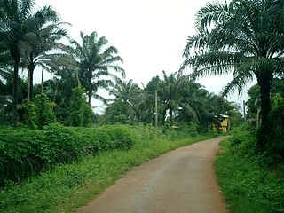
Umunya is an Olu Town and one of the five communities that make up Oyi Local Government Area (LGA) of Anambra State Nigeria. It is bordered by six neighbors: Ifite-Dunu, Awkuzu, Nteje, Nkwelle-Ezunaka, Ogbunike, and Umudioka. In the south lies Umudioka and Ifite-Dunu, both in Dunukofia LGA. In the north, Nteje and Nkwelle-Ezunaka. In the east, Awkuzu and in the west, Ogbunike. The boundaries are naturally demarcated by streams except at the border with Nkwelle-Ezunaka where an expanse of Umunya heath namely, Oli-Omoto, Ogwugwu-Obo, Ugwueze, etc. crossed the Kpokili River. Nearly all ten villages of Umunya have their own fresh water springs. The town has fertile lands; hence, its economy is based on agriculture.
Awka-Etiti, historically known as Awka-Diedo ; later mentioned as Awka-Nkakwu (Okankaku) by colonial authors, is an affluent town comprising seven villages in Idemili South local government area of Anambra state, Nigeria. The seven villages of Awka-Etiti in order of age established are: Nkolofia, Umunocha, Ejighinandu, Iruowelle, Umudunu, Nnaba and Ogunzele.
Ebenebe is a town in the Awka North Local Government Area of Anambra State, Nigeria. The town has an estimated population of 45,897 according to the 2006 Nigerian Census. Ebenebe is made up of eight villages, each of which contain hamlets.

Ogbunike is a town in the Oyi local government area of Anambra State, Nigeria.
Nteje is the headquarters of Oyi Local Government Area of Anambra State, Nigeria. It is situated about 25 kilometres north-east of Onitsha by land route. It is located on the map along the longitude 6.45°E and the latitude 6.14°N. The land is fairly low, about 500 feet above sea level.

Awo-Omamma, in the Northeast of Niger Delta basin is an oil-rich indigenous Igbo town on the banks of Njaba River. It is a potential tourism hub in the region due to its species of wildlife in Umuezukwe and green vegetation.
Akpujiogu is an Igbo town in Orumba South Local Government Area of Anambra State in southeastern Nigeria. Often referred to as just "Akpu", the town's geographical coordinates lie within 6” 02’46 North and 7” 12’36 East. It shares boundaries with Ajalli, Ufuma, Nawfija, Ogboji, and Ndiowu.
Ifitedunu is a town in the Dunukofia Local Government Area of Anambra State, Nigeria. It borders Abba, Awkuzu and Ukpo in the North, Abagana in the South Umunachi on the East and Umudioka and Umunya on West.
