
Kyzyl-Kyya is a city in Batken Region, in southwestern Kyrgyzstan. It is a city of regional significance, not part of a district, and consists of the town proper and the villages Karavan, Ak-Bulak and Jin-Jigen. Its area is 78 square kilometres (30 sq mi), and its resident population was 56,819 in 2021. It is situated on the southern edge of the Fergana Valley, 32 km southeast of Fergana, and 65 km southwest of Osh. The town is one of the oldest centers of the coal mining industry in Kyrgyzstan.
Dostuk is a village in Naryn District of Naryn Region of Kyrgyzstan on the river Naryn and highway A361 about 35 km west of Naryn. Its population was 750 in 2021. Until 2012 it was an urban-type settlement.
Bel-Kyshtak is a village in Osh Region of Kyrgyzstan. It is part of the Kara-Suu District. Its population was 2,144 in 2021.
Andarak is a village in Batken Region of Kyrgyzstan. It is part of the Leylek District. The town of Isfana is 9 km to the northeast of Andarak. Its population was 8,001 in 2021.
Kyzyl-Alay also known as Chagyr is a mountain village in Osh Region of Kyrgyzstan, near highway M41. It is part of the Alay District. Its population was 1,310 in 2021.
Korgon is a village in Batken Region of Kyrgyzstan. It is part of the Leylek District. Its population was 2,204 in 2021.
Teskey is a village in Batken Region of Kyrgyzstan. It is part of the Kadamjay District. Its population was 191 in 2021.
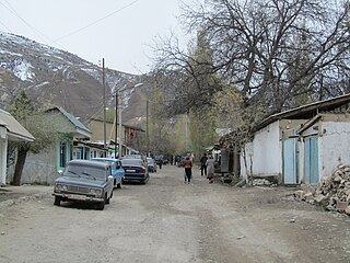
Gejige is a village in the Osh Region of Kyrgyzstan. It is part of the Alay District. Its population was 129 in 2021.
Chiy-Talaa is a village in Osh Region of Kyrgyzstan. It is part of the Alay District. Its population was 2,114 in 2021.
Austan is a village in Batken Region of Kyrgyzstan. It is part of the Kadamjay District. Nearby towns and villages include Maydan and Pum. Its population was 209 in 2021.
Kyzyl-Bulak is a village in Batken Region of Kyrgyzstan. It is part of the Kadamjay District. Its population was 2,272 in 2021.
Orozbekov is a village in Batken Region of Kyrgyzstan. It is part of the Kadamjay District. It has 7 main zones: Garaj, Kuldu, Boston, Zar, Joo-Kesek, Naiman and Uchkun. Its population was 3,503 in 2021. The village was named after politician Abdykadyr Orozbekov.
Ak-Tash is a village in Osh Region of Kyrgyzstan. It is part of the Kara-Suu District. Its population was 5,148 in 2021. It is on the border with Uzbekistan, 7 km southwest of Kara-Suu.

Kayragach is a village in Batken Region of Kyrgyzstan. It is part of the Leylek District. Its population was 3,006 in 2021.
Kojo-Korum is a village in Batken Region of Kyrgyzstan. It is part of the Kadamjay District. Its population was 72 in 2021. Nearby towns and villages include Sovet and Böjöy.
Pum is a village in Batken Region of Kyrgyzstan. It is part of the Kadamjay District. Its population was 1,009 in 2021.
Kara-Kyshtak is a village in Batken Region of Kyrgyzstan. It is part of the Kadamjay District. Its population was 1,299 in 2021. Nearby towns and villages include Kara-Jygach and Pum.
Kara-Jygach is a village in Batken Region of Kyrgyzstan. It is part of the Kadamjay District. Its population was 3,152 in 2021. Nearby towns and villages include Kara-Kyshtak and Chauvay.
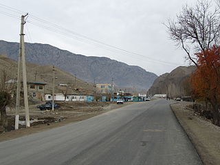
Chauvay is a village in Kadamjay District of Batken Region of Kyrgyzstan. It was established in regard with the extraction of mercury and antimony in 1947. Its population was 1,636 in 2021. Until 2012 it was an urban-type settlement.
Sovet is a village in Kadamjay District of Batken Region of Kyrgyzstan. Its population was 1,502 in 2021. Until 2012 it was an urban-type settlement.
