Umetići | |
|---|---|
Village | |
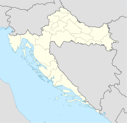  Umetići | |
| Coordinates: 45°18′N16°26′E / 45.300°N 16.433°E | |
| Country |  Croatia Croatia |
| Region | Continental Croatia (Banovina) |
| County |  Sisak-Moslavina Sisak-Moslavina |
| Municipality | Donji Kukuruzari |
| Area | |
• Total | 5.3 km2 (2.0 sq mi) |
| Population (2021) [2] | |
• Total | 68 |
| • Density | 13/km2 (33/sq mi) |
| Time zone | UTC+1 (CET) |
| • Summer (DST) | UTC+2 (CEST) |
Umetici is a village in the Donji Kukuruzari municipality in central Croatia. It is connected by the D30 highway.
