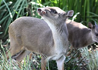
The blue duiker is a small antelope found in central, southern and eastern Africa. It is the smallest species of duiker. The species was first described by Swedish naturalist Carl Peter Thunberg in 1789. 12 subspecies are identified. The blue duiker reaches 32–41 centimetres (13–16 in) at the shoulder and weighs 3.5–9 kilograms (7.7–19.8 lb). Sexually dimorphic, the females are slightly larger than the males. The dark tail measures slightly above 10 centimetres (3.9 in). It has short, spiky horns, around 5 centimetres (2.0 in) long and hidden in hair tufts. The subspecies show a great degree of variation in their colouration. The blue duiker bears a significant resemblance to Maxwell's duiker.

Kilimanjaro National Park is a Tanzanian national park, located 300 kilometres (190 mi) south of the equator and in Kilimanjaro Region, Tanzania. The park is located near the region of Moshi. The park includes the whole of Mount Kilimanjaro above the tree line and the surrounding montane forest belt above 1,820 metres (5,970 ft). It covers an area of 1,688 square kilometres (652 sq mi), 2°50'–3°10'S latitude, 37°10'–37°40'E longitude. The park is administered by the Tanzania National Parks Authority (TANAPA). It was established as a national park in 1973.

The wildlife of Botswana refers to the flora and fauna of this country. Botswana is around 90% covered in savanna, varying from shrub savanna in the southwest in the dry areas to tree savanna consisting of trees and grass in the wetter areas. Even under the hot conditions of the Kalahari Desert, many different species survive; in fact the country has more than 2500 species of plants and 650 species of trees. Vegetation and its wild fruits are also extremely important to rural populations living in the desert and are the principal source of food, fuel and medicine for many inhabitants.

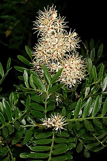
Umtiza is a monotypic genus in the legume family Fabaceae containing the single species Umtiza listeriana. This tree is endemic to a small coastal portion of the Eastern Cape in South Africa.
Mpofu Nature Reserve is a nature reserve in the Amatole district of the Eastern Cape Province, South Africa that is managed by Eastern Cape Parks.

The Buffalo River is situated in the city of East London on the East Coast of South Africa. It is to the west of the Nahoon River. It is the only navigable river in South Africa. The town of East London was thus established around it.

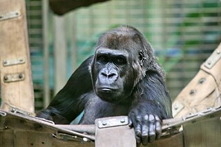
Nouabalé-Ndoki National Park is a national park in the Republic of the Congo. Established in 1993, in the northern provinces of Congo, it is home to forest elephants, great apes, including western lowland gorillas and the eastern sub-species of chimpanzees and bongo. It is 3,921.61 km2 (1,514.14 sq mi) of pristine tropical rainforest with no human habitation within it and with human population densities in its periphery that are comparatively low for the sub-region. The forests have a rich biodiversity of 300 bird species, plus 1,000 plant and tree species which include endangered mahoganies.

Mkhambathi Nature Reserve is a protected area at Lusikisiki in the Eastern Cape, South Africa. It is 7,720 hectares, with the Pondoland Marine Protected Area off its coastal edge. The reserve is located in the Pondoland Centre of Plant Endemism and the greater Maputaland–Pondoland–Albany Hotspot, and is covered in open grassland, dotted with patches of indigenous forest, swamp forests and flanked by the forested ravines of the Msikaba and Mtentu rivers.
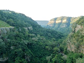
Buffalo Pass is a mountain pass situated in the Eastern Cape, on the M5, near East London, South Africa. It traverses the entirety of the Umtiza Nature Reserve and the surrounding Controlled Forest Area.

The Angolan Scarp savanna and woodlands is an ecoregion located on the coast of Angola, an area with a variety of habitats and rich in wildlife including many endemic birds and animals.

The Cross River National Park is a national park of Nigeria, located in Cross River State, Nigeria. There are two separate sections, Okwangwo and Oban . The park has a total area of about 4,000 km2, most of which consists of primary moist tropical rainforests in the North and Central parts, with mangrove swamps on the coastal zones. Parts of the park belong to the Guinea-Congolian region, with a closed canopy and scattered emergent trees reaching 40 or 50 meters in height.

The Dzanga-Sangha Special Reserve is a protected reserve of southwestern Central African Republic. It was established in 1990 and covers 6865.54 km2. It is one of several areas within the Dzanga-Sangha Complex of Protected Areas (DSCPA), each within its own protective status and along with Lobéké National Park in Cameroon and Nouabalé-Ndoki National Park in Republic of Congo, it is part of the Sangha Trinational Landscape. Other areas within the DSCPA include the Dzanga Ndoki National Park which has two sectors, the 495 km2 (191 sq mi) Dzanga park and the 725 km2 (280 sq mi) Ndoki park. A conference of the Ministers of Forests of Central African Forest Commission (COMIFAC) had resolved to establish within the Congo basin, the Sangha River Tri-national Protected area (STN) encompassing these three parks. The forest special reserve is operated by the Central African Forest Commission (COMIFAC).
The Dzanga-Ndoki National Park is located in the southwestern extremity of the Central African Republic. Established in 1990, the national park is 1,143.26 square kilometres (441.42 sq mi). The national park is split into two non-continuous sectors, the northern Dzanga sector 49,500 ha and the southern Ndoki sector 72,500 ha. Notable in the Dzanga sector is a gorilla density of 1.6/km2 (4.1/sq mi), one of the highest densities ever reported for the western lowland gorilla.
The Okomu National Park, formerly the Okomu Wildlife Sanctuary, is a forest block within the 1,082 km2 (418 sq mi) Okomu Forest Reserve in the Ovia South-West Local Government Area of Edo State in Nigeria. The park is about 60 km (37 mi) north west of Benin City. The park holds a small fragment of the rich forest that once covered the region, and is the last habitat for many endangered species. It continues to shrink as villages encroach on it, and is now less than one third of its original size. Powerful corporations are involved in plantation development and logging concessions around the park, which also pose a threat.

Wildlife in the Central African Republic is in the vast natural habitat located between the Congo Basin's rain forests and large savannas, where the human density was smaller than 0.5 per km2 prior to 1850. The forest area of 22.755 million, considered one of the richest storehouses of wildlife spread over national parks, hunting reserves and community hunting areas, experienced an alarming loss of wildlife because of greed for ivory and bushmeat exploitation by hunters – mostly Arab slavers from across the borders of the Central African Republic with Chad and Sudan.

The Krantzkloof Nature Reserve, managed by Ezemvelo KZN Wildlife, conserves 668 ha of the Molweni and Nkutu River gorges that incise the sandstone Kloof plateau in KwaZulu-Natal, South Africa. The reserve conserves coastal scarp forest, sourveld grassland, a cliff face biotope, and aquatic environments along its rivers. Scarp forest is a threatened forest type, protected by South Africa's forests act of 1998, while the grassland is classified as KwaZulu-Natal sandstone sourveld, the most threatened terrestrial habitat in the Durban metropole. The reserve was established in 1950 and was augmented by land donations as late as 1999.
Chinko, also known as Chinko Nature Reserve and the Chinko Project Area, is a protected area in the Central African Republic. The nonprofit conservation organization African Parks began managing Chinko in partnership with the government of the Central African Republic in December 2014.
Roosfontein Nature Reserve is a protected nature area in Durban, KwaZulu-Natal, South Africa. Threatened protected species such as the Dwarf Chameleon and Tephrosia inandensis are found in the reserve, which is an example of North Coast Grassland.
The Double Mouth Nature Reserve, part of the greater East London Coast Nature Reserve, is a coastal reserve in the Wild Coast region of the Eastern Cape. Alongside it are the Quko River mouth and the 50-metre high Morgan Bay Cliffs.
The Kwelera Nature Reserve, part of the greater East London Coast Nature Reserve, is a coastal forest reserve in the Wild Coast region of the Eastern Cape, South Africa. Access to the reserve is through the adjacent Kwelera National Botanical Garden, which the reserve now serves as part of the botanical garden. The reserve stretches from the Kwelera River on the eastern side, to the Gqunube River (Gonubie) at the western end of the reserve.


