
Rancocas Creek is a tributary of the Delaware River in southwestern New Jersey in the United States. The creek's main stem is 8.3 miles (13.4 km) long, with a North Branch of 28.3 miles (45.5 km) and a South Branch flowing 21.7 miles (34.9 km). The creek system drains a rural agricultural and forested area on the western edge of the Pinelands north and northeast of Camden and the New Jersey suburbs of Philadelphia.
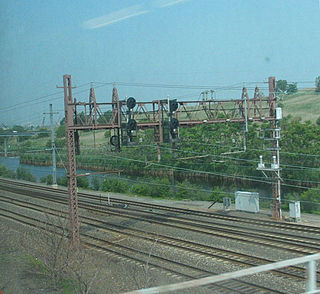
The Kearny Connection in Kearny, New Jersey allows suburban passenger trains from New Jersey Transit's Morris and Essex Lines to run to New York Penn Station, instead of their traditional ferry terminal on the river in Hoboken. New Jersey Transit dubbed the new service MidTOWN DIRECT; the connection opened on June 10, 1996. The project took three years, and $70 million to build. The project cut travel time by 20 minutes, eliminating the need to go first to Hoboken and transfer to PATH. Two tracks, one on each side of the Northeast Corridor (NEC), carry trains from the DL&W main line, which passes under the NEC, northeast onto the NEC. The new junction on the NEC is designated "Swift Interlocking" and is seven miles west of New York.

Conrail's Passaic and Harsimus Line serves freight in northeastern New Jersey, as an alternate to the mainly passenger Northeast Corridor. It takes trains from the Northeast Corridor and Lehigh Line near Newark Liberty International Airport northeast and east into Jersey City, New Jersey, serving as part of CSX's main corridor from upstate New York to the rest of the east coast.
Nescochague Creek is a 6.4-mile-long (10.3 km) tributary of the Mullica River in southern New Jersey in the United States. The creek starts just northwest of Hammonton, arcs along the southern boundary of Wharton State Forest, and joins the Mullica River just above County Route 542.
Manantico Creek, spelled Menantico on federal maps, is an 11.1-mile-long (17.9 km) tributary of the Maurice River in Cumberland County, New Jersey in the United States.
The South Branch Raritan River is a 50-mile-long (80 km) tributary of the Raritan River in central New Jersey in the United States.
The North Branch Raritan River is a tributary of the Raritan River in central New Jersey in the United States.
Westecunk Creek is an 11.1-mile-long (17.9 km) tributary of Little Egg Harbor in southeastern New Jersey in the United States.
The Ridgeway Branch is a 10.6-mile-long (17.1 km) tributary of the Union Branch in Ocean County, New Jersey in the United States.

Stony Brook, also known as Stoney Brook, is a tributary of the Millstone River in Hunterdon and Mercer counties, New Jersey, in the United States.

The Millstone River is a 38.6-mile-long (62.1 km) tributary of the Raritan River in central New Jersey in the United States.
Beden Brook, also Bedens Brook, Beden's Brook, or Beeden's Brook, is a tributary of the Millstone River in central New Jersey in the United States.

The Black River, known as the Lamington River downstream of Pottersville, is a tributary of the North Branch Raritan River in central New Jersey in the United States.
Great Swamp Brook is a 9.1-mile-long (14.6 km) tributary of Nescochague Creek in the southern New Jersey Pine Barrens in the United States.

The Skylands Region is a region and marketing area of the State of New Jersey located in the Northern and Central part of the state. It is one of six tourism regions established by the New Jersey State Department of Tourism, the others being the Gateway Region, Greater Atlantic City Region, the Southern Shore Region, the Delaware River Region and the Shore Region. The area officially encompasses Hunterdon, Morris, Somerset, Sussex and Warren counties; the northwestern part of the Passaic County fits in with the Skylands Region, but it is part of the Gateway Region and not the Skylands Region. One could also say that the western most part of Bergen is also part of the skylands. The area features uplifted land, rolling hills and mountains characteristic of North Jersey. The region contains 60,000 acres of state parkland, and a diverse geography filled with lakes, rivers and picturesque hills.

Middle Brook is a tributary of the Raritan River in Somerset, New Jersey, in the United States. The stream can be referred to as Rha-weigh-weiros, a Native American name meaning "running from a deep hole", on early maps of the area.

The Newark and New York Railroad was a passenger rail line that ran between Downtown Newark and the Communipaw Terminal at the mouth of the North River in Jersey City, bridging the Hackensack River and Passaic River just north of their mouths at the Newark Bay in northeastern New Jersey. The Central Railroad of New Jersey operated it from its opening in 1869. Through operation ended in 1946; portions remained in use until 1967.

Carters Brook, also known as Carter Brook, is a branch of the Heathcote Brook in Somerset and Middlesex counties, New Jersey in the United States.
The Heathcote Brook Branch is a tributary of Heathcote Brook in southern Middlesex County, New Jersey in the United States.

Pike Run, also known as North Pike Run, is a tributary of Beden Brook in Somerset County, New Jersey in the United States. It is the namesake for the nearby residential development of Pike Run in Belle Mead, New Jersey.


