Ryglice is a town in Lesser Poland Voivodeship, Tarnów County, the seat of the urban-rural gmina Ryglice. It is located about 30 kilometres from Tarnów, near the town of Tuchów, and had town privileges in 1824-1934, and from 2001. Between 1975 and 1998, Ryglice administratively belonged to Tarnów Voivodeship. On 30 June 2007, the population of the town was 2,811.
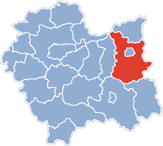
Gmina Skrzyszów is a rural gmina in Tarnów County, Lesser Poland Voivodeship, in southern Poland. Its seat is the village of Skrzyszów, which lies approximately 7 kilometres (4 mi) south-east of Tarnów and 81 km (50 mi) east of the regional capital Kraków.
Gmina Tuchów is an urban-rural gmina in Tarnów County, Lesser Poland Voivodeship, in southern Poland. Its seat is the town of Tuchów, which lies approximately 16 kilometres (10 mi) south of Tarnów and 82 km (51 mi) east of the regional capital Kraków.
Gmina Szerzyny is a rural gmina in Tarnów County, Lesser Poland Voivodeship, in southern Poland. Its seat is the village of Szerzyny, which lies approximately 31 kilometres (19 mi) south-east of Tarnów and 99 km (62 mi) east of the regional capital Kraków.
Pasmo Brzanki Landscape Park is a protected area in southern Poland, established in 1995.

Falkowa is a village in the administrative district of Gmina Ciężkowice, within Tarnów County, Lesser Poland Voivodeship, in southern Poland. It lies approximately 10 kilometres (6 mi) south-west of Ciężkowice, 35 km (22 mi) south of Tarnów, and 77 km (48 mi) south-east of the regional capital Kraków.
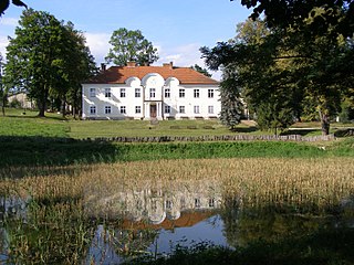
Kąśna Górna is a village in the administrative district of Gmina Ciężkowice, within Tarnów County, Lesser Poland Voivodeship, in southern Poland. It lies approximately 7 kilometres (4 mi) west of Ciężkowice, 29 km (18 mi) south of Tarnów, and 75 km (47 mi) south-east of the regional capital Kraków.
Nowa Jastrząbka is a village in the administrative district of Gmina Lisia Góra, within Tarnów County, Lesser Poland Voivodeship, in southern Poland. It lies approximately 9 kilometres (6 mi) north-east of Lisia Góra, 14 km (9 mi) north-east of Tarnów, and 86 km (53 mi) east of the regional capital Kraków.
Bistuszowa is a village in the administrative district of Gmina Ryglice, within Tarnów County, Lesser Poland Voivodeship, in southern Poland. It lies approximately four miles west of Ryglice, 18 km (11 mi) south of Tarnów, and 85 km (53 mi) east of the regional capital Kraków.
Kowalowa is a village in the administrative district of Gmina Ryglice, within Tarnów County, Lesser Poland Voivodeship, in southern Poland. It lies approximately 6 kilometres (4 mi) east of Ryglice, 24 km (15 mi) south-east of Tarnów, and 93 km (58 mi) east of the regional capital Kraków.
Lubcza is a village in the administrative district of Gmina Ryglice, within Tarnów County, Lesser Poland Voivodeship, in southern Poland. It lies approximately 10 kilometres (6 mi) east of Ryglice, 25 km (16 mi) south-east of Tarnów, and 97 km (60 mi) east of the regional capital Kraków.
Wola Lubecka is a village in the administrative district of Gmina Ryglice, within Tarnów County, Lesser Poland Voivodeship, in southern Poland. It lies approximately 6 kilometres (4 mi) north-east of Ryglice, 19 km (12 mi) south-east of Tarnów, and 91 km (57 mi) east of the regional capital Kraków.
Zalasowa is a village in the administrative district of Gmina Ryglice, within Tarnów County, Lesser Poland Voivodeship, in southern Poland. It lies approximately 6 kilometres (4 mi) north of Ryglice, 15 km (9 mi) south-east of Tarnów, and 87 km (54 mi) east of the regional capital Kraków.
Rzepiennik Suchy is a village in the administrative district of Gmina Rzepiennik Strzyżewski, within Tarnów County, Lesser Poland Voivodeship, in southern Poland. It lies approximately 6 kilometres (4 mi) east of Rzepiennik Strzyżewski, 29 km (18 mi) south of Tarnów, and 90 km (56 mi) east of the regional capital Kraków.
Łukanowice is a village in the administrative district of Gmina Wojnicz, within Tarnów County, Lesser Poland Voivodeship, in southern Poland. It lies approximately 4 kilometres (2 mi) east of Wojnicz, 12 km (7 mi) south-west of Tarnów, and 69 km (43 mi) east of the regional capital Kraków.
Olszyny is a village in the administrative district of Gmina Wojnicz, within Tarnów County, Lesser Poland Voivodeship, in southern Poland. It lies approximately 10 kilometres (6 mi) south of Wojnicz, 22 km (14 mi) south-west of Tarnów, and 66 km (41 mi) east of the regional capital Kraków.
Gwoździec is a village in the administrative district of Gmina Zakliczyn, within Tarnów County, Lesser Poland Voivodeship, in southern Poland. It lies approximately 7 kilometres (4 mi) north-west of Zakliczyn, 25 km (16 mi) south-west of Tarnów, and 62 km (39 mi) east of the regional capital Kraków.
Zawada Lanckorońska is a village in the administrative district of Gmina Zakliczyn, within Tarnów County, Lesser Poland Voivodeship, in southern Poland. It lies approximately 5 kilometres (3 mi) north-west of Zakliczyn, 23 km (14 mi) south-west of Tarnów, and 64 km (40 mi) east of the regional capital Kraków.