Navigation is a field of study that focuses on the process of monitoring and controlling the movement of a craft or vehicle from one place to another. The field of navigation includes four general categories: land navigation, marine navigation, aeronautic navigation, and space navigation.
Hydrography is the branch of applied sciences which deals with the measurement and description of the physical features of oceans, seas, coastal areas, lakes and rivers, as well as with the prediction of their change over time, for the primary purpose of safety of navigation and in support of all other marine activities, including economic development, security and defense, scientific research, and environmental protection.

A nautical chart is a graphic representation of a sea area and adjacent coastal regions. Depending on the scale of the chart, it may show depths of water and heights of land, natural features of the seabed, details of the coastline, navigational hazards, locations of natural and human-made aids to navigation, information on tides and currents, local details of the Earth's magnetic field, and human-made structures such as harbours, buildings, and bridges. Nautical charts are essential tools for marine navigation; many countries require vessels, especially commercial ships, to carry them. Nautical charting may take the form of charts printed on paper or computerized electronic navigational charts. Recent technologies have made available paper charts which are printed "on demand" with cartographic data that has been downloaded to the commercial printing company as recently as the night before printing. With each daily download, critical data such as Local Notices to Mariners are added to the on-demand chart files so that these charts are up to date at the time of printing.
Piloting or pilotage is navigating, using fixed points of reference on the sea or on land, usually with reference to a nautical chart or aeronautical chart to obtain a fix of the position of the vessel or aircraft with respect to a desired course or location. Horizontal fixes of position from known reference points may be obtained by sight or by radar. Vertical position may be obtained by depth sounder to determine depth of the water body below a vessel or by altimeter to determine an aircraft's altitude, from which its distance above the ground can be deduced. Piloting a vessel is usually practiced close to shore or on inland waterways. Pilotage of an aircraft is practiced under visual meteorological conditions for flight.

A navigator is the person on board a ship or aircraft responsible for its navigation. The navigator's primary responsibility is to be aware of ship or aircraft position at all times. Responsibilities include planning the journey, advising the ship's captain or aircraft commander of estimated timing to destinations while en route, and ensuring hazards are avoided. The navigator is in charge of maintaining the aircraft or ship's nautical charts, nautical publications, and navigational equipment, and they generally have responsibility for meteorological equipment and communications. With the advent of GPS, the effort required to accurately determine one's position has decreased by orders of magnitude, so the entire field has experienced a revolutionary transition since the 1990s with traditional navigation tasks being used less frequently.

A bathymetric chart is a type of isarithmic map that depicts the submerged topography and physiographic features of ocean and sea bottoms. Their primary purpose is to provide detailed depth contours of ocean topography as well as provide the size, shape and distribution of underwater features. Topographic maps display elevation above ground and are complementary to bathymetric charts. Charts use a series of lines and points at equal intervals to showcase depth or elevation. A closed shape with increasingly smaller shapes inside of it can indicate an ocean trench or a seamount, or underwater mountain, depending on whether the depths increase or decrease going inward.

The Canadian Hydrographic Service (CHS) is part of the federal department of Fisheries and Oceans Canada and is Canada's authoritative hydrographic office. The CHS represents Canada in the International Hydrographic Organization (IHO).

The National Geodetic Survey (NGS), formerly the United States Survey of the Coast (1807–1836), United States Coast Survey (1836–1878), and United States Coast and Geodetic Survey (USC&GS) (1878–1970), is a United States federal agency that defines and manages a national coordinate system, providing the foundation for transportation and communication; mapping and charting; and a large number of applications of science and engineering. Since its foundation in its present form in 1970, it has been part of the National Oceanic and Atmospheric Administration (NOAA), of the United States Department of Commerce.

The American Practical Navigator, originally written by Nathaniel Bowditch, is an encyclopedia of navigation. It serves as a valuable handbook on oceanography and meteorology, and contains useful tables and a maritime glossary. In 1867 the copyright and plates were bought by the Hydrographic Office of the United States Navy. As of 2019 it is still published by the U.S. Government and is available free online from the National Geospatial-Intelligence Agency (NGA), the modern successor agency to the 19th Century Hydrographic Office. The publication is considered one of America's nautical institutions.

Sailing Directions are written directions that describe the routes to be taken by boats and ships during coastal navigation and port approaches. There are also products known as Sailing Directions, which are books written by various Hydrographic Offices throughout the world. They are known as Pilot Books, because they provide local knowledge of routes and landmarks, which would typically be provided by a local marine pilot. As such, they are used frequently by naval and government vessels, who are exempted from 'Compulsory Pilotage' in many ports.
A notice to mariners advises mariners of important matters affecting navigational safety, including new hydrographic information, changes in channels and aids to navigation, and other important data.
A Local Notice to Mariners is an authoritative instruction issued by a designated official, typically the harbormaster.
Nautical publications is a technical term used in maritime circles describing a set of publications, either published by national governments or by commercial and professional organisations, for use in safe navigation of ships, boats, and similar vessels. Other publications might cover topics such as seamanship and cargo operations. In the UK, the United Kingdom Hydrographic Office, the Witherby Publishing Group and the Nautical Institute provide numerous navigational publications, including charts, publications on how to navigate and passage planning publications. In the US, publications are issued by the US government and US Coast Guard.

Distances Between Ports is a publication that lists the distances between major ports. Reciprocal distances between two ports may differ due to the different routes of currents and climatic conditions chosen. To reduce the number of listings needed, junction points along major routes are used to consolidate routes converging from different directions.
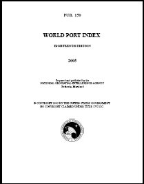
The World Port Index contains a tabular listing of thousands of ports throughout the world, describing their location, characteristics, known facilities, and available services. Of particular interest are the applicable volume of Sailing Directions and the number of the harbor chart. The table is arranged geographically, with an alphabetical index.

The Radio Navigational Aids publication contains a detailed list of selected worldwide radio stations that provide services to the mariner. The publication is divided into chapters according to the nature of the service provided by the radio stations. The services include Radio direction finder and Radar Stations; stations broadcasting navigational warnings, time signals or medical advice; communication traffic for distress, emergency and safety including the Global Maritime Distress Safety System (GMDSS) and long range navigational aids. It also contains chapters describing procedures of the AMVER System, and the interim emergency procedures and communication instructions to be followed by U.S merchant vessels in times of crisis. A new edition of Publication 117 is published annually. This publication is available in its entirety on the website and there are also database queries available for much of the data contained within.
A rutter is a mariner's handbook of written sailing directions. Before the advent of nautical charts, rutters were the primary store of geographic information for maritime navigation.
The United States Hydrographic Office prepared and published maps, charts, and nautical books required in navigation. The office was established by an act of 21 June 1866 as part of the Bureau of Navigation, Department of the Navy. It was transferred to the Department of Defense on 10 August 1949. The office was abolished on 10 July 1962, replaced by the Naval Oceanographic Office.
Australian Pilot is a series of editions of Sailing Directions to navigators in Australian coastal waters.