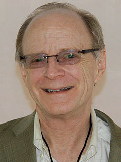
Donald Ervin Knuth is an American computer scientist, mathematician, and professor emeritus at Stanford University. He is the 1974 recipient of the ACM Turing Award, informally considered the Nobel Prize of computer science. Knuth has been called the "father of the analysis of algorithms".
Interdisciplinarity or interdisciplinary studies involves the combining of two or more academic disciplines into one activity. It draws knowledge from several other fields like sociology, anthropology, psychology, economics etc. It is about creating something by thinking across boundaries. It is related to an interdiscipline or an interdisciplinary field, which is an organizational unit that crosses traditional boundaries between academic disciplines or schools of thought, as new needs and professions emerge. Large engineering teams are usually interdisciplinary, as a power station or mobile phone or other project requires the melding of several specialties. However, the term "interdisciplinary" is sometimes confined to academic settings.

DBLP is a computer science bibliography website. Starting in 1993 at the University of Trier, Germany, it grew from a small collection of HTML files and became an organization hosting a database and logic programming bibliography site. Since November 2018, DBLP is a branch of Schloss Dagstuhl – Leibniz-Zentrum für Informatik (LZI). DBLP listed more than 4.86 million journal articles, conference papers, and other publications on computer science in December 2019, up from about 14,000 in 1995 and 3.66 million in July 2016. All important journals on computer science are tracked. Proceedings papers of many conferences are also tracked. It is mirrored at three sites across the Internet.

Wassily Wassilyevich Leontief, was a Russian-American economist known for his research on input-output analysis and how changes in one economic sector may affect other sectors.

Geomatics is defined in the ISO/TC 211 series of standards as the "discipline concerned with the collection, distribution, storage, analysis, processing, presentation of geographic data or geographic information". Under another definition, it "consists of products, services and tools involved in the collection, integration and management of geographic data". It includes geomatics engineering and is related to geospatial science.

Microbial ecology is the ecology of microorganisms: their relationship with one another and with their environment. It concerns the three major domains of life—Eukaryota, Archaea, and Bacteria—as well as viruses.

Fisheries science is the academic discipline of managing and understanding fisheries. It is a multidisciplinary science, which draws on the disciplines of limnology, oceanography, freshwater biology, marine biology, meteorology, conservation, ecology, population dynamics, economics, statistics, decision analysis, management, and many others in an attempt to provide an integrated picture of fisheries. In some cases new disciplines have emerged, as in the case of bioeconomics and fisheries law. Because fisheries science is such an all-encompassing field, fisheries scientists often use methods from a broad array of academic disciplines. Over the most recent several decades, there has been declines in fish stocks (populations) in many regions along with increasing concern about the impact of intensive fishing on marine and freshwater biodiversity.

Torsten Hägerstrand was a Swedish geographer. He is known for his work on migration, cultural diffusion and time geography.
Geographic information science or geographical information science is the scientific discipline that studies the techniques to capture, represent, process, and analyze geographic information. It can be contrasted with geographic information systems (GIS), which are software tools.

Kwame Nkrumah University of Science and Technology (KNUST) is a university in Kumasi, Ashanti, Ghana. The Kwame Nkrumah University of Science and Technology is the public university established in the country, as well as the largest university in the Kumasi Metropolis and in the Ashanti Region. KNUST has its roots in the plans of the King Asantehene Agyeman Prempeh I to establish a university in Kumasi as part of his drive towards modernization of his Ashanti kingdom. This plan never came to fruition due to the clash between British empire expansion and the desire for King Prempeh I to preserve his Ashanti kingdom's independence.
Geographic information retrieval (GIR) or geographical information retrieval is the augmentation of information retrieval with geographic information. GIR aims at solving textual queries that include a geographic dimension, such as "What wars were fought in Greece?" or "restaurants in Beirut". It is common in GIR to separate the text indexing and analysis from the geographic indexing. Semantic similarity and word-sense disambiguation are important components of GIR. To identify place names, GIR often relies on gazetteers.

Geography is a field of science devoted to the study of the lands, features, inhabitants, and phenomena of the Earth and planets. The first person to use the word γεωγραφία was Eratosthenes. Geography is an all-encompassing discipline that seeks an understanding of Earth and its human and natural complexities—not merely where objects are, but also how they have changed and come to be.

James W. Pennebaker is an American social psychologist. He is the Centennial Liberal Arts Professor of Psychology at the University of Texas at Austin and a member of the Academy of Distinguished Teachers. His research focuses on the relationship between natural language use, health, and social behavior, most recently "how everyday language reflects basic social and personality processes".
The Open Science Grid Consortium is an organization that administers a worldwide grid of technological resources called the Open Science Grid, which facilitates distributed computing for scientific research. Founded in 2004, the consortium is composed of service and resource providers, researchers from universities and national laboratories, as well as computing centers across the United States. Members independently own and manage the resources which make up the distributed facility, and consortium agreements provide the framework for technological and organizational integration.

Michael Batty CBE, FBA, FRS, FAcSS is a British urban planner, geographer and spatial data scientist, and Bartlett Professor of Planning in The Bartlett at University College London. He has been Director—now Chairman—of the Centre for Advanced Spatial Analysis, set up when he was appointed to UCL in 1995. His research and the work of CASA is focused on computer models of city systems. He was awarded the William Alonso Prize of the Regional Science Association in 2011 for his book Cities and Complexity, the same prize a second time for his book The New Science of Cities in 2017-2018, the University Consortium GIS Research Award in 2012, and the Lauréat Prix International de Géographie Vautrin Lud, the so-called 'Nobel for geography', in 2013. In 2015, he was awarded the Founder's Medal of the Royal Geographical Society and in 2016, the Gold Medal of the Royal Town Planning Institute (RTPI). He also received the Senior Scholar Award of the Complex Systems Society in September 2016.

Dawn Jeannine Wright is an American geographer and oceanographer. She is a leading authority in the application of geographic information system (GIS) technology to the field of ocean and coastal science, and played a key role in creating the first GIS data model for the oceans. Wright is Chief Scientist of the Environmental Systems Research Institute. She has also been a professor of geography and oceanography at Oregon State University since 1995 and is a former Oregon Professor of the Year as named by the Council for the Advancement and Support of Education and the Carnegie Foundation for the Advancement of Teaching. Wright was the first African-American female to dive to the ocean floor in the deep submersible ALVIN.

Bruce Kingma is an American economist and academic entrepreneur, who since 1988 has taught and worked in the United States, Canada, and New Zealand. Kingma is a pioneer in experiential entrepreneurship education and community engagement and his work cover topics ranging from academic entrepreneurship, entrepreneurship and religion, information economics, online education, community engagement, library science, and nonprofit management.

Taurine cattle, also called European cattle, are a subspecies of domesticated cattle originating in the Near East. Both taurine cattle and indicine cattle (zebus) are descended from the aurochs. Taurine cattle were originally considered a distinct species, but are now typically grouped with zebus and aurochs into one species, Bos taurus. Most modern breeds of cattle are taurine cattle.
CyberGIS, or cyber geographic information science and systems, is an interdisciplinary field combining cyberinfrastructure, e-science, and geographic information science and systems (GIS). CyberGIS has a particular focus on computational and data-intensive geospatial problem-solving within various research and education domains. The need for GIS has extended beyond traditional forms of geographic analysis and study, which includes adapting to new sources and kinds of data, high-performance computing resources, and online platforms based on existing and emerging information networks. The name cyberGIS first appeared in Geographic Information Science literature in 2010. CyberGIS is characterized as digital geospatial ecosystems. These systems are developed and have evolved through heterogeneous computing environments, as well as human communication and information environments. CyberGIS can be considered a new generation of geographic information systems (GIS). These systems are based on advanced computing and information infrastructure, which analyze and model geospatial data, providing computationally intensive spatial analysis, modeling, and collaborative geospatial problem-solving at previously unprecedented scales.
Keith Charles Clarke is a Professor of Analytical Cartography and Modelling in the Department of Geography at the University of California, Santa Barbara, USA.


