Related Research Articles

Clydesdale was the name given to one of the nineteen districts of the Strathclyde region in Scotland from 1975 to 1996. The name is an archaic title for Lanarkshire, one of the traditional counties of Scotland. Clydesdale and Strathclyde take their names from a similar origin: strath, dale and the river Clyde.

Greater Glasgow is an urban settlement in Scotland consisting of all localities which are physically attached to the city of Glasgow, forming with it a single contiguous urban area. It does not relate to municipal government boundaries and its territorial extent is defined by the General Register Office for Scotland, which determines settlements in Scotland for census and statistical purposes. Greater Glasgow had a population of 1,199,629 at the time of the 2001 UK Census making it the largest urban area in Scotland and the fifth-largest in the United Kingdom. However, the population estimate for the Greater Glasgow 'settlement' in mid-2016 was 985,290 – the reduced figure explained by the removal of the Motherwell & Wishaw (124,790), Coatbridge & Airdrie (91,020) and Hamilton (83,730) settlement areas east of the city due to small gaps between the populated postcodes. The 'new towns' of Cumbernauld and East Kilbride (75,120) were never included in these figures despite their close ties to Glasgow due to having a clear geographical separation from the city. In the 2020 figures, the Greater Glasgow population had risen to just over 1 million.
Forth Wanderers Football Club are a Scottish football club based in the village of Forth, South Lanarkshire. Formed in 1904 they compete in the West of Scotland League Conference A and play in red strips with a white trim with a second strip of all black.

Hillhouse is a council-built housing estate on the western side of the town of Hamilton in South Lanarkshire, Scotland.

Cumbernauld, Kilsyth and Kirkintilloch East is a constituency of the House of Commons of the Parliament of the United Kingdom. It was created for the 2005 general election, replacing Cumbernauld and Kilsyth and part of Strathkelvin and Bearsden.
Lanark and Hamilton East is a county constituency of the House of Commons of the Parliament of the United Kingdom, which was first used at the 2005 general election. It covers parts of the former Clydesdale, Hamilton North and Bellshill and Hamilton South constituencies, and it elects one Member of Parliament (MP) by the first past the post voting system.

East Kilbride, Strathaven and Lesmahagow is a county constituency of the House of Commons of the Parliament of the United Kingdom, which was first used in the general election of 2005. It replaced East Kilbride and some of Clydesdale, and it elects one Member of Parliament (MP) by the first past the post system of election.
Lanarkshire was a Scottish county constituency of the House of Commons of the Parliament of the United Kingdom (Westminster) from 1708 to 1868. It elected one Member of Parliament (MP) by the first past the post voting system.
Scotland is an unincorporated community in Gadsden County, Florida, United States. It is located south of Havana at the intersection of County Roads 159 and 270.
The North Calder Water is a river in North Lanarkshire, Scotland. It flows for 12 miles (19 km) from the Black Loch via the Hillend Reservoir, Caldercruix, Plains, Airdrie, Calderbank, Carnbroe and Viewpark to the River Clyde at Daldowie, south-east of Glasgow. For the last 2 miles (3.2 km) of its course, it forms part of the boundary between North Lanarkshire and Glasgow. The name Calder is thought to be Brythonic and to mean 'hard cold flowing' water.

The lands of Daldowie in Glasgow, Scotland lie astride the River Clyde on the south and the North Calder Water to the east, and stretch to the present area of Broomhouse in the north.
South Medwin is a river in the Lanarkshire region of Scotland. Along with the confluence of the North Medwin River it forms the Medwin water basin. The South Medwin flows westward to join the River Clyde a mile (1.5 km) south of Carnwath at a point called "The Meeting".
The ML postcode area, also known as the Motherwell postcode area, is a group of twelve postcode districts in south-central Scotland, within twelve post towns. These cover most of North Lanarkshire and South Lanarkshire, plus very small parts of West Lothian, the Scottish Borders and Dumfries and Galloway.
The G postcode area, also known as the Glasgow postcode area, is a group of postcode districts in central Scotland, within five post towns. These districts are primarily centered on Glasgow itself, and West Dunbartonshire, plus parts of the council areas of Argyll and Bute, East Dunbartonshire, North Lanarkshire, South Lanarkshire, East Renfrewshire and Stirling.

North Medwyn is a river in the Lanarkshire region of Scotland. Along with the confluence of the South Medwyn River it forms the Medwyn water basin. The North Medwyn is a tributary of the River Clyde.
Woodhead in Hamilton, South Lanarkshire lies south of Little Earnock, and north of Meikle Earnock. There is a pub, The Woodhead, and the main area in Woodhead is Woodhead Green. The houses are largely local authority homes probably around 40–50 years old; about 28% are social housing. There is a frequent bus service from Woodhead to Hamilton bus station and Glasgow.
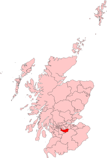
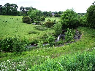
Cartland is a village in South Lanarkshire, Scotland.

Duneaton Water is a river in South Lanarkshire, Scotland. It joins the River Clyde at Abington.
Larissa is an historic town located along Hunter Creek in Douglas County, Missouri, United States. The GNIS classifies it as a populated place. Larissa was located on the north part of the floodplain of Hunter Creek, along county road VV-210, at an elevation of 935 feet. The location is approximately one mile upstream (northwest) of the Crystal Springs fish hatchery.
References
- ↑ "Unthank, South Lanarkshire - Postcode Information". www.postcodes-uk.com.
Coordinates: 55°34′36″N3°33′48″W / 55.57667°N 3.56333°W
| | This South Lanarkshire location article is a stub. You can help Wikipedia by expanding it. |