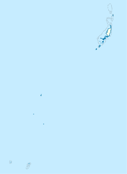
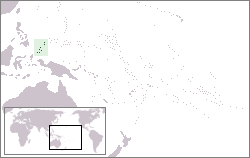
Palau, officially the Republic of Palau, is an island country in the Micronesia subregion of Oceania in the western Pacific. The republic consists of approximately 340 islands and connects the western chain of the Caroline Islands with parts of the Federated States of Micronesia. It has a total area of 466 square kilometers (180 sq mi), making it one of the smallest countries in the world. The most populous island is Koror, home to the country's most populous city of the same name. The capital Ngerulmud is located on the largest island of Babeldaob, in Melekeok State. Palau shares maritime boundaries with international waters to the north, the Federated States of Micronesia to the east, Indonesia to the south, and the Philippines to the northwest.

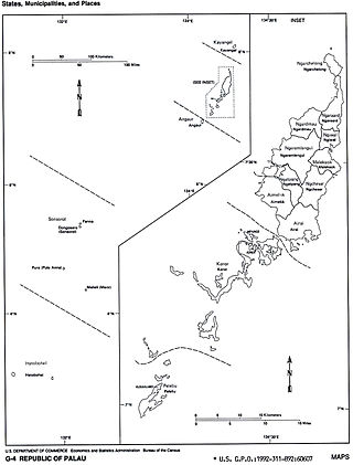
Koror is the state comprising the main commercial centre of the Republic of Palau. It consists of several islands, the most prominent being Koror Island. It is Palau’s most populous state.

Babeldaob is the largest island in the island nation of the Republic of Palau. It is in the western Caroline Islands, and the second largest island in the Micronesia region of Oceania. Palau's capital, Ngerulmud, is located on Babeldaob, in Melekeok State.

Ngarchelong is a state in Palau. Ngarchelong is at the northernmost tip of the island of Babeldaob. Only the state of Kayangel is farther north.

Aimeliik is an administrative division of the island country of Palau. It is one of the Republic of Palau's 16 states. It has an area of 52 km² and a population of 334. State capital is the village of Mongami. Following the four other villages which are: Medorm, Imul, Elechui and Ngmechiangel.

Ngchesar also known as Oldiais is one of the sixteen states of the nation of Palau in Oceania.

Ngaraard is the eighth state of the Republic of Palau, and was originally named Kerradel.

Kayangel (Ngcheangel) is the northernmost state of Palau 24 km (15 mi) north of Koror. The land area is about 1.4 km2 (0.54 sq mi). The population is 54. There is one hamlet in the state - Orukei which is also its capital.

Ngiwal is one of the sixteen states of Palau. It has a population of 282 and an area of 26 km2

Ngardmau is one of Palau's sixteen states and is located on the west side of Babeldaob between the states of Ngaraard and Ngeremlengui.

Ngatpang is one of Palau's sixteen states. It comprises an area of around 47 square kilometers in the west of Palau's largest island, Babeldaob, facing onto Ngeremeduu Bay. It has a population of 282, making it Palau's 9th largest state in population.
Ngeremlengui is one of Palau's sixteen states. It has a population of 349, and is just west of the capital in Melekeok state. Among the 16 states of Palau, it’s the one with the lowest density but the one with the most neighbor states. It’s also the seventh most populous state.
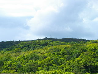
Chol (Choll) is a village at the northern end of Ngaraard State in Palau. This village consists of a large, long, beach that runs along its entire east coast. The village has a series of ancient paths and platforms, similar to the rest of the villages in Ngaraard. There is also a large man-made channel that connects the village to the sea on the western coast. At the center of the village, along the compact road, there is a small marketplace with benches where one can purchase some village refreshments.

Melekeok is a state of the Republic of Palau located on the central east coast of Babeldaob Island. The seat of government of the country, Ngerulmud, is located in the state. The state consists of long beaches, hills, steep ridges, rivers, and the largest and only natural freshwater lake in Palau and Micronesia, Lake Ngardok.
The following is an alphabetical list of topics related to the Republic of Palau.
Sakaziro Demk of Ngardmau state is a high chief beouch and one of the many chiefs of Palau. High chief beouch is the position of highest political and social leadership in a village, and is held by a son of the oldest queen or princess of Ngedngoll, the highest clan of Ngardmau. In Palau, all 16 states have traditional chiefs and queens, presidents, and governors.
Kaseküla is a village in Lääneranna Parish, Pärnu County, in western Estonia.
Anelema is a village in Põhja-Pärnumaa Parish, Pärnu County in southwestern Estonia.
Jamalia is a village in Jaunpur, Uttar Pradesh, India.