

The Usk Bridge (Welsh: Pont-Yr-Wysg) in Brecon, Powys, Wales is the town's oldest route over the River Usk. It carries the B4601 road, formerly the A40, between Brecon and Llanfaes. [1]
The Usk Bridge (Welsh: Pont-Yr-Wysg) in Brecon, Powys, Wales is the town's oldest route over the River Usk. It carries the B4601 road, formerly the A40, between Brecon and Llanfaes. [1]
The river was fordable at Brecon and the date of construction of the original bridge here is uncertain. The existing stone bridge was built in 1563 [2] and replaced an earlier bridge that was washed away in the floods of 1535. [3] It was widened in 1794 by bridge builder Thomas Edwards, at a cost of £1,000 [2] (equivalent to £120,000 in 2019) [4]
During the 20th century it was widened further with the addition of metal framed footpaths on either side. [2] In the 1950s it required widening to take modern road traffic and a new concrete bed, described as "functional and safe but extremely ugly", was laid on top of the original stone base. [3]
The bridge is a Grade I listed structure. [2]

Brecon, archaically known as Brecknock, is a market and minster town in Powys, mid-Wales. In 1841, it had a population of 5,701. The population in 2001 was 7,901, increasing to 8,250 at the 2011 census. Historically it was the county town of Brecknockshire (Breconshire); although its role as such was eclipsed with the formation of the County of Powys, it remains an important local centre. Brecon is the third-largest town in Powys, after Newtown and Ystradgynlais. It lies north of the Brecon Beacons mountain range, but is just within the Brecon Beacons National Park.

The A40 is a major trunk road connecting London to Goodwick (Fishguard), Wales, and officially called The London to Fishguard Trunk Road (A40) in all legal documents and Acts. It is approximately 260 miles (420 km) long.

Llanfoist is a village, near Abergavenny, in Monmouthshire, Wales.

The Taff Trail is a popular walking and cycle path that runs for 55 miles (89 km) between Cardiff Bay and Brecon in Wales. It is so named because it follows the course of the River Taff. Along much of its length, it follows the National Cycle Network Route 8 that continues to Holyhead, and is substantially off-road.

Blorenge, also called The Blorenge, is a prominent mountain overlooking the valley of the River Usk in Abergavenny, Monmouthshire, southeast Wales. It is situated in the southeastern corner of the Brecon Beacons National Park. The summit plateau reaches a height of 1,841 feet (561 m).

The Monmouthshire and Brecon Canal is a small network of canals in South Wales. For most of its currently (2018) navigable 35-mile (56 km) length it runs through the Brecon Beacons National Park, and its present rural character and tranquillity belies its original purpose as an industrial corridor for coal and iron, which were brought to the canal by a network of tramways and/or railroads, many of which were built and owned by the canal company.

William Edwards was a Welsh Methodist minister who also practised as a stonemason, architect and bridge engineer.

The Great Western Railway Usk bridge is a crossing of the River Usk in Newport city centre, Wales. It carries the Great Western Main Line across the river in an east—west direction.

Newport Bridge, opened in 1927 across the River Usk in Newport, connects the High Street and Clarence Place with Newport Castle and Newport city centre.

Llangynidr is a village, community and electoral ward in Powys, Wales, about 4 miles (6.4 km) west of Crickhowell and 9 miles (14.5 km) south-east of Brecon. The River Usk flows through the village as does the Monmouthshire and Brecon Canal. It is in the historic county of Brecknockshire.

Tor y Foel is a hill in the Brecon Beacons National Park in the county of Powys in Wales. It is located on the eastern flank of Talybont Reservoir, and the summit at 551m is marked by a small cairn. It gives excellent panoramic views over the valley of the River Usk, across to the Black Mountains and west to the Brecon Beacons.

The Grwyne Fawr is a river in the Brecon Beacons National Park in south Wales. A section of it forms the administrative border between Powys and Monmouthshire and also of the historic counties of Brecon and Monmouth. The river and its major tributary the Grwyne Fechan flow into the River Usk at Glangrwyney.

Allt yr Esgair is a hill in the Brecon Beacons National Park in Powys, Wales. It is commonly referred to locally as simply 'The Allt'. The Welsh name signifies 'wooded slope of the ridge'. It takes the form of a northwest-southeast aligned ridge which rises to a height of 393m and which overlooks the valley of the River Usk to the west and south. To the northeast are panoramic views across Llangorse Lake to the Black Mountains There is a viewfinder on the summit erected as a monument to Eirene Lloyd White, Baroness White of Rhymney. It is a Marilyn with a prominence of 199 metres.

The River Honddu is a river in the county of Powys, mid Wales. Early recorded versions of the name are of the form Hothenei and hodni which are believed to contain the Welsh adjective 'hawdd', meaning 'pleasant' or 'easy', together with a suffix -ni. Later forms such as Honddey and Honthy have undergone metathesis whereby -ddn- became -ndd-.
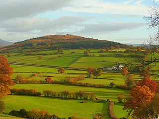
Myarth is a hill in the Usk Valley in the county of Powys in South Wales, about 2 miles west of Crickhowell. Its summit at 292 metres (958 ft) is covered by trees, whilst the larger part of its slopes are also wooded. It is listed as a Marilyn. Myarth has an elongate form commonly ascribed to erosion by the west-to-east movement of the Usk Valley glacier during successive ice ages. The River Usk runs along the foot of the hill on its southern side. Myarth forms a prominent feature in many views over the Usk Valley and often features in commercial photography of the area.
Llanspyddid is a small village just west of Brecon within the Brecon Beacons National Park. It lies within the valley of the River Usk in the community of Glyn Tarell in the county of Powys, Wales. Llanspyddid sits on the A40 trunk road between Brecon and Llandovery. The Welsh name signifies the 'church of Saint Ysbyddyd', though the village church is in fact dedicated to Saint Cadog.

Llanfrynach is a village and community in the county of Powys, Wales, and the historic county of Brecknockshire. The population of the community as taken at the 2011 census was 571. It lies just to the southeast of Brecon in the Brecon Beacons National Park. The village sits astride the Nant Menasgin, a right bank tributary of the River Usk. The B4558 passes just to its north and the Monmouthshire and Brecon Canal also passes around the village. The Welsh name signifies the 'church of Brynach'.

Pen-y-crug is a hill in the Brecon Beacons National Park in the county of Powys, south Wales. It is commonly referred to locally as simply 'The Crug'. The Welsh name signifies 'top of the mound'. It slopes are moderately gently on three sides; only to the west do they steepen somewhat. Its flat trig point adorned summit at 331m overlooks the valley of the River Usk to the south. To the southeast are panoramic views over Brecon whilst eastwards are the Black Mountains and south the Brecon Beacons.

Cwmwysg is a small rural community southwest of Trecastle in the valley of the Usk river, Powys, Wales.

Crickhowell Bridge is an 18th-century bridge that spans the River Usk in Crickhowell, Powys, Wales. The main A4077 road to Gilwern crosses it. The bridge is claimed to be the longest stone bridge in Wales at over 128 metres (420 ft).