
Savaiʻi is the largest and highest island both in Samoa and in the Samoan Islands chain. The island is also the sixth largest in Polynesia, behind the three main islands of New Zealand and the Hawaiian Islands of Hawaii and Maui. While it is larger than the second main island, Upolu, it is significantly less populated.

Falealupo is a village in Samoa situated at the west end of Savai'i island 20 miles (32 km) from the International Date Line used until 29 December 2011. The village has two main settlements, Falealupo-Uta, situated inland by the main island highway and Falealupo-Tai, situated by the sea. The road to the coastal settlement is about 9 km, most of it unsealed, from the main highway. The village's population is 545.
Aiga-i-le-Tai is a district of Samoa which includes the small islands of Manono, Apolima and tiny uninhabited Nu'ulopa lying in the Apolima Strait between the country's two main islands of Upolu and Savai'i.

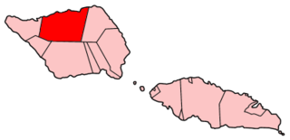
Gagaʻemauga is a district on the island of Savaiʻi in Samoa. The district is situated on the central north side of Savaiʻi. The name 'Gagaʻemauga' literally means "near side of the mountain", meaning the eastern side of the mountain chain running through the centre of Savaiʻi Island.
Gagaʻifomauga is a political district on the island of Savaiʻi in Samoa. The district is situated on the northern side of the island with a population of 4,878.
Palauli is a district and village of Samoa, with a population of 9,300. It consists of two sections on the southern side of Savai'i. The capital is Vailoa which is also referred to as Vailoa i Palauli.

Satupaʻitea is a large village district with four sub-villages on the south east coast of Savaiʻi Island in Samoa.

Vaisigano is a political district at the western tip of Savai'i island in Samoa. The capital of the district is Asau.
Faʻasaleleaga is a district of Samoa situated on the eastern side of Savaiʻi island. It has a population of 13,566.

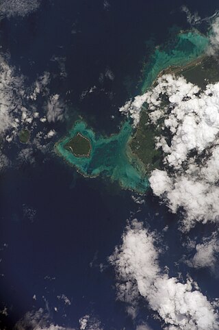
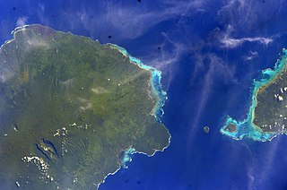
The Apolima Strait is about 13 km wide and separates the two largest islands of Samoa: Savai'i to the northwest, and Upolu to the southeast.
Matautu is the name of different villages in Samoa. Places named Matautu are found on the two largest islands, Upolu and Savaiʻi.
Lalomalava is a village at the southeast end of Savai'i island in Samoa. The village is part of the electoral constituency Fa'asaleleaga I which is within the larger political district (Itumalo) of Fa'asaleleaga. The population is 307.

Fagamalo is a village situated on the central north coast of Savai'i in Samoa. It is a sub-village or pito nu'u of the larger traditional village enclave of Matautu in the political district of Gaga'emauga. The population of the village is 383.
Tui Fiti or Tuifiti is the name of a figure referred to in different legends in Samoan mythology and in other parts of Polynesia. In other stories, "Tui Fiti" means "high chief of Fiti."

Avao is a village on the north central coast of Savai'i island in Samoa. The village is part of the electoral constituency of Gaga'emauga 2, which is included in the larger political district of Gaga'emauga.
Lelepa is a village on the north central coast of Savai'i island in Samoa. The village is part of the electoral constituency Gaga'emauga 2, which forms part of the larger political district of Gaga'emauga.
Saleia is a village on the north central coast of Savai'i island in Samoa. The village is part of the electoral constituency of Gaga'emauga 2 which forms part of the larger political district of Gaga'emauga.
Safa'i is a village located on the north-central coast of Savai'i island in Samoa. The village is part of the electoral constituency Gaga'emauga 2 which forms part of the larger political district Gaga'emauga.
Savai'i Public Library is the only public library on the island of Savai'i, the largest and westernmost island in Samoa.
