| Valiente Formation | |
|---|---|
| Stratigraphic range: Serravallian | |
| Type | Formation |
| Unit of | Bocas del Toro Group |
| Underlies | Nancy Point Formation |
| Location | |
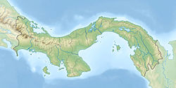
| Coordinates | 9°12′N82°06′W / 9.2°N 82.1°W |
| Approximate paleocoordinates | 8°48′N80°18′W / 8.8°N 80.3°W |
| Region | Bocas del Toro |
| Country | Panama |
| Type section | |
| Named for | Valiente Peninsula |
 Valiente Formation (Panama) | |
The Valiente Formation is a geologic formation of the Bocas del Toro Group in the Bocas del Toro Province of northwestern Panama. The formation underlies the Nancy Point Formation and preserves bivalve, gastropod and scaphopod fossils dating back to the Serravallian period. [1]