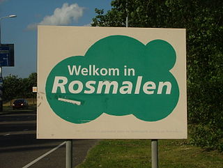
Rosmalen is a town in the province of North Brabant, in the south of the Netherlands. The town is located 6 kilometers east of the city of 's-Hertogenbosch and has been part of that municipality since 1996. Its population is around 37,240 on 1 January 2021. In 2005 the town began construction of a new neighbourhood, De Groote Wielen, to include 5,000 homes and other buildings.

Maasland is a town in the western Netherlands, in the province of South Holland. It lies in the municipality (gemeente) of Midden-Delfland and covers an area of 24.42 km2.

The Hoekse Waard is an island between the Oude Maas, Dordtsche Kil, Hollands Diep, Haringvliet and Spui rivers in the province of South Holland in the Netherlands. The island, part of the namesake municipality of Hoeksche Waard, is a mostly agricultural region, south of the outskirts of Rotterdam. The Hoeksche Waard consists of reclaimed land (polders): after the Saint Elisabeth flood of 1421 most of the area was flooded. The land has been reclaimed gradually in the following centuries.
Rhoon is a village that borders the municipality of the city of Rotterdam, South Holland, the Netherlands.
Poortugaal is a village that is situated near the municipality of Rotterdam. Together with Rhoon, Poortugaal forms the municipality of Albrandswaard. The village has a long history dating back to the 15th century. It has a church dating from that period. The name is probably derived from Portugal.

Numansdorp is a village and former municipality in the province South Holland in the Netherlands and is located on the island Hoeksche Waard near the Hollands Diep. On 1 January 1984, the municipalities Numansdorp and Klaaswaal were merged into one municipality called Cromstrijen. Cromstrijen was merged into the new municipality Hoeksche Waard in January 2019.

The Dollart or Dollard is a bay in the Wadden Sea between the northern Netherlands and Germany, on the west side of the estuary of the Ems river. Most of it dries at low tide. Many water birds feed there.

Het Verdronken Land van Reimerswaal is an area of flood-covered land in Zeeland in the Netherlands between Noord Beveland and Bergen op Zoom. Some of it was lost in the St. Felix's Flood in 1530, and some of it in 1532. The Oosterschelde formerly flowed along its east and north edges. It is sometimes divided into the "Verdronken Land van Zuid-Beveland" and the "Verdronken Land van de Markiezaat van Bergen op Zoom". Verdronken is Dutch for "drowned", and Markizaat van Bergen op Zoom is the marquisate of Bergen op Zoom).

Bommenede or Bommenee is a former island, village, and municipality in the Netherlands, located about 5 km east of the city of Brouwershaven.
's-Gravenhoek is a former municipality in the Dutch province of Zeeland. It consisted of a number of polders on the north side of the island of Noord-Beveland, east of Wissenkerke.

Klaaskinderenkerke is a former village in the Dutch province of Zeeland. The polder Klaaskinderen was flooded on December 14, 1511, and was never reclaimed again. The church of Klaaskinderenkerke disappeared in this flood, and in the 19th century, only a small hamlet was left.

Maire is a former village in the Dutch province of Zeeland. It was located northwest of the village of Rilland.
Rengerskerke en Zuidland is a former municipality in the Dutch province of Zeeland. It existed until 1813, when it was merged with Kerkwerve.

Valkenisse is a former municipality in the Dutch province of Zeeland, on the peninsula of Walcheren.

Charlois is a neighbourhood of the Dutch city of Rotterdam. It is located on the south bank of the Nieuwe Maas.
Kralingen is a former village in the Dutch province of South Holland, now a neighbourhood of Rotterdam. It is located about 3 kilometres east of the city centre, in the borough Kralingen-Crooswijk.

Maasdam is a village in the Dutch province of South Holland. It is located about 14 km south of the city of Rotterdam, in the municipality of Hoeksche Waard, on the rural Hoeksche Waard island.

Overschie is a neighborhood of Rotterdam, Netherlands, formerly a separate village with its own municipality.

The Oude Maas is a distributary of the river Rhine, and a former distributary of the river Maas, in the Dutch province of South Holland. It begins at the city of Dordrecht where the Beneden Merwede river splits into the Noord and the Oude Maas. It ends when it joins the Nieuwe Maas to form Het Scheur.

The Nieuwe Maas is a distributary of the Rhine River, and a former distributary of the Maas River, in the Dutch province of South Holland. It runs from the confluence of the rivers Noord and Lek, and flows west through Rotterdam. It ends west of the city where it meets the Oude Maas, near Vlaardingen, to form Het Scheur. After a few miles, the Scheur continues as the artificial Nieuwe Waterweg. The total length of the Nieuwe Maas is approximately 24 kilometres (15 mi).
