Rilland | |
|---|---|
Village | |
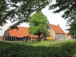 Farm in Rilland | |
 Flag  Coat of arms | |
 Rilland Location in the province of Zeeland in the Netherlands  Rilland Rilland (Netherlands) | |
| Coordinates: 51°24′59″N4°10′51″E / 51.41639°N 4.18083°E | |
| Country | Netherlands |
| Province | Zeeland |
| Municipality | Reimerswaal |
| Area | |
• Total | 56.95 km2 (21.99 sq mi) |
| Elevation | 1.6 m (5.2 ft) |
| Population (2021) [1] | |
• Total | 3,015 |
| • Density | 52.94/km2 (137.1/sq mi) |
| Time zone | UTC+1 (CET) |
| • Summer (DST) | UTC+2 (CEST) |
| Postal code | 4411 [1] |
| Dialing code | 0113 |
Rilland is a village in the Dutch province of Zeeland. It is located in the municipality of Reimerswaal.