
Svalbard is a Norwegian archipelago in the Arctic Ocean. Situated north of mainland Europe, it is about midway between continental Norway and the North Pole. The islands of the group range from 74° to 81° north latitude, and from 10° to 35° east longitude. The largest island is Spitsbergen, followed by Nordaustlandet and Edgeøya. While part of the Kingdom of Norway since 1925, Svalbard is not part of geographical Norway proper; administratively, the archipelago is not part of any Norwegian county, but forms an unincorporated area administered by a governor appointed by the Norwegian government, and a special jurisdiction subject to the Svalbard Treaty that is, unlike Norway proper, outside of the Schengen Area, the Nordic Passport Union and the European Economic Area. Since 2002, Svalbard's main settlement, Longyearbyen, has had an elected local government, somewhat similar to mainland municipalities. Other settlements include the Russian mining community of Barentsburg, the research station of Ny-Ålesund, and the mining outpost of Sveagruva. Ny-Ålesund is the northernmost settlement in the world with a permanent civilian population. Other settlements are farther north, but are populated only by rotating groups of researchers.

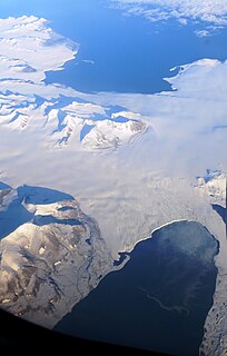
Nordaustlandet is the second-largest island in the archipelago of Svalbard, Norway, with an area of 14,443 square kilometres (5,576 sq mi). It lies north east of Spitsbergen, separated by Hinlopen Strait. Much of Nordaustlandet lies under large ice caps, mainly Austfonna and Vestfonna, the remaining parts of the north being tundra inhabited by reindeer and walruses. The island is uninhabited and lies entirely within Nordaust-Svalbard Nature Reserve.

An ice cap is a mass of ice that covers less than 50,000 km2 of land area. Larger ice masses covering more than 50,000 km2 are termed ice sheets.
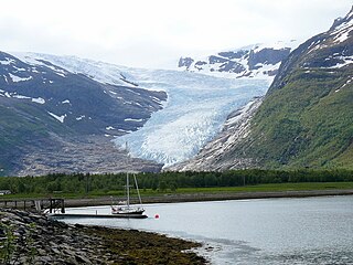
Svartisen is a collective term for two glaciers located in Nordland county in northern Norway. It is part of Saltfjellet-Svartisen National Park, located in the Saltfjell mountain range. The glaciers are located in the municipalities of Beiarn, Meløy, Rana, and Rødøy. Svartisen consists of two separate glaciers that are separated by the 1-kilometre (0.62 mi) long Vesterdalen valley. The two glaciers are:
Glacial surges are short-lived events where a glacier can advance substantially, moving at velocities up to 100 times faster than normal. Surging glaciers cluster around a few areas. High concentrations of surging glaciers occur in Svalbard, the Canadian Arctic islands, Alaska and Iceland. In some glaciers, surges can occur in fairly regular cycles, with 15 to 100 or more surge events per year. In other glaciers, surging remains unpredictable. In some glaciers, however, the period of stagnation and build-up between two surges typically lasts 10 to 200 years and is called the quiescent phase. During this period the velocities of the glacier are significantly lower, and the glaciers can retreat substantially.
Austfonna is an ice cap located on Nordaustlandet in the Svalbard archipelago in Norway. Covering an area of 7,800 km2, it is Europe's third-largest glacier by area and volume, after the Severny Island ice cap of Novaya Zemlya, Russia, and Vatnajökull in Iceland. The combined area of Austfonna and the Vegafonna ice cap is 8,492 km2.

Olav V Land is a peninsula in eastern Spitsbergen Island, Svalbard named after Olav V of Norway. It is covered by the Olav V Icefield, measuring about 4,150 square kilometres (1,600 sq mi).

The following outline is provided as an overview of and topical guide to Svalbard:

The economy of Svalbard is dominated by coal mining, tourism and research. In 2007, there were 484 people working in the mining sector, 211 people working in the tourism sector and 111 people working in the education sector. The same year, mining gave a revenue of 2.008 billion kr, tourism NOK 317 million and research 142 million. In 2006, the average income for economically active people was NOK 494,700, or 23% higher than on the mainland. Almost all housing is owned by the various employers and institutions and rented to their employees; there are only a few privately owned houses, most of which are recreational cabins. Because of this, it is nearly impossible to live on Svalbard without working for an established institution. The Spitsbergen Treaty and Svalbard Act established Svalbard as an economic free zone and demilitarized zone in 1925.
Wedel Jarlsberg Land is the land area between Van Keulenfjorden and Hornsund on the southwestern part of Spitsbergen, Svalbard. The area is largely covered with glaciers, and is completely within the Sør-Spitsbergen National Park.

Heer Land is a land area on the east coast of Spitsbergen, Svalbard. It is bordered by Rindersbukta to the southwest, Braganzavågen and Kjellströmdalen to the northwest, Storfjorden to the east and southeast, and Torell Land to the south. It is named after paleobotanist Oswald Heer. Heer Land mainly consist of glaciers and nunataks.
Sabine Land is a land area on the east coast of Spitsbergen, Svalbard. It is named after explorer General Sir Edward Sabine. Among the glaciers in the area is the 250-square-kilometer (97 sq mi) Nordmannsfonna glacier.
James I Land is a land area on the northwestern part of Spitsbergen, Svalbard. It is named after King James I of England and Scotland. The 30 kilometer long glacier Sveabreen divides James I Land from Oscar II Land.

Kjerulfbreen is a glacier in Oscar II Land at Spitsbergen, Svalbard. It has a length of about 7.5 kilometers, and is debouching into the Trygghamna bay at the northern side of Isfjorden. The glacier is named after Norwegian geologist Theodor Kjerulf.
Olsokbreen is a glacier in Sørkapp Land at Spitsbergen, Svalbard. It has a length of about seventeen kilometers, and debouches into the bay Stormbukta at the western shore of Spitsbergen. The glacier front is about five kilometer long. Olsokbreen is a southern branch of the glacier Mefonna, which also has the northern branch Samarinbreen. Tributary glaciers to Olsokbreen are Kvithettbreen and Valettebreen, both coming from the east, from or between the mountains of Snøkrossen, Gråtinden, Kvithetta, Haitanna and Guilbaudtoppen.
Vasil'evbreen is a glacier in Sørkapp Land at Spitsbergen, Svalbard. It has an extension of about twenty kilometers, with several tributary glaciers. It is named after Russian astronomer Alexandr Semenovich Vasil'ev. The glacier has a wide front facing towards the eastern shore of Spitsbergen, including the bay of Isbukta. The southern part of Vasil'evbreen is called Randbreen, located north of Istoppane and Dumskolten, and south of Søre Randberget.
Recherchebreen is a glacier in Wedel Jarlsberg Land at Spitsbergen, Svalbard. The glacier has a length of about 16 kilometers (9.9 mi). It is located in a valley between Martinfjella and Observatoriefjellet, and debouches into Recherche Fjord. Among its tributary glaciers are Foldnutfonna, Varderyggfonna, Dollfusbreen, Ramondbreen and Bjørnbreen.

Tinayrebreen is a glacier in Haakon VII Land at Spitsbergen, Svalbard. It has a length of about ten kilometers, and extends from the glacier cap of Isachsenfonna to Möllerfjorden, where it debouches into the bay of Tinayrebukta. The glacier is named after French painter Jean Paul Louis Tinayre.
