Stadion Galgenwaard is a football stadium in Utrecht that has been the home of the football club FC Utrecht since 1970. The stadium, which underwent a renovation starting at the beginning of the 21st century, has a capacity of 23,750 spectators.

Nationalmuseum is the national gallery of Sweden, located on the peninsula Blasieholmen in central Stockholm.

The St. Cyril and St. Methodius University of Veliko Tarnovo is a Bulgarian university based in Veliko Tarnovo.

Stadio Porta Elisa is a multi-use stadium in Lucca, Italy. The authorized capacity is 7,386, but it can hold about 12,000; 2,500 of them are covered.

Aruch, is a village in the Aragatsotn Province of Armenia. It is located on the southern part of Mount Aragats. The settlement dates back to the 6th century when it was the winter camp of the royal army. It was later made to a permanent base by Grigor Mamikonian (661-682). The village is the location of the 7th century Armenian monastic complex Aruchavank, adjacent to it are the remains of the Mamikonians' palace.

Dąbkowice Górne is a village in the administrative district of Gmina Łowicz, within Łowicz County, Łódź Voivodeship, in central Poland. It lies approximately 6 kilometres (4 mi) south-west of Łowicz and 43 km (27 mi) north-east of the regional capital Łódź.

Həsənqaya is a village in the Tartar Rayon of Azerbaijan. Prior to the Nagorno-Karabakh War it was located within the Nagorno-Karabakh Autonomous Oblast. Since then it has been under the control of the independent Republic of Azerbaijan.
Czerwona Góra is a village in the administrative district of Gmina Sadowie, within Opatów County, Świętokrzyskie Voivodeship, in south-central Poland. It lies approximately 5 kilometres (3 mi) west of Sadowie, 10 km (6 mi) north-west of Opatów, and 49 km (30 mi) east of the regional capital Kielce.
Świętochy is a village in the administrative district of Gmina Siennica, within Mińsk County, Masovian Voivodeship, in east-central Poland.
Nowe Lubiejewo is a village in the administrative district of Gmina Ostrów Mazowiecka, within Ostrów Mazowiecka County, Masovian Voivodeship, in east-central Poland.
Tuchola Żarska is a village in the administrative district of Gmina Lubsko, within Żary County, Lubusz Voivodeship, in western Poland. It lies approximately 8 kilometres (5 mi) east of Lubsko, 19 km (12 mi) north of Żary, and 34 km (21 mi) south-west of Zielona Góra.

Lizaki is a village in the administrative district of Gmina Kościerzyna, within Kościerzyna County, Pomeranian Voivodeship, in northern Poland. It lies approximately 6 kilometres (4 mi) south-west of Kościerzyna and 57 km (35 mi) south-west of the regional capital Gdańsk.
Zawada is a village in the administrative district of Gmina Mrągowo, within Mrągowo County, Warmian-Masurian Voivodeship, in northern Poland. It lies approximately 6 kilometres (4 mi) east of Mrągowo and 59 km (37 mi) east of the regional capital Olsztyn.

Nowaczyzna (, is a village in the administrative district of Gmina Łukta, within Ostróda County, Warmian-Masurian Voivodeship, in northern Poland. It lies approximately 6 kilometres north-west of Łukta, 18 km north of Ostróda, and 31 km west of the regional capital Olsztyn.
Kęty is a village in the administrative district of Gmina Małdyty, within Ostróda County, Warmian-Masurian Voivodeship, in northern Poland. It lies approximately 9 kilometres (6 mi) south of Małdyty, 23 km (14 mi) north-west of Ostróda, and 51 km (32 mi) west of the regional capital Olsztyn.
Partevtsi is a village in Gabrovo Municipality, in Gabrovo Province, in northern central Bulgaria.
Jõeküla is a village in Järva Parish, Järva County in northern-central Estonia.
Luiste is a village in Märjamaa Parish, Rapla County in western Estonia.

Loznica is a village in the municipality of Višegrad, Bosnia and Herzegovina.

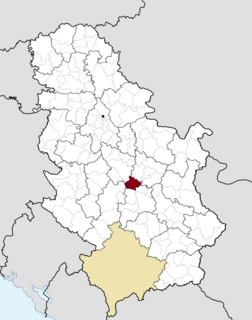
Medveđa is a village in the municipality of Trstenik, Serbia. According to the 2002 census, the village has a population of 2694 people.