Velp | |
|---|---|
Town | |
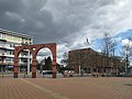
 360° Panorama, Main Street, Velp, The Netherlands. | |
 Velp Location in the province of Gelderland in the Netherlands  Velp Velp (Netherlands) | |
| Coordinates: 51°59′41″N5°58′33″E / 51.99472°N 5.97583°E | |
| Country | Netherlands |
| Province | Gelderland |
| Municipality | Rheden |
| Area | |
• Total | 11.02 km2 (4.25 sq mi) |
| Elevation | 18 m (59 ft) |
| Population (2021) [1] | |
• Total | 18,100 |
| • Density | 1,640/km2 (4,250/sq mi) |
| Time zone | UTC+1 (CET) |
| • Summer (DST) | UTC+2 (CEST) |
| Postal code | 6881-6883 [1] |
| Dialing code | 026 |
| Major roads | A12 |
Velp is a Dutch village located east of Arnhem within the municipality of Rheden, between Arnhem, Rozendaal, and the town of Rheden.
Contents
Velp was a separate municipality from 1812 to 1818, when it was merged with Rheden. The municipality also included the village of Rozendaal. [3]