
Miryalaguda is a city in Nalgonda district of the Indian state of Telangana. In 2015, the Government of India placed Miryalaguda under the Atal Mission for Rejuvenation and Urban Transformation scheme. It is located about 44 kilometres (27 mi) from the district headquarters Nalgonda, 142 kilometres (88 mi) from the state capital Hyderabad.

Nalgonda is a city and municipality in the Indian state of Telangana. It is the headquarters of the Nalgonda district, as well as the headquarters of the Nalgonda mandal in the Nalgonda revenue division. It is located about 90 kilometres (56 mi) from the state capital Hyderabad.
Nakrekal is a census town in Nalgonda district of the Indian state of Telangana. It is located in Nakrekal mandal in Nalgonda division..It is located about 26km from Suryapet and 29km from Nalgonda.

Nalgonda district is a district in the Telangana state of India. Nalgonda district has the highest number of mandals in the state with 31 mandals. The district shares boundaries with Suryapet, Rangareddy, Yadadri and Nagarkurnool districts and with the state boundary of Andhra Pradesh.

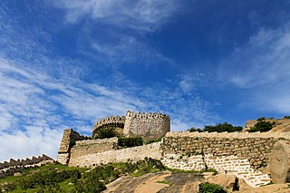
Devarakonda is a town in the Nalgonda district of the Indian state of Telangana. It is a municipality in Devarakonda mandal of Devarakonda division. It is located about 60 kilometres (37 mi) from the district headquarters Nalgonda, 104 kilometres (65 mi) from the state capital Hyderabad

Bhongir, officially known as Bhuvanagiri, is a city and a district headquarters of the Yadadri Bhuvanagiri district and part of the Hyderabad Metropolitan Region of the Indian state of Telangana.

Choutuppal is a census town in Yadadri Bhuvanagiri district of the Indian state of Telangana. It is located in Choutuppal mandal of Choutuppal division. Its part of Hyderabad Metropolitan Development Authority. 49 Kms from Hyderabad.
Jangaon (Janagama) is a city and the district headquarters of Jangaon district in the Indian state of Telangana. It is also the mandal and divisional headquarters of Jangaon Mandal and Jangaon revenue division respectively. It is about 85 kilometres (53 mi) from the state capital Hyderabad. It lies on the National Highway 163
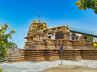
Chandur is a census town and Municipality and it is a Mandal Headquarters of Chandur Mandal in Nalgonda district & in the state of Telangana, India. It is located in Chandur mandal of Nalgonda division Postal code or Pin code: 508255. A beautiful and peaceful town. There are various legends about the etymology of the name one of the folklore says Chandi uuru as there is a famous Chandi maata temple of which the deity resembles to the goddess Durga of Vijayawada and is said to be commenced at the same time of the famous temple.

Chityal is a municipality in Nalgonda district of the Indian state of Telangana. It is located in Chityal mandal of Nalgonda division. 74 Kms from Hyderabad.
Nidamanoor is one of the 33 mandals in Nalgonda district of the Indian state of Telangana. It is under the administration of Miryalaguda revenue division. It comes under left canal of Nagarjuna Sagar Dam.
Nalgonda mandal is one of the 59 mandals in Nalgonda district of the Indian state of Telangana. It is under the administration of Nalgonda revenue division and the headquarters are located at Nalgonda.
Narketpally is a town in Nalgonda district of the Indian state of Telangana. It is situated at 85KM east of Hyderabad right on highway NH65 of Nalgonda division.
Samsthan Narayanapur is a Mandal in Bhuvanagiri district of Telangana State, India. Narayanapur Mandal Headquarters is Narayanapur town. It belongs to Telangana region. It is located 39 km towards west from District headquarters Bhongir.
Gundlapally is a village in Nalgonda district of Telangana State, India. It is located in.
'Mungode,' 'Munugodu' or 'Munugode' is a village located in Munugode Mandal in Nalgonda Division of Nalgonda district of Telangana state, India. It is 21 Kilometers westward from Nalgonda town. Munugode village has a population of 10141, of which 5294 are males, while 4847 are females, as per Population Census 2011.
M.Turkapally is a village in Nalgonda district of the Indian state of Telangana. It is located in Turkapally mandal of Bhongir division.

Warangal district, formerly Warangal Rural district, is a district in the Indian state of Telangana. The district shares boundaries with Mahabubabad, Jangaon, Hanamkonda, Mulugu and Bhupalpally districts.
Yadadri Bhuvanagiri District, is a district in the Indian state of Telangana. The administrative headquarters is located at Bhuvanagiri Town. The district shares boundaries with Suryapet, Nalgonda, Jangaon, Siddipet, Medchal-Malkajgiri and Rangareddy districts. It was carved out of Nalgonda district on 11 October 2016 during a large reorganization of the districts of Telangana.
Suryapet district is a district in the Indian state of Telangana. The city of Suryapet is the district headquarters. The district has three revenue divisions Suryapet, Kodad and Huzurnagar. It is sub-divided into 23 mandals. The district shares boundaries with Nalgonda, Khammam, Yadadri, Jangaon and Mahabubabad districts and with Andhra Pradesh state.

