
Kristiansand, historically spelled Christianssand and Christiansand, is a city and municipality in Agder county, Norway. It is the fifth largest city in Norway and the municipality is the sixth largest in Norway, with a population of around 112,000 as of January 2020, following the incorporation of the municipalities of Søgne and Songdalen into the new and revised municipality of greater Kristiansand. In addition to the city itself, Statistics Norway counts four other densely populated areas in the municipality: Skålevik in Flekkerøy with a population of 3,526 in the Vågsbygd borough, Strai with a population of 1,636 in the Grim borough, Justvik with a population of 1,803 in the Lund borough, and Tveit with a population of 1,396 in the Oddernes borough. Kristiansand is divided into five boroughs: Grim, which is located northwest in Kristiansand with a population of 15,000; Kvadraturen, which is the centre and downtown Kristiansand with a population of 5,200; Lund, the second largest borough; Søgne, with a population of around 12,000 and incorporated into the municipality of Kristiansand as of January 2020; Oddernes, a borough located in the west; and Vågsbygd, the largest borough with a population of 36,000, located in the southwest.

Vågsbygd is a borough and district in the city of Kristiansand in Vest-Agder county, Norway. It is the largest borough and district in Kristiansand. Until 1965, Vågsbygd was a part of Oddernes municipality. The borough includes the districts of Flekkerøy, Voiebyen, Vågsbygd/Augland, and Slettheia. The Kristiansand Cannon Museum on Kroodden is an authentic fortress from World War II.

Grim is a borough in the city of Kristiansand in Vest-Agder county, Norway. The borough has a population of about 16,000 people and is the second least populated borough in Kristiansand. Grim is located in the northwestern part of the municipality, north of Vågsbygd borough, northwest of Kvadraturen borough, and west of Lund borough. Grim also borders Songdalen and Vennesla municipalities to the west and north, respectively.

Lund is a borough and district in the city of Kristiansand in Vest-Agder county, Norway. It is the second largest borough in the city after Vågsbygd. In 2015, the population was about 30,000. Lund is divided into 4 districts: Lund (centrum), Gimlekollen, Justvik, and Ålefjær.
Kvadraturen is the city center of Kristiansand in Vest-Agder county, Norway, with a population of 6,750 (2015). The borough is made up of the centre together with the harbour to the south and the more rural district of "Eg" to the north. Kvadraturen is the administrative centre of the municipality of Kristiansand as well as the administrative centre of Vest-Agder county, but is far smaller in area than the other boroughs in the municipality, such as the borough of Grim to the north and west, and the borough of Lund to the east.

Kristiansand Bus Terminal is the main bus terminal serving Kristiansand, Norway. It has bus lines to many places, including Oslo and Stavanger. The bus terminal is located next to Kristiansand Station and the city harbor. It was built between 1960 and 1965.

Tollbodgata is a street in Kristiansand, Norway. The street is one way westbound with sidewalks on both sides of the road. It consists mostly of apartments, houses and stores.
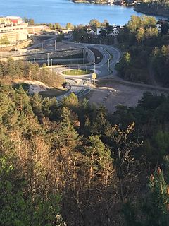
Hannevika or Hannevig / Hannevik is a neighbourhood in the city of Kristiansand in Vest-Agder county, Norway. It is located in the borough of Grim and in the district of Tinnheia. The neighborhood is located along the European route E39 highway and the start of Norwegian County Road 456. Hannevika is a large industrial area. Glencore and Hennig-Olsen Iskremfabrikk are the two largest industries located there. Hannevika is located southeast of Eigevannskollen, northeast of Kartheia, and south of Kolsberg.
Ternevig is a neighbourhood in the city of Kristiansand in Vest-Agder county, Norway. The neighborhood is located in the borough of Vågsbygd and in the district of Voiebyen. Ternevig is northeast of Møvik, southeast of Voie, east of Møviklia, and west of the ocean and the island of Andøya. There is a small hospital located in Ternevig serving the borough of Vågsbygd. There is also a marina located in this neighborhood.
Skutevika is a neighbourhood in the city of Kristiansand in Vest-Agder county, Norway. The neighborhood is located in the borough of Vågsbygd and in the district of Voiebyen. Skutevika is north of Kroodden, south of Møviklia, east of Steindalen, and west of Spinneren.

Steindalen is a neighbourhood in the city of Kristiansand in Vest-Agder county, Norway. The neighborhood is located in the borough of Vågsbygd and in the district of Voiebyen. Steindalen is north of Kroodden, south of Voieåsen, east of Voietun, and west of Møviklia.
Voieåsen is a neighbourhood in the city of Kristiansand in Vest-Agder county, Norway. The neighborhood is located in the borough of Vågsbygd and in the district of Voiebyen. Voieåsen is north of Møviklia, south of Voie, east of Voielia, and west of Møvik.
Voielia is a neighbourhood in the city of Kristiansand in Vest-Agder county, Norway. The neighborhood is located in the borough of Vågsbygd and in the district of Voiebyen. Voielia is north of Voietun, south of Rådyr, east of Bråvann, and west of Voieåsen.
Rådyr is a neighbourhood in the city of Kristiansand in Vest-Agder county, Norway. The neighborhood is located in the borough of Vågsbygd and in the district of Voiebyen. The neighborhood of Rådyr is north of Voielia, south of Kjos Haveby, east of Bråvann, and west of Kjosbukta.
Storenes is a neighbourhood in the city of Kristiansand in Vest-Agder county, Norway. It is located in the borough of Vågsbygd and in the district of Vågsbygd. The neighborhood is located along the Kristiansandsfjorden, southeast of Augland.
Vestheiene is a neighbourhood in the city of Kristiansand in Vest-Agder county, Norway. It is located in the borough of Grim and in the district of Hellemyr. Vestheiene is located to the east of Breimyr and west of Hellemyrtoppen. Solkollen lies to the north of Vestheiene.

Hamresanden is a 3-kilometre (1.9 mi) long beach in the municipality of Kristiansand in Vest-Agder county, Norway. The sandy beach is located at Hamre in the district of Tveit, along the Topdalsfjorden at the mouth of the river Topdalselva. It is located near Kristiansand Airport, Kjevik. Hamresanden goes from Grovikheia in Hånes to Ve.
Elisenhøy is a neighbourhood in the city of Kristiansand in Vest-Agder county, Norway. It is located in the borough of Grim and in the district of Grim. It is located on the south side of the Norwegian National Road 9, east of Klappane and Grim torv, northwest of Fagervoll, and south of Krossen.

Posebyen is a neighbourhood in the city of Kristiansand in Vest-Agder county, Norway. Posebyen is located in the downtown borough of Kvadraturen, along the western shore of the river Otra. It consists mostly of large, white, wooden houses, many of which were left intact after the big city fire in 1892. Therefore, it forms the largest continuous collection of old wooden houses in any city in Northern Europe.

Markens gate is the main pedestrian street in Kristiansand, Norway. It is located in the west of the borough Kvadraturen and the length of the entire street is 1 kilometer, while the pedestrian part is 550 meters and another 160 meters with Otterdalsparken. The streets goes from Slottet Mall in the north and is a pedestrian street all the way down to Dronningens gate, it's only crossed by traffic from Tordenskjolds gate, Kristian IVs gate and Henrik Wergelands gate before Dronningens gate. The pedestrian parts stretches over 7 quarters. Compared to other Norwegian cities, Markens street is one of the most walked streets in the country.

