Veurne/Sint-Augustinus Heliport

Last updated
Veurne/Sint-Augustinus Heliport
Summary
Airport type Public
Operator AZ Sint-Augustinus Veurne
Serves Veurne
Location Belgium
Elevation  AMSL 13 ft / 4 m
Coordinates 51°03′44″N002°40′10″E / 51.06222°N 2.66944°E / 51.06222; 2.66944 Coordinates: 51°03′44″N002°40′10″E / 51.06222°N 2.66944°E / 51.06222; 2.66944
Map
Belgium location map.svg
Airplane silhouette.svg
EBVS
Location of Veurne/Sint-Augustinus Heliport in Belgium
Helipads
Number Length Surface
m ft
1 30 98 Asphalt
Sources: Belgian AIP [1]

Veurne/Sint-Augustinus Heliport( ICAO : EBVS) is a hospital heliport located near Veurne, West Flanders, Belgium.

ICAO airport code four-letter code designating many airports around the world

The ICAOairport code or location indicator is a four-letter code designating aerodromes around the world. These codes, as defined by the International Civil Aviation Organization and published in ICAO Document 7910: Location Indicators, are used by air traffic control and airline operations such as flight planning.

Veurne Municipality in Flemish Community, Belgium

Veurne is a city and municipality in the Belgian province of West Flanders. The municipality comprises the town of Veurne proper and the settlements of Avekapelle, Booitshoeke, Bulskamp, De Moeren (Belgium), Eggewaartskapelle, Houtem, Steenkerke, Vinkem, Wulveringem, and Zoutenaaie.

West Flanders Province of Belgium

West Flanders is the westernmost province of the Flemish Region, in Belgium. It is the only coastal Belgian province, facing the North Sea to the north. It has land borders with the Netherlands to the northeast, the Flemish province of East Flanders to the east, the Walloon province of Hainaut in the southeast and France to the west. Its capital is Bruges (Brugge). Other important cities are Kortrijk in the south and Ostend on the coast, Roeselare and Ypres (Ieper). The province has an area of 3,125 km² which is divided into eight administrative districts (arrondissementen) containing 64 municipalities.

Contents

See also

Related Research Articles

Transport in Belgium

Transport in Belgium is facilitated with well-developed road, air, rail and water networks. The rail network has 2,950 km (1,830 mi) of electrified tracks. There are 118,414 km (73,579 mi) of roads, among which there are 1,747 km (1,086 mi) of motorways, 13,892 km (8,632 mi) of main roads and 102,775 km (63,861 mi) of other paved roads. There is also a well-developed urban rail network in Brussels, Antwerp and Charleroi. The ports of Antwerp and Bruges-Zeebrugge are two of the biggest seaports in Europe. Brussels Airport is Belgium's biggest airport.

Sint-Truiden Municipality in Flemish Community, Belgium

Sint-Truiden is a city and municipality located in the province of Limburg, Flemish Region, Belgium, near the towns of Hasselt and Tongeren. The municipality includes the old communes of Aalst, Brustem, Duras, Engelmanshoven, Gelinden, Gorsem, Groot-Gelmen, Halmaal, Kerkom-bij-Sint-Truiden, Melveren, Metsteren, Ordingen, Runkelen, Velm, Wilderen, and Zepperen.

Koksijde Air Base Belgian Air Component facility

Koksijde Air Base is a Belgian Air Component facility in Koksijde, 1 nautical mile north northwest of Veurne, Belgium. 40 Squadron operating 5 Westland Sea King Mk.48 helicopters for search and rescue (SAR) duties. Also based at Koksijde Air Base are Aérospatiale Alouette III helicopters. The Westland Sea King Mk.48 helicopters will be replaced with NH90 NFH helicopters starting in March 2012.

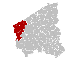
Arrondissement of Veurne Arrondissement in Flemish Region, Belgium

The Arrondissement of Veurne is one of the eight administrative arrondissements in the Province of West Flanders, Belgium. It is both an administrative and a judicial arrondissement. However, the Judicial Arrondissement of Veurne also comprises all municipalities in the Arrondissement of Diksmuide.

Bridgetown Heliport heliport on Barbados

Bridgetown Heliport, is found in the city of Bridgetown, Saint Michael on the island of Barbados. The heliport is situated on the shores of Carlisle Bay roughly 12.9 km (8.0 mi) from Sir Grantley Adams International Airport in neighbouring Christ Church.

The first edition of the Tour of Flanders, a cycling race in Belgium, was held on 25 May 1913. Paul Deman won the event in a five-man sprint before Joseph Van Daele and Victor Doms. The event was created by sports journalist Karel Van Wijnendaele and organized by sports newspaper Sportwereld.

Sint-Lucas Hospital Heliport airport in Belgium

Sint-Lucas Hospital Heliport is a hospital heliport located near Brugge, West Flanders, Belgium.

Ghent/Industry Zone Heliport airport in Belgium

Ghent/Industry Zone Heliport is a heliport serving Ghent University Hospital located near Ghent, East Flanders, Belgium.

Oeren Heliport airport in Belgium

Oeren Heliport is a private heliport located near Veurne, West Flanders, Belgium.

Baudour Heliport airport in Saint-Ghislain, Belgium

Baudour Heliport is a hospital heliport located near Douvrain, in the Walloon municipality of Saint-Ghislain, Hainaut, Belgium.

1914 Tour of Flanders

The second running of the Tour of Flanders cycling race in Belgium was held on Sunday, 22 March 1914. Belgian Marcel Buysse won the race in a sprint of a seven-strong group on the velodrome of Evergem, part of Ghent. 19 of 47 riders finished. The race started and finished in Ghent.

References