
The history of Antarctica emerges from early Western theories of a vast continent, known as Terra Australis, believed to exist in the far south of the globe. The term Antarctic, referring to the opposite of the Arctic Circle, was coined by Marinus of Tyre in the 2nd century AD.

Fabian Gottlieb Thaddeus von Bellingshausen, a Baltic German naval officer in the Imperial Russian Navy, cartographer and explorer, who ultimately rose to the rank of admiral. He participated in the First Russian circumnavigation of the globe and subsequently became a leader of another circumnavigation expedition that discovered the continent of Antarctica.
The Australian National Antarctic Research Expeditions is the historical name for the Australian Antarctic Program (AAp) administered for Australia by the Australian Antarctic Division (AAD).

Denman Glacier is a glacier 7 to 10 nautical miles wide, descending north some 70 nautical miles, which debouches into the Shackleton Ice Shelf east of David Island, Queen Mary Land. It was discovered in November 1912 by the Western Base party of the Australasian Antarctic Expedition under Sir Douglas Mawson. Mawson named the glacier for Lord Denman, Governor-General of Australia in 1911, a patron of the expedition.
The Ronne Antarctic Research Expedition (RARE) was an expedition from 1947–1948 which researched the area surrounding the head of the Weddell Sea in Antarctica.
The French Antarctic Expedition is any of several French expeditions in Antarctica.

The Australasian Antarctic Expedition (AAE) was an Australasian scientific team that explored part of Antarctica between 1911 and 1914. It was led by the Australian geologist Douglas Mawson, who was knighted for his achievements in leading the expedition. In 1910 he began to plan an expedition to chart the 3,200-kilometre-long (2,000 mi) coastline of Antarctica to the south of Australia. The Australasian Association for the Advancement of Science approved of his plans and contributed substantial funds for the expedition.
Mawson's Huts are the collection of buildings located at Cape Denison, Commonwealth Bay, in the far eastern sector of the Australian Antarctic Territory, some 3000 km south of Hobart. The buildings were erected and occupied by the Australasian Antarctic Expedition (AAE) of 1911-1914, led by geologist and explorer Sir Douglas Mawson.

A number of governments have set up permanent research stations in Antarctica and these bases are widely distributed. Unlike the drifting ice stations set up in the Arctic, the research stations of the Antarctic are constructed either on rock or on ice that is fixed in place.
John Biscoe was an English mariner and explorer who commanded the first expedition known to have sighted the areas named Enderby Land and Graham Land along the coast of Antarctica. The expedition also found a number of islands in the vicinity of Graham Land, including the Biscoe Islands that were named after him.

Endurance Glacier is a broad glacier north of Mount Elder, draining south-east to the south coast of Elephant Island in the South Shetland Islands of Antarctica, and is the main discharge glacier on the island. It was named by the UK Antarctic Place-Names Committee after HMS Endurance, which anchored off the glacier on several occasions in support of the Joint Services Expedition to Elephant Island, 1970–71.
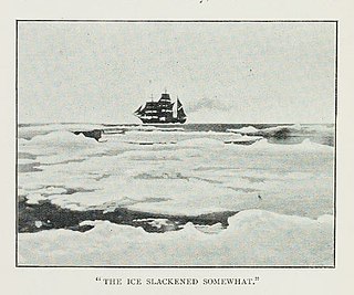
The Southern Cross Expedition, officially known as the British Antarctic Expedition 1898–1900, was the first British venture of the Heroic Age of Antarctic Exploration, and the forerunner of the more celebrated journeys of Robert Falcon Scott and Ernest Shackleton. The brainchild of the Norwegian-born, half-British explorer and schoolmaster Carsten Borchgrevink, it was the first expedition to over-winter on the Antarctic mainland, the first to visit the Great Ice Barrier since James Clark Ross's expedition of 1839 to 1843, and the first to effect a landing on the Barrier's surface. It also pioneered the use of dogs and sledges in Antarctic travel.
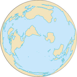
The Southern Ocean, also known as the Antarctic Ocean or the Austral Ocean, and the "Southern Icy Ocean".</ref> comprises the southernmost waters of the World Ocean, generally taken to be south of 60° S latitude and encircling Antarctica. As such, it is regarded as the fourth largest of the five principal oceanic divisions: smaller than the Pacific, Atlantic, and Indian Oceans but larger than the Arctic Ocean. This ocean zone is where cold, northward flowing waters from the Antarctic mix with warmer subantarctic waters.

Posadowsky Glacier is a glacier about 9 nautical miles long, flowing north to Posadowsky Bay immediately east of Gaussberg. Posadowsky Bay is an open embayment, located just east of the West Ice Shelf and fronting on the Davis Sea in Kaiser Wilhelm II Land. Kaiser Wilhelm II Land is the part of East Antarctica lying between Cape Penck, at 87°43'E, and Cape Filchner, at 91°54'E, and is claimed by Australia as part of the Australian Antarctic Territory. Other notable geographic features in this area include Drygalski Island, located 45 mi NNE of Cape Filchner in the Davis Sea, and Mirny Station, a Russian scientific research station.
The Tryne Islands are a group of numerous small Antarctic islands and rocks, about 7 km (4 mi) in extent, forming the western limit of Tryne Bay and Tryne Sound at the north-eastern end of the Vestfold Hills. The islands were mapped by Norwegian cartographers from aerial photographs taken by the Lars Christensen Expedition (1936–37) and named Trynøyane.

Hawker Island is an irregularly shaped island about 2 km (1.2 mi) long, lying some 7 km south-west of Davis Station between Mule Island and Mule Peninsula, Vestfold Hills, in the eastern part of Prydz Bay, Antarctica. It was mapped by Norwegian cartographers from aerial photographs taken by the Lars Christensen Expedition, 1936–37. It was remapped by the Australian National Antarctic Research Expeditions (1957–58) and named after Alan Charles Hawker, a radio supervisor at Davis Station in 1957.

Vostok was a 28-gun sloop-of-war of the Imperial Russian Navy, the lead ship of the First Russian Antarctic Expedition in 1819—1821, during which Fabian Gottlieb von Bellingshausen and Mikhail Lazarev circumnavigated the globe, discovered the continent of Antarctica and twice circumnavigated it, and discovered a number of islands and archipelagos in the Southern Ocean and the Pacific.

Mirny was a 20-gun sloop-of-war of the Imperial Russian Navy, the second ship of the First Russian Antarctic Expedition in 1819—1821, during which Fabian Gottlieb von Bellingshausen and Mikhail Lazarev circumnavigated the globe, discovered the continent of Antarctica and twice circumnavigated it, and discovered a number of islands and archipelagos in the Southern Ocean and the Pacific.


