Victoria | |
|---|---|
Municipality | |
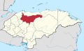
 Victoria Location in Honduras | |
| Coordinates: 14°56′18″N087°23′33″W / 14.93833°N 87.39250°W | |
| Country | Honduras |
| Department | Yoro |
| Villages | 19 |
| Area | |
• Total | 795.75 km2 (307.24 sq mi) |
| Elevation | 383 m (1,255 ft) |
| Population (2015) | |
• Total | 34,215 |
| • Density | 42.997/km2 (111.36/sq mi) |
| Time zone | UTC-6 (Central America) |
Victoria is a municipality in the Honduran department of Yoro. [1]
Contents
It is served by Victoria Airport, a 700 metres (2,300 ft) grass airstrip.