
Victory Avenue is a road in Mong Kok, Kowloon. [1] It begins at Argyle Street, and ends at Waterloo Road. There are a number of pet shops along the road, as well as restaurants due to the large number of schools around the area.
Victory Avenue is a road in Mong Kok, Kowloon. [1] It begins at Argyle Street, and ends at Waterloo Road. There are a number of pet shops along the road, as well as restaurants due to the large number of schools around the area.

New York State Route 440 (NY 440) is a freeway located entirely on Staten Island in New York City. The route acts as a connector between the two segments of New Jersey Route 440, running from the Staten Island community of Richmond Valley in the south to Port Richmond in the north. NY 440 is connected to the two New Jersey segments by the Outerbridge Crossing to the south and the Bayonne Bridge to the north. It is one of several signed New York State routes that are not connected to any others in the state, and one of only two NYS routes that is the middle section of another state's highway bearing the same number. From the Korean War Veterans Parkway to Interstate 278 (I-278), it is known as the West Shore Expressway. North of I-278, it is named the Dr. Martin Luther King Jr. Expressway. NY 440 is the southernmost state route in the state of New York.

Avenue D is the easternmost named avenue in the East Village neighborhood of Manhattan, New York City, east of Avenue C and west of the FDR Drive. It runs through East 13th and Houston Streets, and continues south of Houston Street as Columbia Street until Delancey Street and Abraham E. Kazan Street until its end at Grand Street. Avenues A, B, C and D are the origin of the name of the section of the East Village neighborhood through which they run, Alphabet City.

Roads and expressways in Chicago summarizes the main thoroughfares and the numbering system used in Chicago and its surrounding suburbs.

Oak Lawn is a neighborhood in Dallas, Texas, defined in Dallas City Ordinance 21859 as Planned Development District No. 193, the Oak Lawn Special Purpose District. The unofficial boundaries are Turtle Creek Boulevard, Central Expressway, the City of Highland Park, Inwood Road, and Harry Hines Boulevard. It is over 12 square miles (31 km2) in area. Officially it is bounded by the City of Highland Park, the North Central Expressway, Stemmons Freeway, Woodall Rodgers Freeway, and other roads. The district is within the boundary defined by the City of Dallas law, excluding any existing planned development districts within.
Meiers Corners is a neighborhood on Staten Island, one of the five boroughs of New York City, United States.

Park Avenue in the suburb of Sandymount, Dublin 4, Ireland is the name of a road joining Sydney Parade Avenue to Gilford Road. It is home to a number of cricket and rugby union grounds including Pembroke Cricket Club, the Railway Union Sports Club and Monkstown Rugby Club. Of architectural note is the Church of St John, noted for its French Bath stone's decay due to its proximity to the sea. The church is on an island at the junction of Park Avenue and St Johns Road, which continues east towards the sea at Sandymount Strand.
Rivonia is a suburb of Johannesburg, South Africa in the Sandton area. It is located in Region E of the City of Johannesburg Metropolitan Municipality. Rivonia is one of the most affluent residential and business suburbs of Johannesburg, and regarded as the hub of upstart and established I.T. companies. The main retail thoroughfare in the area, Rivonia Boulevard, is the location of several shopping complexes as well as many other shops and restaurants. The area known as Rivonia includes the original township of Edenburg, Edenburg Extension 1, and 19 smaller extensions designated 'Rivonia Extension ...', numbered from 0 to 25. There is no designated township called Rivonia. The post code for Rivonia is 2128.
Louis Botha Avenue is a major street in Johannesburg, South Africa. Originally part of the main road between central Johannesburg and Pretoria, it runs along through the north-eastern parts of the city from Hillbrow to Sandton, passing through numerous older suburbs, including Houghton and Orange Grove, before it becomes the Pretoria Main Road (R101) which passes the Alexandra Township and continues to Midrand and Pretoria.
Parktown North is a suburb of Johannesburg, South Africa. It is one of the older residential areas of the Northern Suburbs, having been created as a residential area for the poorer relatives of the Randlords who had built their mansions on Parktown Ridge during the early days of the Rand gold rush. It takes its name from being North of Parktown. The suburb has many old colonial-style houses, and manages to maintain a village atmosphere, despite being near to one of the busiest roads in the city, Jan Smuts Avenue.
Linden is a suburb of Johannesburg, South Africa - situated towards the north western suburbs of the city on the border of the former independent town of Randburg. This established suburb between 5 km (3.1 mi) to 8 km (5.0 mi) north-west of the Johannesburg CBD was designed so that most of the streets and avenues form similar sized blocks. A number of shops, churches and schools can be found on 3rd Avenue and 4th Avenue. Attractions include arts, crafts, studios, coffee shops, pubs, restaurants and small shops. Bordering suburbs include Northcliff, Blairgowrie, Victory Park, Greenside and Cresta.
Peiraios Street is a main road in Athens, Greece linking the center of the city with the port of Piraeus. It is part of the system of national roads, as number 56. Its length spans 10 km. Major intersections and an interchange include Karaoli Dimitriou Street, Kifissou Avenue, the Konstantinopouleos Avenue junction, Apostolou Pavlou with Vasileiou tou Megalou, Ermou, Thermopylon, Sofokleous, Deligiorgi and Sokratous Street. The island areas of the road are aligned with trees, and historically the avenue runs over parts of the north wall and ancient road of Phaleron.
Victory Boulevard is a major thoroughfare on Staten Island, New York City, measuring approximately 8.0 miles (12.87 km). It stretches from the West Shore community of Travis to the upper East Shore communities of St. George and Tompkinsville. In the late 1940s, the portion of Victory Boulevard between Richmond Avenue and Forest Avenue was designated as New York State Route 439A (NY 439A). The section between Forest Avenue and Bay Street became part of NY 439 at the same time. Both designations were removed in c. 1968.

New York State Route 439 (NY 439) was an east–west state highway on Staten Island in New York in the United States. The western terminus of the route was at the Goethals Bridge, where it continued into New Jersey as its Route 439. Its eastern terminus was at the Staten Island Ferry terminal in the St. George neighborhood. In between, NY 439 followed the Staten Island Expressway, Forest Avenue, Victory Boulevard, and Bay Street.

Archer Creek, a northern tributary of the Parramatta River, is a creek west of Sydney Harbour, located in Sydney, New South Wales, Australia. It joins the Parramatta River at Meadowbank Park, Meadowbank.
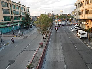
Andres Bonifacio Avenue, also known as A. Bonifacio Avenue, is a 3.784-kilometer (2.351 mi) national secondary road connecting the North Luzon Expressway and Epifanio de los Santos Avenue at Balintawak Interchange in Quezon City and Blumentritt Road at the city's boundary with Manila in a north–south direction.

Tandang Sora Avenue, formerly known as Banlat Road, is a major east-west thoroughfare bisecting Quezon City in Metro Manila, the Philippines. It is a two-to-six lane highway and municipal road that runs for 9.6 kilometers (6.0 mi) from its eastern terminus at Magsaysay Avenue in Pansol and U.P. Campus in Diliman to its western terminus at Quirino Highway in Baesa and Talipapa in Novaliches, crossing Barangays Culiat, New Era, Pasong Tamo, Tandang Sora, and Sangandaan.

Victory Square (Ukrainian: Площа Перемоги; a square in the Novozavodsky district of Chernihiv at the intersection of Victory Avenue and Ivan Mazepa Street.
| | This Hong Kong road article is a stub. You can help Wikipedia by expanding it. |
| | This Kowloon-related article is a stub. You can help Wikipedia by expanding it. |