
Vanvikan is a village in the municipality of Indre Fosen in Trøndelag county, Norway. It is located along the Trondheimsfjord in the southeastern part of the municipality. The village of Seter lies about 10 kilometres (6.2 mi) northeast of Vanvikan and the lake Storvatnet lies about 4 kilometres (2.5 mi) north of the village. One of the schools in the municipality, Vanvikan Skole is located in the village of Vanvikan. Stranda Church is also located in the village.

Opphaug is a village in the municipality of Ørland in Trøndelag county, Norway. The village is located on the Ørlandet peninsula about 4 kilometres (2.5 mi) east of the village of Uthaug, 5 kilometres (3.1 mi) northwest of the villages of Ottersbo and Austrått, and 5 kilometres (3.1 mi) northeast of the town of Brekstad.

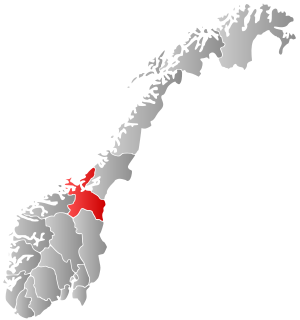
Selbekken is the administrative centre of the municipality of Agdenes in Trøndelag county, Norway. The village is located directly south of the village of Lensvik along the Trondheimsfjorden and the Norwegian County Road 710. The 0.48-square-kilometre (120-acre) village has a population (2018) of 390 and a population density of 813 inhabitants per square kilometre (2,110/sq mi).
Langørjan or Rye is a village in the municipality of Trondheim in Trøndelag county, Norway. The village is located in the borough of Heimdal in the Byneset district about 12 kilometres (7.5 mi) west of the city of Trondheim and about 7.5 kilometres (4.7 mi) north of the village of Spongdal.
Eggkleiva is a village in the municipality of Skaun in Trøndelag county, Norway. It is located along Norwegian County Road 709, about halfway between the villages of Skaun and Børsa. The village of Melby lies about 6 kilometres (3.7 mi) southwest of Eggkleiva.

Børsa is the administrative centre of the municipality of Skaun in Trøndelag county, Norway. The village lies along the shore of the Gaulosen, an arm off the vast Trondheimsfjorden. It is about 6 kilometres (3.7 mi) west of the village of Buvika, along the European route E39 highway. The villages of Skaun and Eggkleiva lie just a short distance to the south and the town of Orkanger lies about 15 kilometres (9.3 mi) to the west. Historically, this village was the administrative centre of the old municipality of Børsa from 1838 until 1965. [
Malmsjøen is a lake in the municipality of Skaun in Trøndelag county, Norway. It is located about 1.5 kilometres (0.93 mi) southeast of the village of Skaun, about 7 kilometres (4.3 mi) north of the village of Korsvegen, and about 10 kilometres (6.2 mi) southwest of the village of Melhus. The Norwegian County Road 709 runs along the northern shore of the lake.
Skogmo is a village in the municipality of Overhalla in Trøndelag county, Norway. It is located along the Norwegian County Road 17, about 4 kilometres (2.5 mi) northeast of the municipal centre, Ranemsletta. The village lies just north of the river Namsen and about 5 kilometres (3.1 mi) southwest of the lake Eidsvatnet.
Forbregd and Lein are two small adjoining villages in the municipality of Verdal in Trøndelag county, Norway. Statistics Norway classifies the urban area as Forbregd/Lein. The village area is located about 4 kilometres (2.5 mi) northeast of the town of Verdalsøra and about 2 kilometres (1.2 mi) northwest of Stiklestad, along the southern shore of the lake Leksdalsvatnet. The 0.43-square-kilometre (110-acre) village has a population (2018) of 849 and a population density of 1,974 inhabitants per square kilometre (5,110/sq mi).
Trolla is a village in the municipality of Trondheim in Trøndelag county, Norway. It is located in the Midtbyen borough, along the Trondheimsfjord on the north coast of the Bymarka area. It is about 10 kilometres (6.2 mi) northeast of the village of Langørjan and about 4 kilometres (2.5 mi) northwest of the Ila neighborhood in the city of Trondheim.
Buvik is a former municipality in the old Sør-Trøndelag county, Norway. Buvik existed from 1855 until 1965. The municipality encompassed the extreme northeastern part of what is now the municipality of Skaun in Trøndelag county. It encompassed the roughly 25-square-kilometre (9.7 sq mi) area surrounding the Vigda river south of the Gaulosen fjord. The administrative centre was located in the village of Buvika.
Trøa is a village in the municipality of Selbu in Trøndelag county, Norway. It is located along the eastern end of the lake Selbusjøen, just north of the village of Innbygda, about 5 kilometres (3.1 mi) north of the municipal center of Mebonden, and about 4 kilometres (2.5 mi) south of the village of Tømra.
Buvika is a village in the municipality of Skaun in Trøndelag county, Norway. It is located at the end of the Gaulosen, an arm of the Trondheimsfjord, about 3.5 kilometres (2.2 mi) southwest of the mouth of the Gaula River. Buvika lies along the European route E39, about halfway between the villages of Børsa and Leinstrand. The village of Buvika was the municipal center of the former municipality of Buvik from 1855 until its dissolution in 1965, and this is also where Buvik Church is located.

Hommelvik is the administrative centre of the municipality of Malvik in Trøndelag county, Norway. The village is located at the end of the Hommelvika, a bay off of the Trondheimsfjord. Hommelvik is about 2.5 kilometres (1.6 mi) southwest of the village of Muruvika, about 4 kilometres (2.5 mi) southeast of the village of Smiskaret, about 8 kilometres (5.0 mi) east of the village of Vikhammer, and about 10 kilometres (6.2 mi) north of the village of Sneisen. The river Homla runs north through the village, emptying into the fjord. The name of the village is derived from the river name.

Sparbu is a village in the municipality of Steinkjer in Trøndelag county, Norway. The village is located about 12 kilometres (7.5 mi) south of the town of Steinkjer. The European route E6 highway runs through the village as does the Nordlandsbanen railway line which stops at the Sparbu Station. The village of Mære lies about 2 kilometres (1.2 mi) to the north, the village of Røra lies about 8 kilometres (5.0 mi) to the south, and the lake Leksdalsvatnet lies about 8 kilometres (5.0 mi) to the east.
Melby is a farming village in the municipality of Skaun in Trøndelag county, Norway. It is located in the south-central part of the municipality, about 4 kilometres (2.5 mi) southwest of the village of Skaun and the Norwegian County Road 709 and about 7 kilometres (4.3 mi) south of Eggkleiva. The town of Orkanger and it suburb of Fannrem both lie about 12 kilometres (7.5 mi) to the west.
Hammarvika is a village in the municipality of Frøya in Trøndelag county, Norway. The village is located about 4 kilometres (2.5 mi) south of the municipal center of Sistranda on the southeastern side of the island of Frøya. The 0.58-square-kilometre (140-acre) village has a population (2018) of 461 and a population density of 795 inhabitants per square kilometre (2,060/sq mi).
Lysthaugen is a village in the municipality of Verdal in Trøndelag county, Norway. It is located on the southern side of the river Verdalselva, about 10 kilometres (6.2 mi) east of the town of Verdalsøra and about 7 kilometres (4.3 mi) southwest of the village of Vuku. The mountain Skitholvola lies about 8 kilometres (5.0 mi) south of the village.
Skaun is a small village in Skaun municipality in Trøndelag county, Norway. The village is located along the Norwegian County Road 709, about 4 kilometres (2.5 mi) south of the village of Eggkleiva. Skaun Church is located in the village.


