
Chelora is a village in Kannur district in the state of Kerala, India 8 km from Kannur town and on the Kannur-Mysore Highway. The Kannur International Airport is 15 km from Chelora. Kadakkara Sri Dharmasastha Temple and Valannur Sri Risheishwara Temple are the two temples that attract people to the village. Chelora Govt Higher Secondary School is a local educational institution. Kappad, Valannur, Mathukoth, Peringalayi and Konganamkott Para are among the major localities in Chelora.
Chettipalayam is a suburb of Coimbatore city in Tamil Nadu, India. The place and its vicinity is also home to Kari Motor Speedway, the LOTUS and the Coimbatore Golf Club. It is located 17 km away from Coimbatore Junction. There is also a railway station in Podanur nearby. It is a Town Panchayat and not within the Coimbatore Corporation limits.
Chinnavedampatti a suburb of Coimbatore City in the state of Tamil Nadu, India. It is located on the North-east direction, which comes under the Coimbatore Corporation.

Ettimadai is a town, and a suburb of Coimbatore, in Coimbatore district in the state of Tamilnadu, India. Ettimadai is located between Palakkad and Coimbatore along the Salem - Kochi Highway (NH544) close to Tamil Nadu - Kerala border. Ettimadai Town panchayat is one of the fast-growing south-western suburbs of Coimbatore. The renowned Amrita Vishwa Vidyapeetham University, along with its schools and Amrita Vidyalayam CBSE School is situated here. It is 20 km (12 mi) from Gandhipuram, heart of coimbatore city and it is home to a Ettimadai railway station.
Kalapatti is a neighborhood of Coimbatore city in Tamil Nadu, India. It is located 17 km North-East direction, within the city limits. Now Kalapatti is merged with Corporation of Coimbatore. Because of an increase of information technology (IT) companies surrounding in and around Kalapatti like Peelamedu, HopeCollege, Saravanampatti there is a fast rapid improvement in this place. The Coimbatore International Airport is just about 7 km from Kalapatti.
Karumathampatti is a Municipality in the Coimbatore district in the state of Tamil Nadu, India. It is one of the prominent developing suburb in Coimbatore metropolitan area, about 25 km away from the city centre. It is situated in between NH544 which connects the city of Coimbatore with Salem – Erode – Tirupur and also in between the State Highway 165 connects Annur – Kamanaikenpalayam. Nearby places are Somanur-3 km, Avinashi-10 km, Tirupur-20 km, Sulur-15 km, Annur-16 km. Coimbatore -27,Mettupalayam-38,Palladam-19. Karumathampatti lies near the junction of two major roads, NH544(Coimbatore – Salem) and Karumathampatti – Annur road.
Kunnathur is a panchayat town in Tirupur district in the Indian state of Tamil Nadu. It was previously under the jurisdiction of the Erode district. However kunnathur is in tiruppur district, legislative assembly consistency for kunnathur is Perundurai which is in Erode district.
Madathukulam is Border to Dindigul District in Tirupur district in the Indian state of Tamil Nadu.

Muthur is a panchayat town in Kangeyam taluk in Tirupur district, Tamil Nadu, India.
Saravanampatti is a neighborhood of the Coimbatore city. It lies on the north-eastern part of the city. Saravanampatti is one of the fast-growing neighbourhoods of Coimbatore, because of the proliferation of IT companies in areas such as Saravanampatti, Peelamedu, Keeranatham, Vilankurichi, Kalapatti. Saravanampatti has been part of Coimbatore Corporation since 2011.
Sarcarsamakulam, also known as Kovilpalayam, is a western suburb in Coimbatore in the Indian state of Tamil Nadu. This town is located 17 kilometers from Coimbatore Junction and 12 kilometers from Coimbatore International Airport, Tamil Nadu, India, on the Sathyamangalam Road. Neighbouring places are Saravanampatti, Kalapatti, Vilankurichi

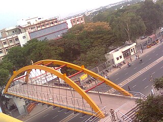
Sulur is a town located in the Coimbatore district of Tamil Nadu, India. It is a suburb of Coimbatore. It is the headquarters of Sulur Taluk of Coimbatore district. There are many market places and many big retail and wholesale shops are available and also taluk office, police station, and a famous RVS institutions consisting of medical college, arts college is there in Sulur. And also two big famous temples are there. It is also a taluk and legislative constituency which comes under the Coimbatore parliamentary constituency.

Vadavalli is a neighborhood in Coimbatore in the Indian state of Tamil Nadu. It is located on the Marudamalai Road and has been under the jurisdiction of the Coimbatore City Municipal Corporation limits since 2007. Located at the foothills of the Western Ghats, Vadavalli has a pleasant climate all through the year and has good ground water resources.
Peelamedu is a major commercial centre and residential locality in the Eastern part of the city of Coimbatore in Tamil Nadu, India. It is governed by Coimbatore City Municipal Corporation since 1981. The growth of Peelamedu during the last decade can be cited due to the growth of the IT sector in Coimbatore. The rapid growth of Peelamedu as a commercial and residential hub could be attributed to its geographical advantage in terms of the connectivity to other parts of the city. It acts as an important hub connecting the rapidly growing business class Information Technology corridor. The Peelamedu area stretches from Nava India to the Coimbatore International Airport near SITRA, encompassing major educational institutions, hospitals, and Industries.
Uthukottai is a town in Suburbs of Chennai, one of the taluk headquarters in Thiruvallur District Tamil Nadu, also one of the border towns of Tamilnadu - Andhra Pradesh, located on the banks of the Arani river. This town is the central hub for many nearby towns and villages for their needs of education, markets, shops, businesses, banks, travel, transport and entertainment(Movie Theatres, badminton courts, cricket grounds, Gyms). The town features a channel which helps to direct water from the Krishna river for local irrigation.
Maniyakaranpalayam is a residential neighbourhood in the city of Coimbatore in Tamil Nadu, India.
Saibaba colony is an area located in Coimbatore, India. The Saibaba Temple is located there, and the name of the area is derived from the temple. The locality is mostly occupied by upper-middle-class people living in Coimbatore. One side is bordered by Thadagam road and the other side by Mettupalayam Road. NSR road in Sai Baba colony is fully occupied by commercial centers.
Ganapathy is a residential neighbourhood in the city of Coimbatore in Tamil Nadu, India. It is located in the north-eastern part of the city. This is the most densely populated area within Coimbatore Corporation limits.
Kurumbapalayam SSKulam is a part of Coimbatore city in the state of Tamil Nadu, India. It is located on NH 209 between Saravanampatti and Annur.
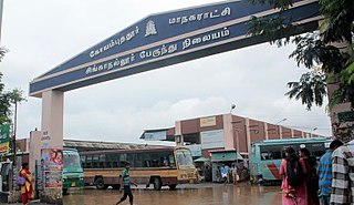
Singanallur is a major residential locality of the city of Coimbatore in Tamil Nadu, India. It is located on the banks of Noyyal river, which runs to the southern boundary of the locality. It is situated in the eastern part of the city, and is a major hub for the inter-city bus services towards Southern and Central districts of Tamilnadu from the city. It is one of the well developed neighborhoods in the city and has been part of Coimbatore Corporation since 1981. The East Zone Office of Coimbatore City Municipal Corporation is located at Singanallur.
