Virampur

Last updated

Virampur
Village
CountryIndia
State Gujarat
District Banaskantha district
Population
  Total5,206
Languages
  Official Gujarati and Hindi
Time zone UTC+5:30 (IST)
PIN
385110

Virampur is a village in the eastern part Banaskantha district of Gujarat, India. It is located 140 km from state capital Gandhinagar. The total geographical area of Virampur village is 3992.8 hectares. Virampur has a total population of 5,206 people.

Banaskantha district District in Gujarat, India

Banaskantha district is one among the thirty-three districts of the Gujarat state of India. The administrative headquarters of the district is at Palanpur which is also its largest city. The district is located in the Northeast of Gujarat and is presumably named after the West Banas River which runs through the valley between Mount Abu and Aravalli Range, flowing to the plains of Gujarat in this region and towards the Rann of Kutch. The district is famous for the Ambaji temple which draw many tourists. As of 2011, 13.27% of Banaskantha's population is urban and 86.70% is rural. It covers an area of 12703 km2 and is the second largest district in the state.

Gujarat State in India

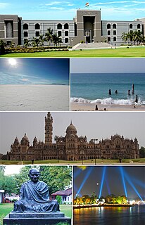
Gujarat is a state on the western coast of India with a coastline of 1,600 km (990 mi) – most of which lies on the Kathiawar peninsula – and a population in excess of 60 million. It is the sixth largest Indian state by area and the ninth largest state by population. Gujarat is bordered by Rajasthan to the northeast, Daman and Diu to the south, Dadra and Nagar Haveli and Maharashtra to the southeast, Madhya Pradesh to the east, and the Arabian Sea and the Pakistani province of Sindh to the west. Its capital city is Gandhinagar, while its largest city is Ahmedabad. The Gujarati-speaking people of India are indigenous to the state. The economy of Gujarat is the fifth-largest state economy in India with 14.96 lakh crore (US$210 billion) in gross domestic product and a per capita GDP of 157,000 (US$2,200).

India Country in South Asia

India, also known as the Republic of India, is a country in South Asia. It is the seventh largest country by area and with more than 1.3 billion people, it is the second most populous country as well as the most populous democracy in the world. Bounded by the Indian Ocean on the south, the Arabian Sea on the southwest, and the Bay of Bengal on the southeast, it shares land borders with Pakistan to the west; China, Nepal, and Bhutan to the northeast; and Bangladesh and Myanmar to the east. In the Indian Ocean, India is in the vicinity of Sri Lanka and the Maldives, while its Andaman and Nicobar Islands share a maritime border with Thailand and Indonesia.

Related Research Articles

Mohali district District in Punjab, India

Mohali district, also known as Ajitgarh district and officially known as Sahibzada Ajit Singh Nagar district or SAS Nagar district, is one of the twenty two districts of Punjab a state in north-west India. It was formed in April 2006 and is 18th district of Punjab, created next to Pathankot district. This district was carved out of areas falling in Ropar and Patiala District. It is situated next to the union territory of Chandigarh and Panchkula district of Haryana.

Hussainpur Village in Punjab, India

Hussainpur is a census town in Jalandhar district in the Indian state of Punjab. It is situated in Jalandhar II Tehsil. The village code is 030405.

Hirekudi village in Karnataka, India

Hirekudi is a village in the southern state of Karnataka, India. It is located in the Chikodi taluk of Belgaum district in Karnataka.

Wadi Qabbani Village in Tulkarm, Mandatory Palestine

Wadi Qabbani, also known as Khirbat ash Sheik Husein was a Palestinian Arab village in the Tulkarm Subdistrict. It was probably depopulated during the 1947–48 Civil War in Mandatory Palestine on March 1, 1948 as part of Operation Coastal Clearing. It was located 12 km northwest of Tulkarm. The name, Qabbani came from the Lebanese family who owned most of the land.

Dhamne S.Bailur is a village in Belgaum district in the southern state of Karnataka, India.

Karambal is a village in Belgaum district in Karnataka, India. Karambal village is located in Khanapur Tehsil of Belgaum district in Karnataka, India. It is situated 3km away from sub-district headquarter Khanapur and 28km away from district headquarter Belgaum. As per 2009 stats, Karmbla is the gram panchayat of Karambal village. The total geographical area of village is 387.3 hectares. Karambal has a total population of 1,400 peoples. There are about 294 houses in Karambal village. Khanapur is nearest town to Karambal which is approximately 3km away.

Lokur is a village in Athni tehsil, Belgaum district, in the state of Karnataka, India. According to Census 2011 information the location code or village code of Lokur village is 597287. It is 32 kilometres (20 mi) from the sub-district headquarters at Athni and 122 kilometres (76 mi) from the district headquarters at Belgaum. As per 2009 stats, Mangasuli is the gram panchayat of Lokur village.

Shippur is a village in Belgaum district of Karnataka, India.

Shiragaon is a village in Hukkeri taluka of Belagavi district of Karnataka, India.

Villages of Albania administrative division of Albania

There are approximately a total of 2,972 villages in Albania. They are listed below, grouped within 12 counties, 61 municipalities and 373 units of local governance.

  1. Villages of Berat County
  2. Villages of Dibër County
  3. Villages of Durrës County
  4. Villages of Elbasan County
  5. Villages of Fier County
  6. Villages of Gjirokastër County
  7. Villages of Korçë County
  8. Villages of Kukës County
  9. Villages of Lezhë County
  10. Villages of Shkodër County
  11. Villages of Tirana County
  12. Villages of Vlorë County
Chak Sahbu Village in Punjab, India

Chak Sahbu is a small village in Jalandhar District of Punjab State, India. The village is administrated by Sarpanch who is elected representative of village. It is located 49 km towards East from Jalandhar, 14 km from Phillaur and 119 km from Chandigarh. The nearest census town and marketplace is located 1 km in Apra, Punjab. The nearest train station is situated 13.9 km away in Phillaur, nearest domestic airport is at Ludhiana and the nearest international airport is 143 km away in Amritsar.

Mandi, Jalandhar Village in Punjab, India

Mandi is a large village in Phillaur tehsil of Jalandhar District of Punjab State, India. The village is administrated by Sarpanch who is elected representative of the village. It is 1 km away from census town and postal head office Apra. The village is 47.3 km from Jalandhar, 15 km from Phillaur and 117 km away from state capital Chandigarh.

Panj Dhera Village in Allowal Punjab, India

Allowal is a medium size village in Phillaur tehsil of Jalandhar District of Punjab State, India. It is located 5 km away from postal head office Phillaur, 14.8 km from Goraya, 48 km from Jalandhar and 111 km from state capital Chandigarh. The village is administrated by a sarpanch who is an elected representative of village as per Panchayati raj (India).

Bakapur, Phillaur Village in Punjab, India

Bakapur is a village in Phillaur tehsil of Jalandhar district of Punjab State, India. It is located 7 km away from postal head office in Phillaur, 10 km from Goraya, 41.5 km from district headquarter Jalandhar and 115 km from state capital Chandigarh. The village is administrated by a sarpanch who is an elected representative of village as per Panchayati raj (India).

Kalpalayam is a village located in the Manachanallur taluk of the Tiruchirappalli district of the Indian state Tamil Nadu. It is situated 3 km away from taluk headquarter Manachanallur and 15 km away from district headquarter Tiruchirappalli.

Karumbakkam is a village located in the Chengalpattu taluk of the Kanchipuram district of the Indian state Tamil Nadu. According to the 2011 Census information, the total geographical area of the village is 184.89 hectares, and the total population is 1,330.

Manjari is a village located in Chikodi Tehsil of Belgaum district in Karnataka, India. It is located 20km away from sub-district headquarter Chikodi and 100km away from district headquarter Belgaum. As per 2009 stats, Manjari village is also a gram panchayat. The total geographical area of village is 555.71 hectares. Manjari has a total population of 8,613 peoples. There are about 1,844 houses in Manjari village. Chikodi is nearest town to Manjari which is approximately 20km away.

References