
Shaniwar Wada is a historical fortification in the city of Pune, India.

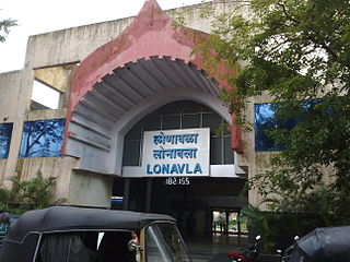
Lonavala is a hill station town and a Municipal Council in the Pune district, Maharashtra, India. It is about 64 km west of Pune and 96 km to the east of Mumbai. It is known for its production of the hard candy chikki and is also a major stop on the railway line connecting Mumbai and Pune. From the Pune suburbs, local trains are available from Pune Junction. Both the Mumbai-Pune Expressway as well as the Mumbai-Bengaluru highway pass through Lonavala.

Khandala is a hill station in the Western Ghats in the state of Maharashtra, India, about 3 kilometres (1.9 mi) from Lonavala, 12 kilometres from Khopoli and 33.4 kilometres (20.8 mi) from Karjat.

Pune district is the most populous district in the Indian state of Maharashtra. The district's population was 9,429,408 in the 2011 census, making it the fourth most populous district amongst India's 640 districts. This district has an urban population of 58.08 percent of its total. It is one of the most industrialized districts in India. In recent decades it has also become a hub for information technology.

Suvarnadurg is a fort that is located between Mumbai and Goa on a small island in the Arabian Sea, near Harnai in Konkan, along the West Coast of India, in the Indian state of Maharashtra. The fort also includes another small land fort called the Kanakadurga at the base of headland of Harnai port on the coast. Building of the fort is credited to Chhatrapati Shivaji Maharaj, founder of the Maratha Empire, in 1660. Subsequently, ChatrapatiShivaji Maharaj, other ttraPeshwas and the Angres further fortified the forts for defence purposes.

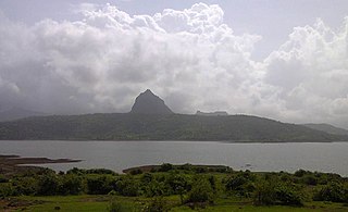
Tikona also known as Vitandgad) is the dominant hill fort in Maval in western India. It is located near Kamshet around 60 km from Pune. The village nearest to the fort is called Tikona-Peth. The 3500 foot high hill is pyramidal in shape and the name Tikona means "triangular".

Chiplun is a city in Ratnagiri district in the state of Maharashtra, India. It is the financial and commercial Hub of Ratnagiri, and the headquarters of Chiplun taluka. It is about 320 km south of Mumbai in the Konkan region of Maharashtra, on the Mumbai–Goa highway (NH-66). It has a long history and a strong cultural background. Recent decades have seen much industrial development in it and its and surrounding areas.
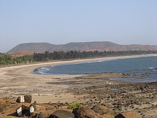
Shrivardhan is a taluka, city and municipal council in the Raigad district of the Indian state of Maharashtra. It has developed into a seaside resort, along with the nearby town of Harihareshwar, which also has a Shiva temple. Located on a peninsula, the town itself boasts many beaches, in addition to proximity to numerous other beach destinations such as Diveagar Beach and Kondivali Beach. People from across Maharashtra come to Shrivardhan and the nearby beaches all year round.

Kolaba Fort is an old fortified maritime base in Alibaug, Konkan, India. It is situated in the sea at a distance of 1–2 km from the shores of Alibag, 35 km south of Mumbai, in the Konkan region of Maharashtra, India. It is a popular tourist destination and a protected monument.
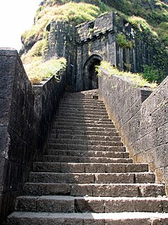
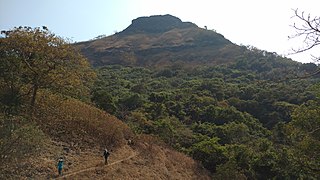
Lohagad is one of the many hill forts of Maharashtra state in India. Situated close to the hill station Lonavala and 52 km (32 mi) northwest of Pune, Lohagad rises to an elevation of 1,033 m (3,389 ft) above sea level. The fort is connected to the neighboring Visapur fort by a small range. The fort was under the Maratha empire for the majority of the time, with a short period of 5 years under the Mughal empire.
Tung Fort is a hill fort in Pune District, India.
Korigad is a hill fort located about 20 km (12 mi) south of Lonavla in Pune district, Maharashtra, India. Its date of construction is not known but likely predates 1500. It is about 923 m above sea level. The planned township of Aamby Valley is built over the fort's southern and eastern foothills. The closest village is Peth Shahpur, about 1 km (0.62 mi) north of the fort.

Khanderi is an island with a fort, located south of Mumbai, along the coast of Maharashtra, India.

Pavananagar is a village near Pavana Dam in Maharashtra, India. It is about 45 km via Paud and 65 km via Kamshet from Pune. There are roads to Pavananagar from Pune & Lonavala. Lonavala to Pavana Dam is 20 km; 40 minutes journey from Lonavala.
- Lonavala → Bhangarwadi → Kusgaon → Aundhgaon → Dudhivarekhind → Prati Pandharpur → Pavana Dam
- Pune → Pirangut → Paud → Kolvan → Pavana Dam → Pavananagar.
- Pune → Nigdi → Kamshet → Bedsa → Pavananagar.
Malavli is a town and a hill station in Pune district in the Indian state of Maharashtra. It is about 55 km away from the city of Pune, 139 km away from the city Mumbai and 39 km from Chinchwad. It is a major stop on the rail line connecting Mumbai and Pune. For Mumbai suburbs local trains are available from Karjat. It is also an important town in order of Lonavla Khandala Malavli on the Mumbai-Pune road link. Both the Mumbai-Pune Expressway as well as the Mumbai-Pune highway pass through Malavli, Lonavla. The population of Lonavla is around 10,000 as of 2010.
Lonavala railway station is a railway station in Lonavala, a hill station in the state of Maharashtra in India. Lonavala station is the origin of Lonavala–Pune Suburban Trains. 17 suburban trains operate on the Pune–Lonavala route. Lonavla is also a halt for Mumbai–Pune Express and Mail trains. The Karjat–Pune passenger train also has a halt at Lonavala. Trains traveling on the Kalyan–Pune route also halt at Lonavala. This station leads access to Lonavala town and nearby areas like Karla Caves, Bhaja Caves, Lohagad, Visapur Fort, Bhushi Dam and Bhor Ghat. Khandala hill station is just 8 kilometres (5.0 mi) from Lonavla.
Malavli Station is a railway station of Pune Suburban Railway on Mumbai–Chennai line.
Konkandiva Fort (transliteration: Konkandiva Qilа̄) is a fort located 70 km from Pune in Maharashtra. This fort is on the boundary of Raigad and Pune district. The fort was important as a surveillance fort to keep watch on the possible attack on the Raigad fort through Ghol Village side along the Mutha river.

Indori fort also known as Induri Fort is one of the many Land forts of Maharashtra state in India. Situated close to the hill station Lonavala and 35 km (22 mi) north of Pune, Indori fort rises to an elevation of 1,033 m (3,389 ft) above sea level. The fort is located on the banks of Indrayani river. The fort was under the Maratha empire for the majority of the time.


