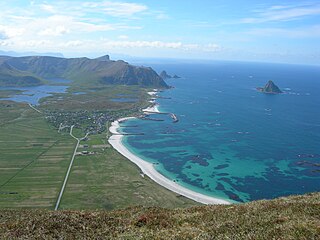
Bleiksvatnet is a lake in Andøy Municipality in Nordland county, Norway. The 1.74-square-kilometre (0.67 sq mi) lake is located just south of the village of Bleik on the island of Andøya. The lake sits at an elevation of 28 metres (92 ft) above sea level. The Bleikmorenen nature reserve is located on the northern shore of the lake.

Midtre Hellstugutinden is a mountain in Lom, Innlandet, Norway. It is the second highest mountain on the Hellstugutindane ridge, and lies just north of Store Hellstugutinden.

Store Knutsholstinden is a mountain in Vågå in Innlandet county, Norway.

Skyvassnuten is a mountain in the municipality of Bykle in Aust-Agder county, Norway. The 1,421-metre (4,662 ft) tall mountain sits just 1.2 kilometres (0.75 mi) east of the municipal/county border with Rogaland. The lake Skyvatn lies at the eastern foot of the mountain and the mountain Sveigen lies immediately south of the mountain. The lake Holmavatnet lies about 5 kilometres (3.1 mi) north of the mountain.

Sveigen is a mountain in the municipality of Bykle in Aust-Agder county, Norway. The 1,389-metre (4,557 ft) tall mountain sits just 700 metres (2,300 ft) east of the municipal/county border with Rogaland. The mountain Skyvassnuten lies to the north of Sveigen and the lake Skyvatn lies to the east.

Austre Høgvagltinden is a mountain of Innlandet, in southern Norway.

Benkehøa is a mountain of Oppland, in southern Norway.
Hammaren is a small mountain of Troms og Finnmark, in northern Norway. It is located on the northern coast of the island Kvaløya in Hammerfest municipality.

Heimdalshøe is a mountain in Vågå and Nord-Fron municipality in Innlandet county, in southern Norway. The mountain is located between the upper Heimdalen in Nord-Fron and the upper Sikkilsdalen in Vågå. It is at a height of 1,843 meters above sea level and is the highest mountain in the Nord-Fron municipality. The prominence of 670 meters is among Scandinavia's 200 highest.
Hesthøi is a mountain of Oppland, in southern Norway.
Lendfjellet is a mountain in Breheimen National Park in southern Norway. The summit makes borderpoint between the municipalities of Lom and Skjåk.
Mårådalsfjellet is a mountain in Skjåk municipality in Oppland, in southern Norway. It has an altitude of 1,850 m (6,070 ft) above sea level. It has a secondary peak called Høgkulen, which has an altitude of 1,842 m (6,043 ft) above sea level.
Skoddetinden is a mountain of Oppland, in southern Norway.

Storegut is a mountain in Jotunheimen National Park in southern Norway. The border between the counties of Oppland and Sogn og Fjordane is close to the summit.
Storhøe is a mountain in the municipality of Dovre in Oppland, in southern Norway. It is 1,707 meters high, and lies 6 km southeast of Fokstugu.
Steinahøfjellet is a mountain in Lom municipality of Oppland, in southern Norway.
Veslbreatinden is a mountain of Oppland, in southern Norway.

Vesltverråtinden is a mountain in Dovrefjell-Sunndalsfjella National Park and Oppland, in southern Norway.

Vestre Hestlægerhøe, also written as Vestre Hestlægerhø, is a mountain in southern Norway. It is located on the municipal boundary of Lom and Vågå, both in the county of Innlandet. Vestre Hestlægerhøe is part of the Jotunheimen mountain range and is located within the Jotunheimen National Park.

Vetldalseggi is a mountain in Reinheimen National Park and Oppland, in southern Norway.


