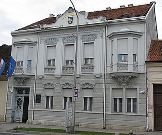
Krašić is a village and municipality in central Croatia, located near Jastrebarsko and Ozalj, south of Žumberak and north of Kupa, about 50 km southwest of Zagreb. Krašić comprises an area of about 3.63 km2. In the 2011 census, the total population was 2,640, in the following settlements:

Sveti Ivan Žabno is a municipality in the Koprivnica-Križevci County in Croatia. According to the 2011 census, there are 5,222 inhabitants in the area.
Vukmanić is a village belonging to Karlovac in Croatia, population 207 (2011). It was the birthplace of Ivan Ribar who preceded Josip Broz Tito as post-World War II leader of Yugoslavia.
Čepin is a town and municipality in Osijek-Baranja County, Croatia. It is located in northeast Slavonia, 10 kilometers southwest from Osijek.
Mece is a settlement in the region of Baranja, Croatia. Administratively, it is located in the Darda municipality within the Osijek-Baranja County. Population is 882 people.
Tušilović is a village in Croatia. It is connected by the D1 highway.
Brezova Glava is a village in Croatia. It is connected by the D1 highway.
Dubranec is a village in Croatia.
Prkovci is a village in Croatia.
Cvetković is a settlement in the Jastrebarsko administrative area of Zagreb County, Croatia. As of 2011 it had a population of 616.
Čabdin is a settlement in the Jastrebarsko administrative area of Zagreb County, Croatia. As of 2011 it had a population of 139.
Izimje is a settlement in the Jastrebarsko administrative area of Zagreb County, Croatia. As of 2011 it had a population of 221 people.
Lokošin Dol is a settlement in the Jastrebarsko administrative area of Zagreb County, Croatia. As of 2011 it had a population of 95 people.
Malunje is a settlement in the Jastrebarsko administrative area of Zagreb County, Croatia. As of 2011 it had a population of 211 people.
Beder, Croatia is a settlement (naselje) in the Samobor administrative territory of Zagreb County, Croatia. As of 2011 it had a population of 83 people.
Draganje Selo is a settlement (naselje) in the Samobor administrative territory of Zagreb County, Croatia. As of 2011 it had a population of 83 people.
Gregurić Breg is a settlement (naselje) in the Samobor administrative territory of Zagreb County, Croatia. As of 2011 it had a population of 118 people.
Javorek, Croatia is a settlement (naselje) in the Samobor administrative territory of Zagreb County, Croatia. As of 2011 it had a population of 73 people.
Mali Lipovec, Croatia is a settlement (naselje) in the Samobor administrative territory of Zagreb County, Croatia. As of 2011 it had a population of 122 people.
Slapnica, Croatia is a settlement (naselje) in the Samobor administrative territory of Zagreb County, Croatia. As of 2011 it had a population of 16 people.