
North Brabant, also unofficially called Brabant, is a province in the south of the Netherlands. It borders the provinces of South Holland and Gelderland to the north, Limburg to the east, Zeeland to the west, and the Flemish provinces of Antwerp and Limburg to the south. The northern border follows the Meuse westward to its mouth in the Hollands Diep strait, part of the Rhine–Meuse–Scheldt delta. North Brabant had a population of about 2,626,000 as of January 2023. Major cities in North Brabant are Eindhoven, Tilburg, Breda, its provincial capital 's-Hertogenbosch, and Helmond
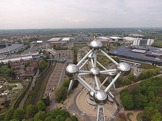
The Heysel Plateau or Heysel Park, usually shortened to Heysel or Heizel, is a neighbourhood, park and exhibition space in Laeken, northern Brussels, Belgium, where the Brussels International Exposition of 1935 and the 1958 Brussels World's Fair took place.

Beveren is a municipality in the Belgian province of East Flanders which comprises the towns of Beveren, Doel, Haasdonk, Kallo, Kieldrecht, Melsele, Verrebroek and Vrasene.

Lokeren is a city and municipality located in the Belgian province of East Flanders, and belongs to the Waasland, also called Land van Waas, of which it is the second most important city after Sint-Niklaas. The city, located on the river Durme, the Lede, and the E17 motorway, has more than 42,100 inhabitants who are called Lokeraars or Rapenfretters. Because Lokeren is located on the Durme, Lokeren is often called "The Durme City". Horse sausages are officially recognized as a regional product.

Edegem is a municipality located in the Belgian province of Antwerp. The municipality only comprises the town of Edegem proper. In 2021, Edegem had a total population of 22,244. The total area is 8.65 km². The old Sint-Antoniuskerk is no longer open to the public. It is not sure when it was first built.

Malle is a municipality located in the Campine region of the Belgian province of Antwerp. The municipality comprises the villages of Oostmalle and Westmalle. In 2021, Malle had a total population of 15,620. The total area is 51.99 km2.

Schoten is a municipality located in Antwerp Province, Belgium. The municipality only comprises the town of Schoten proper. As of 1 January 2020 Schoten has a total population of 34,311. The total area is 29.55 km2 (11.41 sq mi) which gives a population density of 1,122/km2 (2,910/sq mi). Schoten borders the Antwerp districts Merksem to the west and Deurne to the south west. Neighboring municipalities include Brasschaat to the north, Brecht to the north east, Schilde to the east, and Wijnegem to the south.

Mechelen is a city and municipality in the province of Antwerp in the Flemish Region of Belgium. The municipality comprises the city of Mechelen proper, some quarters at its outskirts, the hamlets of Nekkerspoel (adjacent) and Battel, as well as the villages of Walem, Heffen, Leest, Hombeek, and Muizen. The river Dyle (Dijle) flows through the city, hence it is often referred to as the Dijlestad.

Sint-Pieters-Leeuw is a municipality in the province of Flemish Brabant, in the Flemish region of Belgium.

Wilrijk is a district of the municipality and city of Antwerp in the Belgian province of Antwerp. Wilrijk had been a separate municipality before January 1, 1983; the enlarged municipality of Antwerp was decentralized in 2000 and Wilrijk became one of the city's nine districts.

Uccle or Ukkel is one of the 19 municipalities of the Brussels-Capital Region, Belgium. Located in the southern part of the region, it is bordered by the City of Brussels, Forest, Ixelles, and Watermael-Boitsfort, as well as the Flemish municipalities of Drogenbos, Linkebeek and Sint-Genesius-Rode. In common with all of Brussels' municipalities, it is legally bilingual (French–Dutch).
Belgian Americans are Americans who can trace their ancestry to people from Belgium who immigrated to the United States. While the first natives of the then-Southern Netherlands arrived in America in the 17th century, the majority of Belgian immigrants arrived during the 19th and 20th centuries.
The Bokrijk Provincial Domain is a park and museum complex near Genk, Province of Limburg in Belgium. It is known for its open-air museum which displays a large collection of historical buildings from across Flanders which presents the history of rural life in the region. The domain is 5.5 square kilometres (2.1 sq mi) in area and also hosts an important botanical garden (arboretum), nature reserve, and the largest open-air playground in Flanders.
Everberg is a town in the Belgian province Flemish Brabant and is part of the municipality of Kortenberg. The territory covers an area of 925 ha. The neighbouring towns or municipalities are Leefdaal, Kortenberg, Erps-Kwerps, Meerbeek, Sterrebeek, Moorsel and Tervuren. A small hamlet, called Vrebos, can also be found in Everberg.
Rameyen Castle is a castle on a lake in Gestel, part of the municipality of Berlaar, in the province of Antwerp, Belgium. It was once owned by Nicolaas Rubens, Lord of Rameyen, who died in the castle. Nicolaas was the second son of Peter Paul Rubens.

Woluwe-Saint-Lambert or Sint-Lambrechts-Woluwe is one of the 19 municipalities of the Brussels-Capital Region, Belgium. In common with all of Brussels' municipalities, it is legally bilingual (French–Dutch). In French, it is often spelt Woluwé-Saint-Lambert to reflect the Frenchified pronunciation of what was originally a Dutch place name, but the official spelling is without an accent. The Woluwe stream, from which it takes its name, flows through the municipality.

Antwerp is a city and a municipality in the Flemish Region of Belgium. It is the capital and largest city of Antwerp Province, and the third largest city in Belgium by area at 204.51 km2 (78.96 sq mi) after Tournai and Couvin. With a population of 536,079, it is the most populous municipality in Belgium, and with a metropolitan population of over 1.2 million people, the country's second-largest metropolitan region after Brussels.

The Botanic Garden of Antwerp, which also carries the name Den Botaniek, is a landscaped botanical garden created in 1825 in the inner city of Antwerp located at the Leopoldstraat, covering an area of slightly less than 1 hectare. Before that the park was, at the end of the 18th century, a plant garden for the Ecole Centrale and then the herb garden and later the vegetable garden of the Sint-Elisabethgasthuis in Antwerp.

The Peerdsbos is a forest and nature domain situated in the Belgian municipalities of Brasschaat and Schoten, to the north of the city of Antwerp. The domain largely consists of forests and directly borders the Vordenstein domain in Schoten to the south-east, and the Brasschaat municipal park to the northwest.

