CBRX-FM is a Canadian radio station which broadcasts SRC's Ici Musique network at 101.5 FM in Rimouski, Quebec.

Hačava is a village and municipality in Košice-okolie District in the Košice Region of eastern Slovakia.
Burja or Boorja is a village in Srikakulam district of the Indian state of Andhra Pradesh. Burja is located near River Nagavali.
Łańczyno is a village in the administrative district of Gmina Narewka, within Hajnówka County, Podlaskie Voivodeship, in north-eastern Poland, close to the border with Belarus. It lies approximately 9 kilometres (6 mi) east of Narewka, 25 km (16 mi) north-east of Hajnówka, and 58 km (36 mi) south-east of the regional capital Białystok.
Sempółki is a village in the administrative district of Gmina Poddębice, within Poddębice County, Łódź Voivodeship, in central Poland. It lies approximately 11 kilometres (7 mi) north-west of Poddębice and 47 km (29 mi) west of the regional capital Łódź.
Zagóry is a village in the administrative district of Gmina Kamionka Wielka, within Nowy Sącz County, Lesser Poland Voivodeship, in southern Poland. It lies approximately 13 kilometres (8 mi) south-east of Nowy Sącz and 86 km (53 mi) south-east of the regional capital Kraków.
Bodzewko Drugie is a village in the administrative district of Gmina Piaski, within Gostyń County, Greater Poland Voivodeship, in west-central Poland. It lies approximately 6 kilometres (4 mi) south of Piaski, 7 km (4 mi) south-east of Gostyń, and 64 km (40 mi) south of the regional capital Poznań.
Mierzynek is a village in the administrative district of Gmina Międzychód, within Międzychód County, Greater Poland Voivodeship, in west-central Poland. It lies approximately 6 kilometres (4 mi) north-west of Międzychód and 78 km (48 mi) west of the regional capital Poznań.
Ojcowa Wola is a village in the administrative district of Gmina Młynary, within Elbląg County, Warmian-Masurian Voivodeship, in northern Poland. It lies approximately 3 kilometres (2 mi) south of Młynary, 22 km (14 mi) east of Elbląg, and 67 km (42 mi) north-west of the regional capital Olsztyn.

Tečić is a village in Central Serbia (Šumadija), in the municipality of Rekovac, lying at 43°50′07″N21°07′29″E, at the elevation of 210 m. According to the 2002 census, the village had 660 citizens.
Bagwell is an unincorporated community in Red River County, Texas, United States. Bagwell has a post office with the ZIP code 75412. The population in Bagwell is 528. There are 3 people per square mile aka population density. The median age in Bagwell is 47.4, the US median age is 37.4. It is home to Bagwell Baptist Church which has served its community for years.
Đulekare is a village in the municipality of Medveđa, Serbia. According to the 2002 census, the village has a population of 117 people. Of these, 70 (59,82 %) were Serbs, and 47 (40,17 %) were ethnic Albanians.
Fartuni is a village in Tryavna Municipality, in Gabrovo Province, in northern central Bulgaria.

Dawn, is an unincorporated community in Caroline County, in the U.S. state of Virginia. It is located at the intersection of US 301 / SR 2 and SR 30, roughly east of Doswell, north of Hanover, west of Central Garage, and south of Bowling Green.

Koigi is a village in Järva Parish, Järva County, in Estonia. It was the administrative centre of Koigi Parish.
Päri is a village in Lääne-Nigula Parish, Lääne County, in western Estonia.

Masurica is a village in the municipality of Surdulica, Serbia. According to the 2002 census, the village has a population of 1245 people.
Banjani is a village in the municipality of Sokolac, Bosnia and Herzegovina.
Žiljevo is a village in the municipality of Nevesinje, Republika Srpska, Bosnia and Herzegovina.

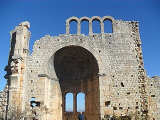
Öküzlü is an archaeological site in Mersin Province, Turkey.


