Wólka Kikolska

Last updated
Wólka Kikolska
Village
Country Flag of Poland.svg Poland
Voivodeship Masovian
County Nowy Dwór Mazowiecki
Gmina Pomiechówek

Wólka Kikolska [ˈvulka kiˈkɔlska] is a village in the administrative district of Gmina Pomiechówek, within Nowy Dwór Mazowiecki County, Masovian Voivodeship, in east-central Poland. [1]

Village Small clustered human settlement smaller than a town

A village is a clustered human settlement or community, larger than a hamlet but smaller than a town, with a population ranging from a few hundred to a few thousand. Though villages are often located in rural areas, the term urban village is also applied to certain urban neighborhoods. Villages are normally permanent, with fixed dwellings; however, transient villages can occur. Further, the dwellings of a village are fairly close to one another, not scattered broadly over the landscape, as a dispersed settlement.

Gmina Pomiechówek Gmina in Masovian, Poland

Gmina Pomiechówek is a rural gmina in Nowy Dwór Mazowiecki County, Masovian Voivodeship, in east-central Poland. It takes its name from the village of Pomiechówek, but its seat is Brody-Parcele, which lies approximately 5 kilometres (3 mi) north-east of Nowy Dwór Mazowiecki and 33 km (20 mi) north-west of Warsaw.

Nowy Dwór Mazowiecki County County in Masovian, Poland

Nowy Dwór Mazowiecki County is a unit of territorial administration and local government (powiat) in Masovian Voivodeship, east-central Poland. It came into being on January 1, 1999, as a result of the Polish local government reforms passed in 1998. Its administrative seat and largest town is Nowy Dwór Mazowiecki, which lies 33 kilometres (21 mi) north-west of Warsaw. The county also contains the towns of Nasielsk, lying 21 km (13 mi) north-east of Nowy Dwór Mazowiecki, and Zakroczym, 5 km (3 mi) west of Nowy Dwór Mazowiecki. Warsaw-Modlin Airport is located within the county. The county covers an area of 691.65 square kilometres (267.0 sq mi). As of 2006 its total population is 75,736, out of which the population of Nowy Dwór Mazowiecki is 27,545, that of Nasielsk is 7,364, that of Zakroczym is 3,367, and the rural population is 37,460.

Related Research Articles

Heather-Dina Lakes Provincial Park

Heather-Dina Lakes Provincial Park is a provincial park in British Columbia, Canada. The Heather-Dina park, which is named after two lakes in the park, features mature, mixed forest with many small lakes. Facilities are quite limited compared to other parks in British Columbia. A primitive campground is located at Heather Lake and another at Dina Lake. Camping, fishing, canoeing, and hiking are popular activities among visitors.

Limehouse was a railway station in Limehouse, London, on the London and Blackwall Railway (LBR).

Albany is a Census-designated place (CDP) and rural unincorporated community located in Bryan County, Oklahoma, on State Highway 70E. The post office opened July 10, 1894. The community was named for Albany, New York. As of the 2010 census, the population was 143. The area code is 580.

Budy Giżyńskie Village in Masovian, Poland

Budy Giżyńskie is a village in the administrative district of Gmina Strzegowo, within Mława County, Masovian Voivodeship, in east-central Poland. It lies approximately 28 kilometres (17 mi) south of Mława and 84 km (52 mi) north-west of Warsaw.

Budy Kowalewkowskie is a village in the administrative district of Gmina Strzegowo, within Mława County, Masovian Voivodeship, in east-central Poland.

Budy Polskie is a village in the administrative district of Gmina Strzegowo, within Mława County, Masovian Voivodeship, in east-central Poland.

Kuskowo Kmiece is a village in the administrative district of Gmina Strzegowo, within Mława County, Masovian Voivodeship, in east-central Poland.

Topolewszczyzna is a village in the administrative district of Gmina Strzegowo, within Mława County, Masovian Voivodeship, in east-central Poland.

Zalesie is a village in the administrative district of Gmina Strzegowo, within Mława County, Masovian Voivodeship, in east-central Poland.

The Yelovaya River, also known as Bolshaya Yelovaya River and Chizhandzi River is a river in Krasnoyarsk Krai in Russia, a left tributary of the Ket River. The river is 331 kilometres (206 mi) long, and its drainage basin covers 6,230 square kilometres (2,410 sq mi).

Kierźliny is a village in the administrative district of Gmina Barczewo, within Olsztyn County, Warmian-Masurian Voivodeship, in northern Poland.

M Telus (concert hall) music venue and former cinema in Montreal, Quebec, Canada

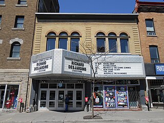
The M Telus is a performing arts centre in Montreal, Quebec, Canada. It is located in the central part of the city's downtown core, on Saint Catherine Street East between Saint-Dominique and De Bullion Streets, in the Quartier des Spectacles. The hall primarily features rock music groups, and is a venue for several festivals, including the Montreal International Jazz Festival and the Francofolies de Montréal.

North Manchester Jamia Mosque

North Manchester Jamia Mosque is a mosque in the Cheetham Hill area of Manchester, run under the headship of Qamaruzzaman Azmi by the Ibadur-Rahman Trust. It is one of the largest Muslim centres in Europe.

Palak-e Sofla is a village in Bala Khiyaban-e Litkuh Rural District, in the Central District of Amol County, Mazandaran Province, Iran. At the 2006 census, its population was 721, in 184 families.

Dzhurynskyi

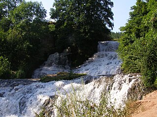
Dzhurynskyi or the Chervonohorodskyi waterfall is located on the Dzhuryn river in Nyrkiv village, Zalishchyky Raion, Ternopil Oblast of western Ukraine Waterfall is 16 metres (52 ft) high and 20 metres (66 ft) wide.

Ivanovtsi is a village in Kyustendil Municipality, Kyustendil Province, south-western Bulgaria.

Poblaće is a village in Pljevlja Municipality, in northern Montenegro. According to the 2003 census, the village had a population of 101 people.

Grove House Wood

Grove House Wood is a 2.2 hectare Local Nature Reserve in Stanford-le-Hope in Essex. According to Natural England, it is owned by Thurrock Council and managed by Essex Wildlife Trust but it is not listed on the web site of either body.

References


Coordinates: 52°30′38″N20°48′22″E / 52.5106°N 20.8061°E / 52.5106; 20.8061

Geographic coordinate system Coordinate system

A geographic coordinate system is a coordinate system that enables every location on Earth to be specified by a set of numbers, letters or symbols. The coordinates are often chosen such that one of the numbers represents a vertical position and two or three of the numbers represent a horizontal position; alternatively, a geographic position may be expressed in a combined three-dimensional Cartesian vector. A common choice of coordinates is latitude, longitude and elevation. To specify a location on a plane requires a map projection.