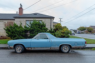
Pine Hill is an unincorporated community in Humboldt County, California. It is located 2.5 miles (4 km) south of downtown Eureka, at an elevation of 135 feet. The area is now part of unincorporated Eureka.

Rosewood is an unincorporated community in Humboldt County, California. It is located 1 mi (1.6 km) south of Eureka, at an elevation of 131 feet.

Fombell is an unincorporated community that includes both Franklin Township and Marion Township, Beaver County, Pennsylvania, United States. Its U.S. postal zip code is 16123. Its elevation ranges from 879 feet (268 m) along the creek to 1280 feet on top of the hills, and it is located at 40°48′34″N80°12′6″W.
Jonesville is an unincorporated community in Butte County, California. It is situated on Jones Creek, 5 miles (8.0 km) east-northeast of Butte Meadows, at an elevation of 5049 feet.
Camp Klamath is an unincorporated community in Del Norte County, California. It is located on the east bank of the Klamath River 1.5 miles (2.4 km) from its mouth, at an elevation of 23 feet.
Hoppaw is an unincorporated community in Del Norte County, California. It is located on Hoppaw Creek 3 miles (4.8 km) east-southeast of the mouth of the Klamath River, at an elevation of 36 feet. It appears in the Requa U.S. Geological Survey Map.

Arlynda Corners is a locality in Humboldt County, California. It lies at an elevation of 13 feet (4.0 m).

Bracut is an unincorporated community in Humboldt County, California. It is located on the Northwestern Pacific Railroad 3 miles (4.8 km) south of Arcata, at an elevation of 16 feet. The name originated as a contraction of the railway cut through Brainard hill in the Humboldt Bay salt marsh. Railway trestle work originally connected the hill south to Eureka and north to Arcata. Much of the hill was subsequently excavated to provide fill to replace the original trestle work; and the railway fill prism became a dike encouraging conversion of the inland salt marsh to pasture land. The leveled hill is now the site of several large structures remaining from previous lumber operations, a District 1 CalTrans yard, and a KOA campground.

Brainard is an unincorporated community in Humboldt County, California. It is located on the Northwestern Pacific Railroad 4 miles (6.4 km) south-southwest of Arcata, at an elevation of 7 feet.
Calville was a community in Humboldt County, California, located 4.5 miles (7.2 km) north of Arcata, at an elevation of 154 feet. It is centered on Sutter Road and Central Avenue, and became part of the large unincorporated community of McKinleyville.
Elk River is an unincorporated community in Humboldt County, California. It is located 2.25 miles (3.6 km) east-northeast of Fields Landing, at an elevation of 69 feet. All the residents of this neighborhood have Eureka, California addresses.
Fairhaven is an unincorporated community and census-designated place (CDP) adjacent to Humboldt Bay in Humboldt County, California, United States. It is located 2.25 miles (3.6 km) west-southwest of downtown Eureka, at an elevation of 10 feet (3.0 m) above sea level.

Freshwater Corners is an unincorporated community in Humboldt County, California. It is located 6 miles (9.7 km) south of Arcata and 2 miles (3.2 km) northwest of Freshwater, at an elevation of 13 feet. All residents of this area have Eureka, California addresses.
Glendale is an unincorporated community in Humboldt County, California. It is located on the Mad River 4 miles (6 km) east-northeast of Arcata, at an elevation of 92 feet.

Port Kenyon is an unincorporated community in Humboldt County, California. It is located 1.5 miles (2.4 km) northwest of Ferndale, at an elevation of 13 feet.
Ridgewood Heights, is an unincorporated community in Humboldt County, California. It is located 3.5 miles (5.6 km) east-northeast of Fields Landing, at an elevation of 417 feet. This neighborhood is part of unincorporated Eureka, California, located entirely within the 95503 zip code.

Rohnerville is an unincorporated community in Humboldt County, California. It is located 2.25 miles (3.6 km) southeast of Fortuna, at an elevation of 197 feet (60 m).
Stafford is an unincorporated community in Humboldt County, California. It is located on the south bank of the Eel River 3 miles (4.8 km) southeast of Scotia, at an elevation of 138 feet.
Westhaven is an unincorporated community in Humboldt County, California. It is located 2.5 miles (4 km) southeast of Trinidad, at an elevation of 328 feet. For census purposes it is amalgamated into Westhaven-Moonstone. The ZIP Code is 95570.
Flicksville is a village located in Northampton County, Pennsylvania. It is located 75 miles (121 km) west of New York City and is part of the Lehigh Valley metropolitan area, which had a population of 861,899 and was the 68th most populous metropolitan area in the U.S. as of the 2020 census.


