Waldo Hills

Last updated

The Waldo Hills are a range of hills in the Willamette Valley of Oregon, United States. Encompassing an area of around 50 square miles (130 km2), the hills are located east of Salem. [1] The hills are named after pioneer Daniel Waldo.

Willamette Valley valley in the Pacific Northwest region of the United States

The Willamette Valley is a 150-mile (240 km) long valley in the Pacific Northwest region of the United States. The Willamette River flows the entire length of the valley, and it is surrounded by mountains on three sides – the Cascade Range to the east, the Oregon Coast Range to the west, and the Calapooya Mountains to the south. It forms the cultural and political heart of Oregon, and is home to approximately 70 percent of its population including its six largest cities: Portland, Eugene, Salem, the state capital, and the cities of Gresham, Hillsboro and Beaverton in the Portland metropolitan area. Eight of Oregon's ten – and 16 of its 20 – largest cities are located in the Willamette Valley.

Oregon State of the United States of America

Oregon is a state in the Pacific Northwest region on the West Coast of the United States. The Columbia River delineates much of Oregon's northern boundary with Washington, while the Snake River delineates much of its eastern boundary with Idaho. The parallel 42° north delineates the southern boundary with California and Nevada. Oregon is one of only three states of the contiguous United States to have a coastline on the Pacific Ocean.

United States Federal republic in North America

The United States of America (USA), commonly known as the United States or America, is a country comprising 50 states, a federal district, five major self-governing territories, and various possessions. At 3.8 million square miles, the United States is the world's third or fourth largest country by total area and is slightly smaller than the entire continent of Europe's 3.9 million square miles. With a population of over 327 million people, the U.S. is the third most populous country. The capital is Washington, D.C., and the largest city by population is New York City. Forty-eight states and the capital's federal district are contiguous in North America between Canada and Mexico. The State of Alaska is in the northwest corner of North America, bordered by Canada to the east and across the Bering Strait from Russia to the west. The State of Hawaii is an archipelago in the mid-Pacific Ocean. The U.S. territories are scattered about the Pacific Ocean and the Caribbean Sea, stretching across nine official time zones. The extremely diverse geography, climate, and wildlife of the United States make it one of the world's 17 megadiverse countries.

Contents

Geology

The hills stretch out from Mill Creek in a northeasterly direction. [1] These hills were formed by a cuesta of Columbia River Basalt Group. [2] Rocks of the hills include Tertiary volcanic bedrock, sedimentary bedrock, and Plio-Pleistocene sedimentary basin fill shaped by elongate domical folds. [3] The Waldo Hills form part of the divider between the upper and lower Willamette Valley. [2] Additionally, the Waldo Hills as part of a larger fault system of low-lying hills in the mid-valley, are the largest geological structure in the mid-Willamette Valley. [2] Along with the Silverton Hills, these hills form the foothills to the Cascade Mountains to the east. [3]

Mill Creek (Marion County, Oregon) tributary of the Willamette River draining parts of Marion County, Oregon, USA

Mill Creek is a 26-mile (42 km) tributary of the Willamette River that drains a 111-square-mile (290 km2) area of Marion County in the U.S. state of Oregon. Flowing generally west from its source south of Silver Falls State Park, it passes through the cities of Aumsville, Stayton, Sublimity, and Turner before emptying into the Willamette in Salem.

Cuesta A hill or ridge with a gentle slope on one side and a steep slope on the other

A cuesta is a hill or ridge with a gentle slope on one side, and a steep slope on the other. In geology the term is more specifically applied to a ridge where a harder sedimentary rock overlies a softer layer, the whole being tilted somewhat from the horizontal. This results in a long and gentle backslope called a dip slope that conforms with the dip of resistant strata, called caprock. Where erosion has exposed the frontslope of this, a steep slope or escarpment occurs. The resulting terrain may be called scarpland.

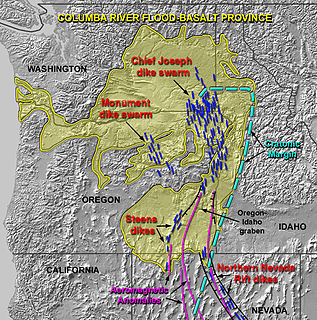
Columbia River Basalt Group

The Columbia River Basalt Group is a large igneous province that lies across parts of the Western United States. It is found in the U.S. states of Washington, Oregon, Idaho, Nevada, and California. The Basalt group includes the Steen and Picture Gorge basalt formations.

Settlement

Euro-American settlement of the Waldo Hills began in 1843 when Daniel Waldo settled a land claim there and began farming. [1] Later settlers included Homer Davenport and Samuel L. Simpson, along with Waldo's sons John and William. [1] In 1846, the hills were the site of the formation and drilling of the Oregon Rangers, a militia formed by the Provisional Government of Oregon. [4]

Homer Davenport American political cartoonist and writer (1867 – 1912)

Homer Calvin Davenport was a political cartoonist and writer from the United States. He is known for drawings that satirized figures of the Gilded Age and Progressive Era, most notably Ohio Senator Mark Hanna. Although Davenport had no formal art training, he became one of the highest paid political cartoonists in the world. Davenport also was one of the first major American breeders of Arabian horses and one of the founders of the Arabian Horse Club of America.

John B. Waldo American judge

John Breckenridge Waldo was an American politician and jurist from the state of Oregon. A native of Oregon, he grew up near Salem as part of a prominent pioneer political family that included father Daniel and brother William. A trained lawyer, he was elected to the Oregon Supreme Court and served for one term from 1880 to 1886, including as the 13th Chief Justice from 1884 to 1886. He also served one term in the Oregon House of Representatives. Waldo spent many summers in the Cascade Range fostering an appreciation for the natural environment, which led to conservation efforts to preserve the range and later to the naming of several natural features after Waldo, notably Waldo Lake.

William Waldo was an American politician and attorney in Oregon. Born in Missouri, he came to the Oregon Country with his family that included father Daniel Waldo. He would serve in the Oregon State Senate, including as president of the body in 1885. Waldo was also a county judge, while his brother John B. Waldo would serve on the Oregon Supreme Court.

See also

Eola Hills range of hills northwest of Salem, Oregon, United States

The Eola Hills are a range of hills northwest of Salem, Oregon, United States. They stretch from the community of Eola about 10 miles (16 km) north to Yamhill County.

Howell Prairie is an area west of Silverton, Oregon, United States, between the Little Pudding River and the Pudding River. It was named for John Howell, a pioneer of 1843. Howell Prairie post office was established in 1876 and closed in 1881. In 1887 a post office named Howell was established at 44.99139°N 122.87806°W; it closed in 1902. The Oregonian Railway Company also had a station named Howell Prairie, which was changed to Switzerland in 1892.

The Salem Hills are a range of hills spanning from southern Salem, Oregon, United States, south to Jefferson, west to the Willamette River and east to Turner and Marion.

Related Research Articles

Salem, Oregon State capital city in Oregon, United States

Salem is the capital of the U.S. state of Oregon, and the county seat of Marion County. It is located in the center of the Willamette Valley alongside the Willamette River, which runs north through the city. The river forms the boundary between Marion and Polk counties, and the city neighborhood of West Salem is in Polk County. Salem was founded in 1842, became the capital of the Oregon Territory in 1851, and was incorporated in 1857.

Marion County, Oregon County in the United States

Marion County is a county located in the U.S. state of Oregon. The population was 315,335 at the 2010 census, making it the fifth-most populous county in Oregon. The county seat is Salem, the state capital. The county was originally named the Champooick District, after Champoeg, a meeting place on the Willamette River. On September 3, 1849, the territorial legislature renamed it in honor of Francis Marion, a Continental Army general from South Carolina who served in the American Revolutionary War.

Silverton, Oregon City in Oregon, United States

Silverton is a city in Marion County, Oregon, United States. The city is situated along the 45th parallel about 12 miles (19 km) northeast of Salem, in the eastern margins of the broad alluvial plain of the Willamette Valley. The city is named after Silver Creek, which flows through the town from Silver Falls into the Pudding River, and thence into the Willamette River. Silverton was originally called Milford, then Silver Creek; on July 16, 1855, Silver Creek became Silverton. Human habitation of the Silverton area extends back approximately 6,000 years before the present. In historical times, the region was dominated by the Kalapuya and Molala peoples, whose seasonal burns of the area made it plow-ready and attractive to early 19th century Euro-American settlers. Farming was Silverton's first major industry, and has been a dominant land-use activity in and around Silverton since the mid-19th century.

Pudding River river in the United States of America

The Pudding River is a 62-mile (100 km) tributary of the Molalla River in the U.S. state of Oregon. Its drainage basin covers 528 square miles (1,368 km2). Among its tributaries are Silver Creek, Butte Creek, Abiqua Creek, and the Little Pudding River.
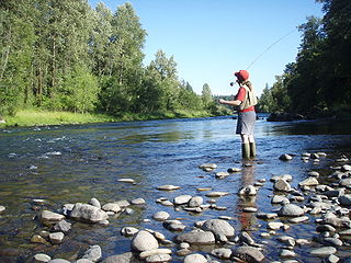
South Santiam River river in the United States of America

The South Santiam River is a tributary of the Santiam River, about 69 miles (111 km) long, in western Oregon in the United States. It drains an area of the Cascade Range into the Willamette Valley east of Corvallis.

Calapooya Mountains mountain range

The Calapooya Mountains are a mountain range in Lane and Douglas counties of southwestern Oregon in the United States. The range runs for approximately 60 miles (97 km) west from the Cascade Range between Eugene on the north and Roseburg on the south.

Theodore Thurston Geer American politician

Theodore Thurston Geer was the tenth Governor of Oregon, serving from January 9, 1899 to January 14, 1903. The Republican politician was in office when the legislature adopted the "Oregon System", Oregon's system of initiative and referendum. He also served in the Oregon House of Representatives, including time as its Speaker.

Oregon Route 219 highway in Oregon

Oregon Route 219 is an Oregon state highway which runs between the cities of Hillsboro and Woodburn, Oregon, in the United States. The Hillsboro-Silverton Highway continues further south to Silverton, signed as OR 214. The highway mainly serves local residents and agricultural traffic; despite its proximity to the Portland area it lies outside the Portland Urban Growth Boundary and so maintains its character as a country road.

<i>Statesman Journal</i> major daily newspaper published in Salem, Oregon, United States

The Statesman Journal is the major daily newspaper published in Salem, Oregon, United States. Founded in 1851 as the Oregon Statesman, it later merged with the Capital Journal to form the current newspaper, the second-oldest in Oregon. The Statesman Journal is distributed in Salem, Keizer, and portions of the mid-Willamette Valley. The average weekday circulation is 27,859, with Sunday's readership listed at 36,323. It is owned, along with the neighboring Stayton Mail and Silverton Appeal Tribune, by the national Gannett Company.

Champoeg Meetings constituent assemblies of European settlers in the southern Oregon Country

The Champoeg Meetings were the first attempts at formal governance by European-American and French Canadian pioneers in the Oregon Country on the Pacific Northwest coast of North America. Between 1841 and 1843, a series of public councils was held at Champoeg, a settlement on the French Prairie of the Willamette River valley in present-day Marion County, Oregon, and at surrounding settlements. The meetings were organized by newly arrived settlers as well as Protestant missionaries from the Methodist Mission and Catholic Jesuit priests from Canada.

Oregon Institute

The Oregon Institute was an American school located in the Willamette Valley of the Oregon Country during the 19th century. Begun in 1842, it was the first school built for European Americans west of Missouri. Founded by members of the Methodist Mission, it was located in what is now Salem, Oregon. The school began as a pre-college institution, but by 1853 was developed as Willamette University. The school's three-story building was a prominent feature in the early days of Oregon; it served as a meeting place for the Oregon Territorial Legislature when it first moved to Salem.
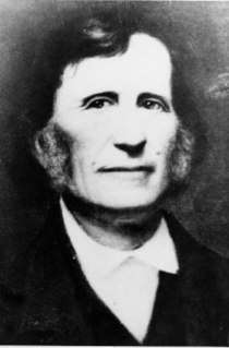
Daniel Waldo (Oregon pioneer) American pioneer

Daniel Waldo was an American legislator in the Provisional Government of Oregon, the namesake for the Waldo Hills near Salem, Oregon, and the father of two prominent Oregon politicians. He was also a member of the Oregon Rangers militia and fought in the Cayuse War.
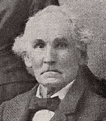
Ralph Carey Geer American politician

Ralph Carey Geer was an American farmer and politician in what became the state of Oregon. A native of Connecticut, he lived in Ohio and Illinois before taking the Oregon Trail west to Oregon where he started a nursery and later raised livestock and grew flax. At times a Republican and later a Democrat, he served in the Oregon House of Representatives and as the clerk for the county. He was related to both Homer Davenport and T. T. Geer.

Salt Creek Falls waterfall

Salt Creek Falls is a cascade and plunge waterfall on Salt Creek, a tributary of the Middle Fork Willamette River, that plunges into a gaping canyon near Willamette Pass in the Willamette National Forest, near Oakridge, Oregon. The waterfall is notable for its main drop of 286 feet (87 m) which makes it the third highest plunge waterfall in Oregon after Multnomah Falls and Watson Falls the second highest, which was re-measured in 2009 and found to be 293 feet rather than an earlier measurement of 272 feet passing Salt Creek Falls. The pool at the bottom of the waterfall is 20 metres (66 ft) deep.

Shaw is an unincorporated community in Marion County, Oregon, United States, on Oregon Route 214.

References

  1. 1 2 3 4 Corning, Howard M. Dictionary of Oregon History. Binfords & Mort Publishing, 1956.
  2. 1 2 3 Yeats, Robert. Tectonic Setting of the Willamette Valley. Geological Society of America, Accessed September 10, 2007.
  3. 1 2 Terry L. Tolan and Marvin H. Beeson. Geologic Map of the Scotts Mills, Silverton, and Stayton Northeast 7.5 Minute Quadrangles, Oregon. Archived 2013-02-17 at the Wayback Machine . United States Geological Survey, 1999.
  4. Brown, J. Henry (1892). Political History of Oregon: Provisional Government. The Lewis & Dryden Printing Co.: Portland.

Coordinates: 44°53′45″N122°51′38″W / 44.89583°N 122.86056°W / 44.89583; -122.86056

Geographic coordinate system Coordinate system

A geographic coordinate system is a coordinate system that enables every location on Earth to be specified by a set of numbers, letters or symbols. The coordinates are often chosen such that one of the numbers represents a vertical position and two or three of the numbers represent a horizontal position; alternatively, a geographic position may be expressed in a combined three-dimensional Cartesian vector. A common choice of coordinates is latitude, longitude and elevation. To specify a location on a plane requires a map projection.