Wara-Wara Bafodia is a chiefdom in Koinadugu District of Sierra Leone with a population of 25,713. [1] Its principal/capital town is Bafodia.

Wara-Wara Bafodia is a chiefdom in Koinadugu District of Sierra Leone with a population of 25,713. [1] Its principal/capital town is Bafodia.
| District capital | 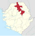 | |
|---|---|---|
| Chiefdoms | ||
| Towns | ||
| | This Sierra Leone location article is a stub. You can help Wikipedia by expanding it. |