Sengbe | |
|---|---|
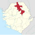
 Interactive map of Sengbe | |
| Country | |
| Province | Northern Province |
| District | Koinadugu District |
| Capital | Yogomaia |
| Population (2004 [1] ) | |
• Total | 22,458 |
| Time zone | UTC+0 (GMT) |
Sengbe is a chiefdom in Koinadugu District of Sierra Leone with a population of 22,458. [1] Its principal town is Yogomaia.