
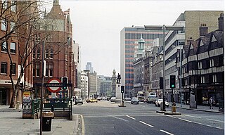
Warren Street is a street in the London Borough of Camden that runs from Cleveland Street in the west to Tottenham Court Road in the east. Warren Street tube station is located at the eastern end of the street. [1]
Warren Street is a street in the London Borough of Camden that runs from Cleveland Street in the west to Tottenham Court Road in the east. Warren Street tube station is located at the eastern end of the street. [1]
The street is crossed by Conway Street in the east and Fitzroy Street at its midpoint. On the south side of Warren Street lie Warren Mews, Richardson's Mews, Grafton Mews, and Whitfield Street. It was mostly constructed in the late 18th century. [2]
It is named after Admiral Sir Peter Warren whose daughter and heiress Anne was wife of Charles FitzRoy, 1st Baron Southampton and thus the first Lady Southampton. [3] Originally a residential street, it now contains mostly shops and businesses.

The West End of London is a district of Central London, west of the City of London and north of the River Thames, in which many of the city's major tourist attractions, shops, businesses, government buildings and entertainment venues, including West End theatres, are concentrated.
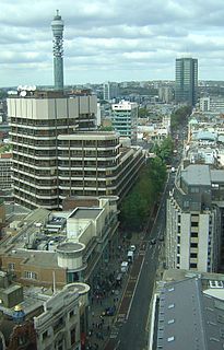
Tottenham Court Road is a major road in Central London, almost entirely within the London Borough of Camden.

St Giles Circus is a road junction in the St Giles district of the West End of London at the eastern end of Oxford Street, where it connects with New Oxford Street, Charing Cross Road and Tottenham Court Road, which it is more often referred to owing to the location of Tottenham Court Road Underground station directly under the junction. It is near to Soho, Covent Garden, Bloomsbury and Fitzrovia.
High Holborn is a street in Holborn and Farringdon Without, Central London, which forms a part of the A40 route from London to Fishguard. It starts in the west at the eastern end of St Giles High Street and runs past the Kingsway and Southampton Row, becoming Holborn at its eastern junction with Gray's Inn Road. The western stretch as far as Drury Lane, was formerly known as Broad Street. On High Holborn, traffic flows one-way westbound from its junction with Drake Street to its western end, and flows both ways for the remainder.

Malet Street is a street in Bloomsbury, in the London Borough of Camden, Central London, England. It runs between Torrington Place and the British Museum, parallel to Gower Street and Tottenham Court Road.
The WC postcode area, also known as the London WC postcode area, is a group of postcode districts in central London, England. The area covered is of high density development, and includes parts of the City of Westminster and the London Boroughs of Camden and Islington, plus a very small part of the City of London.
Cable Street is a road in the East End of London, England, with several historic landmarks nearby. It was made famous by the Battle of Cable Street in 1936.
Dean Street is a street in Soho, central London, running from Oxford Street south to Shaftesbury Avenue.

Great Russell Street is a street in Bloomsbury, London, best known for being the location of the British Museum. It runs between Tottenham Court Road in the west, and Southampton Row in the east. It is one-way only (eastbound) between its western origin at Tottenham Court Road and Bloomsbury Street.

Hinton Admiral is the estate and ancestral home of the Tapps-Gervis-Meyrick family and located in the settlement of Hinton, near Bransgore in Hampshire, England. It is a Grade I Listed building.
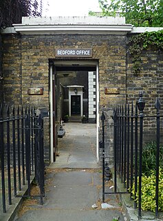
The Bedford Estate is an estate in central London owned by the Russell family, which holds the peerage title of Duke of Bedford. The estate was originally based in Covent Garden, then stretched to include Bloomsbury in 1669. The Covent Garden property was sold for £2 million in 1913 by Herbrand Russell, 11th Duke of Bedford, to the MP and land speculator Harry Mallaby-Deeley, who sold his option to the Beecham family for £250,000; the sale was finalised in 1918.

Rathbone Place is a street in central London that runs roughly north-west from Oxford Street to Percy Street. it is joined on its eastern side by Percy Mews, Gresse Street, and Evelyn Yard. The street is mainly occupied by retail and office premises.

Percy Street is a street in the London Borough of Camden that runs from Rathbone Street in the west to Tottenham Court Road in the east. At its western end it is joined by Rathbone Place and Charlotte Street. Nearby Percy Mews is off Rathbone Place. The street was built in the 1760s and is known for the number of artists that have lived there.

Torrington Place is a street in London that runs between Tottenham Court Road in the West and Byng Place in the East. It is crossed by Huntley Street and Gower Street. Chenies Mews joins it on the north side and is continued by Ridgmount Gardens on the south side.

Conway Street is a street in the London Borough of Camden that runs from the Euston Road in the north to Maple Street in the south, being divided in the middle by Fitzroy Square in the south. The northern part of the street is crossed only by Warren Street.

Whitfield Street is a street in the London Borough of Camden that runs from Warren Street in the north to Windmill Street in the south. The street is crossed by Grafton Way, Maple Street, Howland Street, Wayland Street, and Goodge Street. Whitfield Place starts and ends in Whitfield Street on its eastern side. Hertford Place, Chitty Street and Scala Street all join Whitfield Street on its western side.

Grafton Way is a street in the London Borough of Camden that runs from Tottenham Court Road in the east to Fitzroy Street in the west. Whitfield Street and Grafton Mews adjoin Grafton Way.
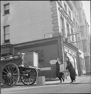
Chitty Street is a street in the London Borough of Camden that runs between Charlotte Street and Whitfield Street. Charlotte Mews adjoins Chitty Street on its south side.
This is a list of the etymology of street names in the London district of Fitzrovia. The following utilises the generally accepted boundaries of Fitzrovia viz. Euston Road to the north, Tottenham Court Road to the east, Oxford Street to the south and Great Portland Street to the west.
This is a list of the etymology of street names in the London district of Bloomsbury. The following utilises the generally accepted boundaries of Bloomsbury viz. Euston Road to the north, Gray's Inn Road to the east, New Oxford Street, High Holborn, Southampton Row and Theobald's Road to the south and Tottenham Court Road to the west.
![]() Media related to Warren Street, London at Wikimedia Commons Coordinates: 51°31′28″N0°08′19″W / 51.52431°N 0.13872°W
Media related to Warren Street, London at Wikimedia Commons Coordinates: 51°31′28″N0°08′19″W / 51.52431°N 0.13872°W
| | This London road or road transport-related article is a stub. You can help Wikipedia by expanding it. |