Watermen's stairs

Last updated

The Pelican Stairs next to the Prospect of Whitby pub in Wapping Wapping prospect of whitby 1.jpg
The Pelican Stairs next to the Prospect of Whitby pub in Wapping

Watermen's stairs were semipermanent structures that formed part of a complex transport network of public stairs, causeways and alleys in use from the 14th century to access the waters of the tidal River Thames in England. They were used by watermen, who taxied passengers across and along the river in London.

Contents

Stairs were used at high tide, and causeways were used at low tide, built down to the littoral water level from street level, their location being memorised during a waterman's apprenticeship. Stairs were recognised by custom and practice as safe plying places to pick up and put down passengers and were a valuable aid to rescue if anyone was unfortunate enough to fall into the river, as they were often built adjacent to a public house.

History

Thames Embankment, 1865 Embankment Construction of the Thames Embankment ILN 1865.jpg
Thames Embankment, 1865

The embanking of the tidal Thames was a centuries-old process that lined the river with walls that were meant to stop high water overflowing onto adjacent lands. Alleyways leading down to the Thames became the only practical way to cross over the river via boat as Old London Bridge was frequently blocked. Wharves and later rudimentary docks began to be used to offload goods but most ships simply moored in lines in the middle of the river and their cargo was rowed to shore and carried up shoreline stairs. Some of the Thames original shoreline did remain free from the construction of houses or walls. The access to the river was via shore, gaps between houses used to launch boats. Samuel Pepys in his diaries of 1665 mentions making landfall at Dukes Shore for example before wading[ citation needed ] up the beach to Narrow Street. As late as the 1850s nearly all new bridges were built with stairs at both ends, and generally on both sides.
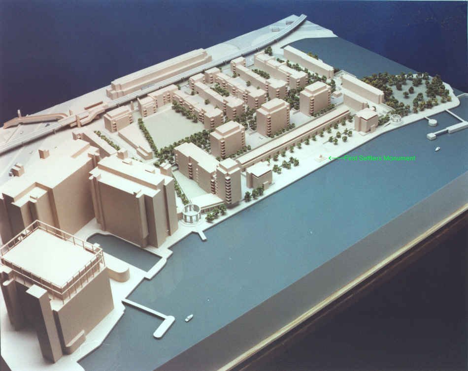
The Embankment [1] which artificially engineered the Thames' natural course in the 1860s left buildings that had been located on the gently sloping incline to the river some distance from the water's edge.

The growth of steamboats in the 1850s allowed boats to dock at specially constructed steamboat piers. Grab chains were built into the now steeply embanked high walls of the central Pool of the river Thames as an aide to rescue but access to the busiest central areas was geared towards mass transit by the 1890s.[ citation needed ] Later with the increased use of the Hackney carriage, London's stairs gradually fell into disuse or were simply built over and the abrupt collapse of traffic in the up river docks on the central tidal Thames in the 1960s effectively ended their use as transit points within London's transport network.

Cause célèbre

Thames access (High Bridge Drawdock, Greenwich) Thames stairs.jpg
Thames access (High Bridge Drawdock, Greenwich)

During the 1990s the continued existence of these sites as rights of way [2] had seemed untenable, despite their importance to London's transport history [3] and as future sites for archaeological investigation. [4] In the 1980s a local lobby group [5] initially based around the Isle of Dogs began to campaign for more local involvement, in the urban renewal of London's East End. Many local people who "worked the river" [6] began to raise awareness of the decaying state of and lack of river access to the Thames as many stairs and small Docks were bulldozed [7] during massive redevelopment. It became something of a cause célèbre amongst local people and amateur rowers across London who now felt that the regeneration of London's port districts specifically favoured businesses and property development over the preservation and fair use of river access for local communities and the public.

Meanwhile, the newly formed – the Pool of London Partnership – established in 1996 to help promote urban renewal of the areas north and south of the river [8] began to successfully lobby for the location of Greater London Authority (GLA) building to be in the Pool of London development area.

In 2002, The City of London recommended that river and foreshore access, the stairs and steps on the Thames, should be opened up where there is a "historical precedent and a practical need". [9]

Barely eleven Stairs are still in existence, tucked away on the quieter stretches of the river, semi derelict as they have not been in regular use since the 1930s. Many of the pubs to which they provided access from water level were destroyed by bombing during World War II. For centuries these locations dotted along the entire length of the river Thames shoreline were the final points of embarkation at which countless individuals began a forced or chosen new life overseas. It remains to be seen if these strange emotive architectural curiosities, milestones in London's long maritime history, that are located outside the now restored old Pool of London's borders, will be preserved for future generations.

Public stairs in use on the River Thames early 1700s

In 1746 the surveyor and cartographer John Rocque published a map of London [10] that listed the main stairs and docks then in use on the Thames.

On the London side of the river, going up stream:

York Water Gate and the Adelphi from the River by Moonlight, circa 1850 York Watergate and Adelphi Buildings, London.jpg
York Water Gate and the Adelphi from the River by Moonlight, circa 1850

Going through the bridge, still on the London side:

Wapping Old Stairs Wapping old stairs 1.jpg
Wapping Old Stairs

Crossing over to the Surrey side above bridge:

Going down through the bridge on the Surrey side:

Bell Water Gate, Old Woolwich 2017-Woolwich, Bell Water river stairs 04.jpg
Bell Water Gate, Old Woolwich

When J. Wallis and J. Cary published their 1784 map of "London, Westminster and Southwark" (which showed the Thames from the White Hart Stairs above Lambeth Palace down to Trinity Steps near Stepney), the stairs appear as follows. London side: The stair and bridges going downstream from Horse Ferry are:

Surrey side: The stairs and bridges* going downstream from White Hart are:

See also

Related Research Articles

<span class="mw-page-title-main">Bermondsey</span> District in the London Borough of Southwark

Bermondsey is a district in southeast London, part of the London Borough of Southwark, England, 2.5 miles (4.0 km) southeast of Charing Cross. To the west of Bermondsey lies Southwark, to the east Rotherhithe and Deptford, to the south Walworth and Peckham, and to the north is Wapping across the River Thames. It lies within the historic county boundaries of Surrey. During the Industrial Revolution Bermondsey became a centre for manufacturing, particularly in relation to tanning. More recently it has experienced regeneration including warehouse conversions to flats and the provision of new transport links.

<span class="mw-page-title-main">Rotherhithe</span> Residential district in southeast London, England

Rotherhithe is a district of south-east London, England, and part of the London Borough of Southwark. It is on a peninsula on the south bank of the Thames, facing Wapping, Shadwell and Limehouse on the north bank, as well as the Isle of Dogs to the east of the Thames and is a part of the Docklands area. It borders Bermondsey to the west and Deptford to the south east.

<span class="mw-page-title-main">Wapping</span> District of East London, England

Wapping is a district in East London in the London Borough of Tower Hamlets. Wapping's position, on the north bank of the River Thames, has given it a strong maritime character, which it retains through its riverside public houses and steps, such as the Prospect of Whitby and Wapping Stairs. It also has a Royal Navy shore establishment base on the riverfront called HMS President and home to Tobacco Dock and King Edward Memorial Park.

The Port of London is that part of the River Thames in England lying between Teddington Lock and the defined boundary with the North Sea and including any associated docks. Once the largest port in the world, it was the United Kingdom's largest port as of 2020. Usage is largely governed by the Port of London Authority ("PLA"), a public trust established in 1908; while mainly responsible for coordination and enforcement of activities it also has some minor operations of its own.

<span class="mw-page-title-main">St Katharine Docks</span> Human settlement in England

St Katharine Docks is a former dock and now a mixed-used district in Central London, in the London Borough of Tower Hamlets and within the East End. It lies on the north bank of the River Thames, immediately downstream of the Tower of London and Tower Bridge. From 1828 to 1968, it was one of the commercial docks that made up the Port of London. It is in the redevelopment zone known as Docklands and is now a popular housing and leisure complex.

<span class="mw-page-title-main">Shadwell</span> District of East London, England

Shadwell is a district of East London, England, in the London Borough of Tower Hamlets, 3 miles (4.8 km) east of Charing Cross. It lies on the north bank of the Thames between Wapping and Ratcliff. This riverside location has meant the area's history and character have been shaped by the maritime trades.

<span class="mw-page-title-main">Pool of London</span> Area of the Thames

The Pool of London is a stretch of the River Thames from London Bridge to below Limehouse.

<span class="mw-page-title-main">Narrow Street</span>

Narrow Street is a narrow road running parallel to the River Thames through the Limehouse area of east London, England. It used to be much narrower, and is the oldest part of Limehouse, with many buildings originating from the eighteenth century.

<span class="mw-page-title-main">Shad Thames</span> Area of Bermondsey in London, England

Shad Thames is a historic riverside street next to Tower Bridge in Bermondsey, London, England, and is also an informal name for the surrounding area. In the 19th century, the area included the largest warehouse complex in London.

<span class="mw-page-title-main">Metropolitan Police Marine Policing Unit</span>

The Marine Policing Unit (MPU) is the waterborne policing unit of London's Metropolitan Police Service, forming part of the Met Taskforce (MO7) within Met Operations. Its 22 vessels are responsible for waterborne policing of the River Thames in Greater London and supporting the rest of the Metropolitan Police and to the City of London Police when dealing with incidents in or around any waterway in London. A specialist underwater and confined-spaces search team carries out searches throughout the Metropolitan Police District. The unit also has 24 officers who are trained in rope access techniques and trained to carry out searches and counter-demonstrator operations at height.

<span class="mw-page-title-main">Execution Dock</span> Site of executions in Wapping, London

Execution Dock was a place in the River Thames near the shoreline at Wapping, London, that was used for more than 400 years to execute pirates, smugglers and mutineers who had been sentenced to death by Admiralty courts. The "dock" consisted of a scaffold for hanging. Its last executions were in 1830.

<span class="mw-page-title-main">Thames Path</span> National Trail following the River Thames in England

The Thames Path is a National Trail following the River Thames from its source near Kemble in Gloucestershire to the Woolwich foot tunnel, south east London. It is about 185 miles (298 km) long. A path was first proposed in 1948 but it only opened in 1996.

<span class="mw-page-title-main">Waterman (occupation)</span>

A waterman is a river worker who transfers passengers across and along city centre rivers and estuaries in the United Kingdom and its colonies. Most notable are those on the River Thames and River Medway in England, but other rivers such as the River Tyne and River Dee, Wales, also had their watermen who formed guilds in medieval times. Waterman can also be a person who navigates a boat carrying passengers. These boats were often rowing boat or boats with sails. Over the years watermen acquired additional skills such as local pilotage, mooring vessels at berths, jetties, buoys, and docks, and acting as helmsman aboard large vessel.

<span class="mw-page-title-main">Tideway</span> The part of the River Thames subject to tides

The Tideway is a part of the River Thames in England which is subject to tides. This stretch of water is downstream from Teddington Lock. The Tideway comprises the upper Thames Estuary including the Pool of London.

The Thames River Police was formed in 1800 to tackle theft and looting from ships anchored in the Pool of London and in the lower reaches and docks of the Thames. It replaced the Marine Police, a police force established in 1798 by magistrate Patrick Colquhoun and justice of the peace John Harriott that had been part funded by the West India Committee to protect trade between the West Indies and London. It is claimed that the Marine Police was England's first ever police force.

<span class="mw-page-title-main">The Thames Barge Driving Race</span>

The Thames Barge Driving Race or Barge Race is a river-race that was set up in 1975 by a charity called The Transport On Water Association (TOW), now known as the Thames Barge Driving Trust with the backing of Members of Parliament and Members of the House of Lords in the United Kingdom.

<span class="mw-page-title-main">Dundee Wharf</span>

Dundee Wharf is a residential development in Limehouse in the London Borough of Tower Hamlets in London. The modern buildings occupy the site of a former shipyard known as Limekiln Dockyard. John Graves established this shipyard in 1633 and then expanded his holdings with Dundee Wharf itself. By 1650 George Margetts developed a ropemaking yard including a ropehouse, storehouse and a ropewalk on the site. A modern wharf with electric cranes was constructed in the 1930s. This was used by the Dundee, Perth & London Shipping Company to operate a twice-weekly service between Perth, Dundee, Leith and London.

References

  1. "Hungerford Pier, Thames Embankment, 1869". Archived from the original on 13 May 2006. Retrieved 28 September 2007.
  2. "Thames Regional Rowing Council: Access to the River Thames". Archived from the original on 18 March 2007. Retrieved 28 September 2007.
  3. "First Settlers Monument". www.tower-bridge.org.uk.
  4. "English Heritage". www.english-heritage.org.uk.
  5. Mason, John (12 May 2004). "Obituary: Ted Johns". The Guardian.
  6. "Tower bridge community". Archived from the original on 30 October 2007. Retrieved 28 September 2007.
  7. "Photo". www.tower-bridge.org.uk. Retrieved 9 September 2021.
  8. "Pool of London: Media". www.pooloflondon.co.uk.
  9. "Archived copy" (PDF). Archived from the original (PDF) on 4 October 2007. Retrieved 28 September 2007.{{cite web}}: CS1 maint: archived copy as title (link)
  10. "Rocque London Index Map". freepages.rootsweb.com.

Sources