Papua New Guinea, officially the Independent State of Papua New Guinea, is a country in Oceania that occupies the eastern half of the island of New Guinea and its offshore islands in Melanesia, a region of the southwestern Pacific Ocean north of Australia. Its capital, located along its southeastern coast, is Port Moresby. The western half of New Guinea forms the Indonesian provinces of Papua and West Papua. It is the world's third largest island country with 462,840 km2 (178,700 sq mi).

Bougainville Island is the main island of the Autonomous Region of Bougainville of Papua New Guinea. It formed the main landmass of the German Empire-associated North Solomons. Its land measures 9,300 km2 (3,600 sq mi). The population of the province is approximately 300,000, which includes islets such as the Carterets. Mount Balbi on the main island at 2,715 m (8,907 ft) is the highest point. Much smaller Buka Island, c. 500 km2 (190 sq mi) lies north across the 400–500 m (1,300–1,600 ft) wide Buka strait. The Buka strait, despite its narrowness, is unbridged; however, regular ferries operate between the key settlements on either side and Buka Town has the main northern airstrip/airport.
The Sko or Skou languages are a small language family spoken by about 7000 people, mainly along the Vanimo coast of Sandaun Province in Papua New Guinea, with a few being inland from this area and at least one just across the border in the Indonesian province of Papua.

Lae is the capital of Morobe Province and is the second-largest city in Papua New Guinea. It is located near the delta of the Markham River and at the start of the Highlands Highway, which is the main land transport corridor between the Highlands region and the coast. Lae is the largest cargo port of the country and is the industrial hub of Papua New Guinea. The city is known as the Garden City and home of the University of Technology.

Western New Guinea, also known as Papua, is the Indonesian part of the island of New Guinea. Since the island is alternatively named as Papua, the region is also called West Papua. Lying to the west of the independent state of Papua New Guinea, it is the one of the few Indonesian territories to be situated in Oceania. Considered to be a part of the Australian continent, the territory is mostly in the Southern Hemisphere and also includes nearby islands, including the Schouten and Raja Ampat archipelagoes. The region is predominantly covered with ancient rainforest where numerous traditional tribes live, such as the Dani of the Baliem Valley, although a large proportion of the population live in or near coastal areas, with the largest city being Jayapura.
Religion in Papua New Guinea is predominantly Christian, with traditional animism and ancestor worship often occurring less openly as another layer underneath or more openly side by side Christianity. The courts, government, and general society uphold a constitutional right to freedom of speech, thought, and belief. There is no state religion, although the government openly partners with several Christian groups to provide services, and churches participate in local government bodies.
The Papua New Guinea national cricket team, nicknamed the Barramundis, is the team that represents the country of Papua New Guinea in international cricket. The team is organised by Cricket PNG, which has been an Associate Member of the International Cricket Council (ICC) since 1973. Papua New Guinea previously had One-Day International (ODI) status, which it gained by finishing fourth in 2014 World Cup Qualifier. Papua New Guinea lost both their ODI and T20I status in March 2018 after losing a playoff match against Nepal during the 2018 Cricket World Cup Qualifier, a result that earned ODI and T20I status for their opponents. On 26 April 2019, at the final World Cricket League 2 fixture; PNG defeated Oman to finish at the fourth position and reclaim their ODI status.

The New Guinea campaign of the Pacific War lasted from January 1942 until the end of the war in August 1945. During the initial phase in early 1942, the Empire of Japan invaded the Australian-administered Mandated Territory of New Guinea and the Australian Territory of Papua and overran western New Guinea, which was a part of the Netherlands East Indies. During the second phase, lasting from late 1942 until the Japanese surrender, the Allies—consisting primarily of Australian forces—cleared the Japanese first from Papua, then the Mandate and finally from the Dutch colony.

New Guinea Force was a military command unit for Australian, United States and native troops from the Territories of Papua and New Guinea serving in the New Guinea campaign during World War II. Formed in April 1942, when the Australian First Army was formed from the Australian I Corps after it returned from the Middle East, it was responsible for planning and directing all operations within the territory up until October 1944. General Headquarters Southwest Pacific Area Operational Instruction No.7 of 25 May 1942, issued by Commander-Allied-Forces, General Douglas MacArthur, placed all Australian and US Army, Air Force and Navy Forces in the Port Moresby Area under the control of New Guinea Force. Over the course of its existence, New Guinea Force was commanded by some of the Australian Army's most notable commanders, including Sydney Rowell, Sir Edmund Herring and Sir Leslie Morshead.

The continent of Australia, sometimes known in technical contexts by the names Sahul, Australinea, or Meganesia to distinguish it from the country of Australia, consists of the landmasses which sit on Australia's continental plate. The name "Sahul" takes its name from the Sahul Shelf, which is part of the continental shelf of the Australian continent. The continent includes mainland Australia, Tasmania, and the island of New Guinea, which consists of Papua New Guinea and Western New Guinea. Situated in the geographical region of Oceania, Australia is the smallest of the seven traditional continents.

New Guinea is the world's second-largest island and, with an area of 785,753 km2 (303,381 sq mi), the largest island in the Southern Hemisphere. Located in Melanesia in the southwestern Pacific Ocean, it is separated by the 150-kilometre wide Torres Strait from the Australian continent. Numerous smaller islands are located to the west and east. The eastern half of the island is the major land mass of the independent state of Papua New Guinea. The western half, known as Western New Guinea or West Papua, forms a part of Indonesia and is organized as the provinces of Papua and West Papua.

The Papua conflict is an ongoing conflict in Western New Guinea between Indonesia and the Free Papua Movement. Subsequent to the withdrawal of the Dutch administration from the Netherlands New Guinea in 1962 and implementation of Indonesian administration in 1963, the Free Papua Movement has conducted a low-intensity guerrilla war against Indonesia through the targeting of its military and police.

Abun, also known as Yimbun, Anden, Manif, or Karon, is a Papuan language spoken along the northern coast of the Bird's Head Peninsula in Abun District, Tambrauw Regency. It is not closely related to any other language, and though Ross (2005) assigned it to the West Papuan family, based on similarities in pronouns, Palmer (2018), Ethnologue, and Glottolog list it as a language isolate.

Sumuri or Sumeri is a language spoken in Sumuri District, Teluk Bintuni Regency on the Bomberai Peninsula by about a thousand people.
KambotAKAAp Ma, is a Keram language of Papua New Guinea. Compared to its nearest relative, Ambakich, Kambot drops the first segment from polysyllabic words.

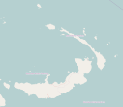
Kait is a village on the south-west coast of New Ireland, Papua New Guinea. It is located in Konoagil Rural LLG. Two notable rivers flow into the Bismarck Sea here.
King is a village on the south-west coast of New Ireland, Papua New Guinea, north of Kait. The villagers speak the Kandas language. Traditionally the chief of Watpi has three wives. It is located in Konoagil Rural LLG.
Tabar Island is an island of the Tabar Group of Papua New Guinea, located to the east of New Ireland. It is inhabited by the Tabar people.

The Pam Islands are an island group of the Admiralty Islands archipelago in the Bismarck Sea, within Papua New Guinea.
Goaribari is an island in southern Papua New Guinea. It is located in Gulf Province within the Gulf of Papua. During high tides, parts of the island are inundated. The vegetation is thick rainforest.