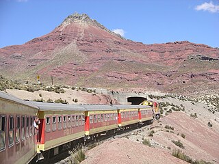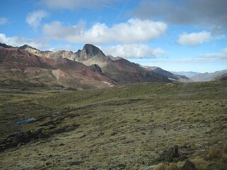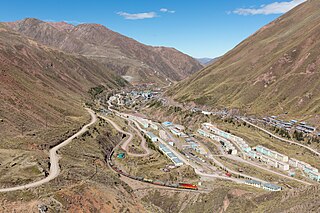
The Yauli Province is one of the nine provinces in Peru that form the Junín Region. It is bordered to the north by the Pasco Region and the Junín Province, to the east by the Tarma Province, to the south by the Jauja Province and to the west by the Lima Region. The population of the province was estimated at 66,093 inhabitants in 2002. The capital of the Yauli Province is La Oroya.

Anticona, also called Ticlio, is a mountain in the Andes of Peru, about 5,150 metres (16,896 ft) high. It is located in the Lima Region, Huarochiri Province, Chicla District, and in the Junín Region, Yauli Province, Morococha District. Anticona lies between the Ticlio mountain pass in the southwest and Yanashinga in the northeast, northwest of a lake named Huacracocha.

Tukumach'ay or Tuku Mach'ay is a mountain in the Andes of Peru, about 5,000 metres (16,404 ft) high. It is situated in the Junín Region, Yauli Province, Yauli District. Tukumach'ay lies southeast of the Antikuna mountain pass and south of Waqraqucha.

Quñuq P'ukru is a mountain in the Cordillera Central in the Andes of Peru, about 5,000 m (16,404 ft) high. It is situated in the Lima Region, Huarochirí Province, Chicla District.

Pachanqutu or Phanchaqutu is a mountain in the Paryaqaqa or Waruchiri mountain range in the Andes of Peru, about 5,400 metres (17,717 ft) high. It is situated in the Lima Region, Huarochirí Province, San Mateo District, and in the Junín Region, Yauli Province, Suitucancha District. It lieson the western border of the Nor Yauyos-Cochas Landscape Reserve. Pachanqutu lies near Tunshu, southeast of Paka (Paca), south of Sullcon and Americo, and west of the branch of Antachaire.

Anta Q'asa is a mountain in the Andes of Peru, about 5,000 metres (16,404 ft) high. It is situated in the Junín Region, Yauli Province, Marcapomacocha District, and in the Lima Region, Huarochirí Province, Chicla District. Anta Q'asa lies southwest of the mountain Pukaqucha, west of the mountains Yuraqqucha and Sillaqaqa, northeast of Llawa P'ukru and east of the mountain Quriqucha.

Sillaqaqa is a mountain in the Andes of Peru, about 5,000 metres (16,404 ft) high. It is situated in the Junín Region, Yauli Province, Marcapomacocha District, and in the Lima Region, Huarochirí Province, Chicla District. Sillaqaqa lies southwest of the mountain Pukaqucha, west of the mountain Yuraqqucha, northeast of Llawa P'ukru and east of the mountains Quriqucha and Anta Q'asa. The peak south of Sillaqaqa is named Inka Kancha.

Yuraqqucha is a mountain in the Andes of Peru, about 5,100 metres (16,732 ft) high. It is located in the Junín Region, Yauli Province, Morococha District, and in the Lima Region, Huarochirí Province, Chicla District. Yuraqqucha lies northwest of a lake named Waqraqucha, the Antikuna mountain pass and the peak of Antikuna. Anta Q'asa, Sillaqaqa, Inka Kancha and Pukaqucha are situated west, southwest and northwest of Yuraqqucha.

Quri is a mountain in the Cordillera Central in the Andes of Peru, about 5,200 metres (17,060 ft) high. It is situated in the Lima Region, Huarochiri Province, San Mateo District, and in the Junín Region, Yauli Province, Yauli District. Quri lies west of the main branch of the Paryaqaqa or Waruchiri mountain range, southwest of a lake named Wallaqucha (Huallacocha).

Pukaqucha is a mountain in the Andes of Peru, about 5,100 metres (16,732 ft) high, at a small lake of the same name. The mountain is located in the Junín Region, Yauli Province, in the districts of Marcapomacocha and Morococha, and in the Lima Region, Huarochirí Province, Chicla District. It lies near the Antikuna pass, northwest of Yuraqqucha and northeast of Inka Kancha and Sillaqaqa.

Qunchupata is a mountain in the Andes of Peru, about 5,100 metres (16,732 ft) high. It is located in the Junín Region, Yauli Province, Marcapomacocha District, and in the Lima Region, Huarochirí Province, Chicla District. Qunchupata lies southwest of Anta Q'asa and Quriqucha and southeast of Yana Ulla. It is situated north of the Hatun Uqhu valley.

Kashpi is a mountain in the Andes of Peru, about 5,200 metres (17,060 ft) high. The mountain is located in the Junín Region, Yauli Province, Marcapomacocha District, and in the Lima Region, Huarochirí Province, Huanza District. It lies southeast of Chunta and northwest of a lake named Pukaqucha.

Chunta is a 5,208-metre-high (17,087 ft) mountain in the Andes of Peru. It is located in the Junín Region, Yauli Province, Marcapomacocha District, and in the Lima Region, Canta Province, Huaros District, and in the Huarochirí Province, Huanza District. It lies northwest of Kashpi.

Chuqi Chukchu is a 5,154-metre-high (16,909 ft) mountain in the Cordillera Central in the Andes of Peru. It is situated in the Lima Region, Huarochiri Province, Chicla District. Chuqi Chukchu lies near the Antikuna mountain pass, northwest of Wayrakancha and northeast of Quñuq P'ukru. The mining village of Q'asa P'allqa (Casapalca) lies at its feet.

Paraqti is a mountain in the Cordillera Central in the Andes of Peru, about 5,000 m (16,404 ft) high. It lies in the Junín Region, Yauli Province, Yauli District, and in the Lima Region, Huarochiri Province, Chicla District. Paraqti is situated near the Antikuna mountain pass, southwest of Tuku Mach'ay and Chinchirusa, and east of Chuqi Chukchu.

Suyruqucha is a mountain in the Paryaqaqa or Waruchiri mountain range in the Andes of Peru, about 5,500 metres (18,045 ft) high. It is located in the Junín Region, Jauja Province, Canchayllo District, in the Yauli Province, Suitucancha District, and in the Lima Region, Huarochiri Province, Quinti District. It lies on the western border of the Nor Yauyos-Cochas Landscape Reserve. It is situated northwest of Qullqip'ukru. Wararayuq lies west of it.

Yana Ulla is a mountain in the Andes of Peru, about 5,100 metres (16,732 ft) high. It is located in the Junín Region, Yauli Province, Marcapomacocha District, and in the Lima Region, Huarochirí Province, Carampoma District. Yana Ulla lies southwest of Quriqucha and northwest of Qunchupata. A lake named Yana Ulla is at the feet of the mountains.

Liyunqucha is a 5,215-metre-high (17,110 ft) mountain in the Andes of Peru. It is located in the Junín Region, Yauli Province, Marcapomacocha District, and in the Lima Region, Huarochirí Province, Carampoma District. Liyunqucha lies northwest of Yana Ulla and southeast of a mountain named Lichiqucha.

Lichiqucha is a mountain in the Andes of Peru which reaches an altitude of approximately 5,000 m (16,000 ft). It is located in the Junín Region, Yauli Province, Marcapomacocha District, and in the Lima Region, Huarochirí Province, in the districts of Carampoma and Huanza. Lichiqucha lies northwest of Liyunqucha.

Lichiqucha is a mountain at a small lake of that name in the Andes of Peru which reaches an altitude of approximately 5,000 m (16,000 ft). It is located in the Junín Region, Yauli Province, Yauli District, and in the Lima Region, Huarochirí Province, Chicla District. Lichiqucha lies southwest of Wayrakancha.


