Wayside, Lynn County, Texas

Last updated

Wayside, Lynn County, Texas
Wayside, Lynn County, Texas, Abandoned shack.jpg
Abandoned shack in Wayside, December 2011
Relief map of Texas.png
Red pog.svg
Wayside
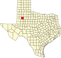
Location of Wayside in Texas
Usa edcp relief location map.png
Red pog.svg
Wayside
Wayside (the United States)
Coordinates: 33°19′37″N101°48′26″W / 33.32694°N 101.80722°W / 33.32694; -101.80722
CountryFlag of the United States.svg  United States
StateFlag of Texas.svg  Texas
County Lynn
Region Llano Estacado
Elevation
[1]
3,169 ft (966 m)
Time zone UTC-6 (CST)
ZIP code
79373
Area code 806

Wayside is a small unincorporated community in Lynn County, Texas, United States. [1] Today, the community is best described as a ghost town, with only a few farms and ranches scattered across the area.

Contents

Geography

In the state of Texas, there are six small communities that share the name Wayside. On the high plains of the Llano Estacado is Wayside (Armstrong County), Wayside (Roberts County), and Wayside (Lynn County). The other three communities, which lie in Central Texas, include Wayside (Bastrop County), Wayside (Wood County) and Wayside (Panola County).

Wayside (Armstrong County) is located approximately 100 miles (161 km) to the north and Wayside (Roberts County) is approximately 270 miles (435 km) to the north-northeast of Wayside (Lynn County). [1]

The remnants of Wayside (Lynn County) lie on the high plains at an altitude of 3,169 feet (966 m) in north-central Lynn County at the intersection of Farm to Market Road 211 and U.S. Highway 87. The nearest major city is Lubbock, located 25 mi (40 km) to the north.

See also

Related Research Articles

<span class="mw-page-title-main">Llano Estacado</span> Southwestern United States in New Mexico and Texas

The Llano Estacado, sometimes translated into English as the Staked Plains, is a region in the Southwestern United States that encompasses parts of eastern New Mexico and northwestern Texas. One of the largest mesas or tablelands on the North American continent, the elevation rises from 3,000 feet (900 m) in the southeast to over 5,000 feet (1,500 m) in the northwest, sloping almost uniformly at about 10 feet per mile (2 m/km).

<span class="mw-page-title-main">Mesquite, Borden County, Texas</span> Ghost town in Texas, United States

Mesquite is a former town in Borden County, Texas, United States. From its inception, Mesquite remained a rural farming community. A school, established in 1905, served the area until 1952, after which the building appears to have been abandoned. Today, all that remains at the site of Mesquite are a Church of Christ, several scattered houses, and the abandoned schoolhouse. The rest of the town appears to have been subsumed by private farms for cropland.

<span class="mw-page-title-main">Southland, Texas</span> Unincorporated community in Texas, United States

Southland is an unincorporated community in Garza County, Texas, United States. It lies along the eastern edge of the Llano Estacado on U.S. Route 84, twenty miles northwest of Post.

<span class="mw-page-title-main">South Plains, Texas</span> Unincorporated community in Texas, United States

South Plains is an unincorporated community in northern Floyd County, Texas, United States. It lies along State Highway 207 north of the city of Floydada, the county seat of Floyd County. Its elevation is 3,215 feet (980 m). Although South Plains is unincorporated, it has a post office, with the ZIP code of 79258.

<span class="mw-page-title-main">Fieldton, Texas</span> Unincorporated community in Texas, United States

Fieldton is an unincorporated community in Lamb County, Texas, United States. Fieldton has a post office with the ZIP code 79326.

<span class="mw-page-title-main">Sagerton, Texas</span> Place in Texas, United States

Sagerton is an unincorporated community in Haskell County, Texas, United States.

<span class="mw-page-title-main">Grassland, Texas</span> Town in Texas, United States

Grassland is an unincorporated community in Lynn County, West Texas, United States. According to the Handbook of Texas, the community had an estimated population of 61 in 2000.

<span class="mw-page-title-main">Patricia, Texas</span> Unincorporated community in Dawson County, Texas, United States

Patricia is an unincorporated community in Dawson County, Texas, United States.

<span class="mw-page-title-main">Double Mountain Fork Brazos River</span> River in Texas, United States

The Double Mountain Fork Brazos River is an ephemeral, sandy-braided stream about 170 mi (280 km) long, heading on the Llano Estacado of West Texas about 11.5 mi (18.5 km) southeast of Tahoka, Texas, flowing east-northeast across the western Rolling Plains to join the Salt Fork, forming the Brazos River about 18 mi (29 km) west-northwest of Haskell, Texas.

<span class="mw-page-title-main">North Fork Double Mountain Fork Brazos River</span> River in Texas, United States

The North Fork Double Mountain Fork Brazos River is an intermittent stream about 75 mi (121 km) long, heading at the junction of Blackwater Draw and Yellow House Draw in the city of Lubbock, flowing generally southeastward to its mouth on the Double Mountain Fork Brazos River in western Kent County. It crosses portions of Lubbock, Crosby, Garza, and Kent counties in West Texas.

<span class="mw-page-title-main">Estacado, Texas</span> Ghost town in Texas, United States

Estacado is a ghost town in Crosby and Lubbock Counties in the U.S. state of Texas. Located along Farm to Market Road 1527, it was established in 1879 as a Religious Society of Friends (Quaker) colony by Paris Cox and originally named Maryetta after his wife. In 1886, it became the first government seat of Crosby County. In 1936, Recorded Texas Historic Landmark number 4779 was designated to commemorate the founding of Estacado.

<span class="mw-page-title-main">Posey, Texas</span> Unincorporated community in Texas, United States

Posey is an unincorporated community located on the level plains of the Llano Estacado, approximately 11 mi (18 km) southeast of Lubbock in southeastern Lubbock County, Texas, United States.

<span class="mw-page-title-main">Heckville, Texas</span> Unincorporated community in Texas, United States

Heckville is an unincorporated community located on the high plains of the Llano Estacado, approximately 16 mi (26 km) northeast of Lubbock or 7 mi (11 km) north of Idalou in northeastern Lubbock County, Texas, United States. This small town was named after Henry Heck, who built a cotton gin to serve the community in 1948.

<span class="mw-page-title-main">Becton, Texas</span> Unincorporated community in Texas, United States

Becton is an unincorporated community in northeastern Lubbock County, Texas, United States, approximately 18 mi (29 km) northeast of Lubbock. This small rural community lies on the high plains of the Llano Estacado in West Texas.

<span class="mw-page-title-main">Close City, Texas</span> Unincorporated community in Texas, United States

Close City is an unincorporated community in western Garza County, approximately 6.5 mi (10.5 km) west-northwest of Post. The small rural community lies on the High Plains of the Llano Estacado in West Texas.

<span class="mw-page-title-main">Salt Fork Brazos River</span> River

The Salt Fork Brazos River is a braided, highly intermittent stream about 150 mi (240 km) long, heading along the edge of the Llano Estacado about 26 mi (42 km) east-southeast of Lubbock, Texas. From its source, it flows generally east-southeastward to join the Double Mountain Fork to form the Brazos River about 18 mi (29 km) west-northwest of Haskell, Texas. The Salt Fork stretches across portions of Crosby, Garza, Kent, and Stonewall counties of West Texas.

<span class="mw-page-title-main">Needmore, Terry County, Texas</span> Unincorporated community in Texas, United States

Needmore is a small unincorporated community in north central Terry County, Texas, United States.

<span class="mw-page-title-main">Canyon Valley, Texas</span> Ghost town in Texas, United States

Canyon Valley is a ghost town in southern Crosby County, Texas, United States. Today, only a few farms and ranches are scattered across the area.

<span class="mw-page-title-main">Wastella, Texas</span> Ghost town in Texas, United States

Wastella is a ghost town in northwestern Nolan County, Texas, United States. It is located at the intersection of U.S. Highway 84 and Farm to Market Road 1982, approximately 8 mi (13 km) northwest of Roscoe. It lies within the physiographic region known as the Rolling Plains, to the southeast of the high plains of the Llano Estacado.

<span class="mw-page-title-main">Whiteflat, Texas</span> Ghost town in Texas, United States

Whiteflat is a ghost town in Motley County, Texas, United States. The population was estimated to be 3 at the 2000 census.

References

  1. 1 2 3 U.S. Geological Survey Geographic Names Information System: Wayside