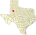
Grassland, Texas

Last updated

Grassland, Texas
Town
Grassland Cemetery Lynn County Texas 2011.jpg
Grassland Cemetery
Relief map of Texas.png
Red pog.svg
Grassland
Location of Grassland in Texas
Coordinates: 33°08′11″N101°35′50″W / 33.13639°N 101.59722°W / 33.13639; -101.59722
Country Flag of the United States.svg  United States
State Flag of Texas.svg  Texas
County Lynn
Physiographic region Llano Estacado
Founded1888
Elevation
[1]
2,956 ft (901 m)
Population
 (2000)
  Total61
Time zone UTC-6 (Central (CST))
  Summer (DST) UTC-5 (CDT)
Area code 806
Website Handbook of Texas

Grassland is an unincorporated community in Lynn County, West Texas, United States. According to the Handbook of Texas, the community had an estimated population of 61 in 2000. [2]

Contents

Geography

Grassland lies on the level plains of the Llano Estacado in West Texas. It is situated at the junction of Farm Roads 212 and 1313 in east central Lynn County, approximately two miles south of U.S. Highway 380 and two miles west of the Garza County line. [2]

History

The community was founded in 1888 and grew up around a ranch owned by Enos Seeds and his brother, Thomas. [2] A post office was established at the site on January 12, 1889. It remained operational until May 7, 1900. During the early 1900s, former ranch lands were divided into smaller plots and sold for farming and other agricultural purposes. Grassland School District No. 21 was created in 1916 to serve local students. That same year, Grassland Methodist Church was organized. The community's status as a hub of religious activities was furthered with the organization of two more churches, the Central Baptist Church of Grassland and Grassland Nazarene during the early 1920s. A total of 76 people were living in Grassland by 1930. That number grew to roughly 200 in 1940. On September 26, 1940, high school students from Grassland and several other rural districts were sent to Tahoka, following the trend of school consolidation found throughout the state at the time. The consolidation process was completed on June 26, 1953, when Grassland's school closed and all students were bussed to nearby Tahoka. The community managed to maintain its peak population of approximately 200 through 1960s, but a marked decline took place during that decade. By 1970, Grassland home to around 60 residents. It remained at that level through 2000.

Education

Public education in the community of Grassland is provided by the Tahoka Independent School District.

Notable person

See also

Related Research Articles

<span class="mw-page-title-main">Lynn County, Texas</span> County in Texas, United States

Lynn County is a county in the U.S. state of Texas. As of the 2020 census, its population was 5,596. Its county seat is Tahoka. The county was created in 1876 and organized in 1903.

<span class="mw-page-title-main">Ralls, Texas</span> City in Texas, United States

Ralls is a city in Crosby County, Texas, United States. It was named after John Robinson Ralls, who, with the help of W.E. McLaughlin, laid out the townsite in July 1911. As of the 2010 census, it had a population of 1,944, down from 2,252 at the 2000 census. Ralls is surrounded by productive farmlands that primarily produce cotton and grains, with lesser amounts of soybean, sunflower seed, and vegetables.

<span class="mw-page-title-main">Cotton Center, Texas</span> Unincorporated community in Texas, United States

Cotton Center is an unincorporated community in western Hale County, Texas, United States, located about 12 miles southwest of Hale Center. Until the late 19th century, the Comanche tribe of Native Americans occupied the area. In 1907, with the coming of a branch of the Santa Fe Railroad, a number of farming operations were established. Cotton Center was originally created in 1925 as a consolidated school district, with a small unincorporated community site, containing the school, cotton gins, and various businesses to support the surrounding farms. In 1935, a local post office opened, and the first irrigation well was drilled. By the late 1940s, irrigation wells proliferated, pumping water from the Ogallala Aquifer. The community revolves around farming and is tied together by the school, which as of 2005 had 140 students in prekindergarten through grade 12.

<span class="mw-page-title-main">Afton, Texas</span> Unincorporated community in Texas, United States

Afton is an unincorporated community in northern Dickens County, Texas, United States.

<span class="mw-page-title-main">Southland, Texas</span> Unincorporated community in Texas, United States

Southland is an unincorporated community in Garza County, Texas, United States. It lies along the eastern edge of the Llano Estacado on U.S. Route 84, twenty miles northwest of Post.

<span class="mw-page-title-main">White River (Texas)</span> River in Texas, United States

The White River is an intermittent stream in the South Plains of Texas and a tributary of the Brazos River of the United States. It rises 8 miles (13 km) west of Floydada in southwestern Floyd County at the confluence of Callahan and Runningwater Draws. From there, it runs southeast for 62 miles (100 km) to its mouth on the Salt Fork of the Brazos River in northwestern Kent County. Besides these two headwaters, which rise near Hale Center and in Curry County, New Mexico, respectively, other tributaries include Pete, Crawfish, and Davidson Creeks. The White River drains an area of 1,690 sq mi (4,377 km2).

<span class="mw-page-title-main">Mulberry Creek (Red River tributary)</span> River

Mulberry Creek is an intermittent stream about 58 mi (93 km) long, formed as a shallow draw on the high plains of the Llano Estacado in Armstrong County, Texas, and flowing southeastward to join the Prairie Dog Town Fork Red River in Hall County, Texas.

<span class="mw-page-title-main">Kalgary, Texas</span> Unincorporated community in Texas, United States

Kalgary is an unincorporated community in Crosby County, Texas, United States. According to the Handbook of Texas, the community had an estimated population of 70 in 2000.

<span class="mw-page-title-main">Fieldton, Texas</span> Unincorporated community in Texas, United States

Fieldton is an unincorporated community in Lamb County, Texas, United States. Fieldton has a post office with the ZIP code 79326.

<span class="mw-page-title-main">Sagerton, Texas</span> Place in Texas, United States

Sagerton is an unincorporated community in Haskell County, Texas, United States.

<span class="mw-page-title-main">Yellow House Canyon</span>

Yellow House Canyon is about 32 km (20 mi) long, heading in Lubbock, Texas, at the junction of Blackwater Draw and Yellow House Draw, and trending generally southeastward to the edge of the Llano Estacado about 10 km (6.2 mi) east of Slaton, Texas; it forms one of three major canyons along the east side of the Llano Estacado and carries the waters of the North Fork Double Mountain Fork Brazos River.

<span class="mw-page-title-main">Double Mountain Fork Brazos River</span> River in Texas, United States

The Double Mountain Fork Brazos River is an ephemeral, sandy-braided stream about 170 mi (280 km) long, heading on the Llano Estacado of West Texas about 11.5 mi (18.5 km) southeast of Tahoka, Texas, flowing east-northeast across the western Rolling Plains to join the Salt Fork, forming the Brazos River about 18 mi (29 km) west-northwest of Haskell, Texas.

<span class="mw-page-title-main">North Fork Double Mountain Fork Brazos River</span> River in Texas, United States

The North Fork Double Mountain Fork Brazos River is an intermittent stream about 75 mi (121 km) long, heading at the junction of Blackwater Draw and Yellow House Draw in the city of Lubbock, flowing generally southeastward to its mouth on the Double Mountain Fork Brazos River in western Kent County. It crosses portions of Lubbock, Crosby, Garza, and Kent counties in West Texas.

<span class="mw-page-title-main">Becton, Texas</span> Unincorporated community in Texas, United States

Becton is an unincorporated community in northeastern Lubbock County, Texas, United States, approximately 18 mi (29 km) northeast of Lubbock. This small rural community lies on the high plains of the Llano Estacado in West Texas.

<span class="mw-page-title-main">Salt Fork Brazos River</span> River

The Salt Fork Brazos River is a braided, highly intermittent stream about 150 mi (240 km) long, heading along the edge of the Llano Estacado about 26 mi (42 km) east-southeast of Lubbock, Texas. From its source, it flows generally east-southeastward to join the Double Mountain Fork to form the Brazos River about 18 mi (29 km) west-northwest of Haskell, Texas. The Salt Fork stretches across portions of Crosby, Garza, Kent, and Stonewall counties of West Texas.

<span class="mw-page-title-main">Needmore, Terry County, Texas</span> Unincorporated community in Texas, United States

Needmore is a small unincorporated community in north central Terry County, Texas, United States.

<span class="mw-page-title-main">Canyon Valley, Texas</span> Ghost town in Texas, United States

Canyon Valley is a ghost town in southern Crosby County, Texas, United States. Today, only a few farms and ranches are scattered across the area.

<span class="mw-page-title-main">Hobbs, Texas</span> Unincorporated community in Texas, United States

Hobbs is an unincorporated community in west Fisher County, Texas, United States. It is located at the intersection of Farm to Market Roads 611 and 1614, about 20 mi (32 km) east of Snyder. It lies within the physiographic region known as the Rolling Plains in the valley of the Clear Fork Brazos River.

<span class="mw-page-title-main">Wastella, Texas</span> Ghost Town in Texas, United States

Wastella is a ghost town in northwestern Nolan County, Texas, United States. It is located at the intersection of U.S. Highway 84 and Farm to Market Road 1982, approximately 8 mi (13 km) northwest of Roscoe. It lies within the physiographic region known as the Rolling Plains, to the southeast of the high plains of the Llano Estacado.

<span class="mw-page-title-main">Whiteflat, Texas</span> Ghost Town in Texas, United States

Whiteflat is a ghost town in Motley County, Texas, United States. The population was estimated to be 3 at the 2000 census.

References

  1. "Grassland". Geographic Names Information System . United States Geological Survey, United States Department of the Interior.
  2. 1 2 3 "Grassland, Texas". The Handbook of Texas online. Archived from the original on October 3, 2012. Retrieved November 11, 2009.