Ancash is a region of northern Peru. It is bordered by La Libertad Region on the north, Huánuco and Pasco regions on the east, the Lima Region on the south, and the Pacific Ocean on the west. Its capital is the city of Huaraz, and its largest city and port is Chimbote. The name of the region originates from the Quechua word anqash, from anqas (blue) or from anka (eagle).

The Aija Province is one of 20 provinces of the Ancash Region in Peru.

The Carlos Fermín Fitzcarrald Province is one of 20 provinces of the Ancash Region of Peru. It is named after Carlos Fermín Fitzcarrald, the rubber tycoon whose life served as an inspiration behind the 1982 film Fitzcarraldo.
Chacas is a district of the province Asunción in the Ancash Region of Peru. Its seat is Chacas.

The Pomabamba Province is one of twenty provinces of the Ancash Region in Peru. It was formerly called Pumapampa and today it is also known as "The City of Cedars". It is located at the left bank of the Pomabamba river, at 3,063 meters (10,049 ft) above sea level. It was created by law on February 21, 1861.
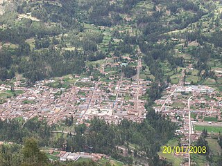
Pomabamba is the largest of 4 districts in the Pomabamba Province of the Ancash Region in Peru.
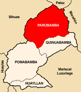
Parobamba District is one of 4 districts in the Pomabamba Province of the Ancash Region in Peru.

Quinuabamba District is one of 4 districts in the Pomabamba Province of the Ancash Region in Peru.

Huayllán District is one of 4 districts in the Pomabamba Province of the Ancash Region in Peru.
Carhuaz District is one of eleven districts of the province Carhuaz in the Ancash Region of Peru. Its seat is Carhuaz.

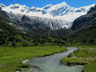
Ocshapalca is a mountain in the Cordillera Blanca in the Andes of Peru, about 5,888 m (19,318 ft) high. It is situated in the Ancash Region, Huaraz Province, on the border of the districts Independencia District and Tarica. Ocshapalca lies between the mountain Hatunkunka in the west and Ranrapalca in the east.
Honcopampa or Joncopampa is an archaeological site in Peru. It is situated in the Ancash Region, Carhuaz Province, Aco District, at a height of about 3,500 metres (11,483 ft). Hunqupampa is considered one of the most important archaeological sites of the Callejón de Huaylas. It lies in the little populated place named Hunqupampa (Joncopampa).
Markahirka or Marka Hirka is an archaeological site with cave paintings and stone tombs (chullpa) on a mountain of the same name in Peru. It is located in the Ancash Region, Huari Province, in the districts of Cajay and Masin. It is situated at a height of 3,580 metres (11,745 ft). Markahirka is also a good viewpoint with views into the Puchka valley (Puchca) and to the towns of Huari (Wari) and Huachis (Wachis).

Waraqayuq or Warak'ayuq is a mountain with an archaeological site of the same name in the Cordillera Blanca in the Andes of Peru, about 4,600 metres (15,092 ft) high. It is situated in the Ancash Region, Huari Province, Chavin de Huantar District, east of the mountain Yanamaray.
Warahirka or Wara Hirka is a mountain with an archaeological site of the same name in Peru. It is situated in the Huánuco Region, Yarowilca Province, Pampamarca District, about 1.5 km from Pampamarca, near La Florida and Warahirka (Huarajirca).
Auga Punta is an archaeological site in Peru located in the Huánuco Region, Huamalíes Province, Jircan District. It is situated at an elevation of ca. 3,700 m (12,100 ft) on a mountain named Jircán, near the village of Urpish.

Wayunkayuq is a mountain in the Andes of Peru which reaches a height of approximately 3,800 m (12,500 ft). It is located in the Junín Region, Tarma Province, Acobamba District, south of Acobamba.
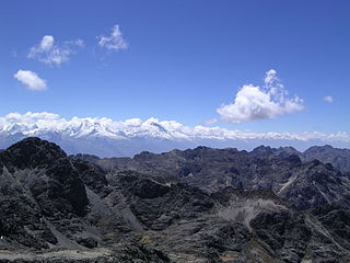
Puma Wayin is a mountain in the Andes of Peru which reaches a height of approximately 4,400 m (14,436 ft). It is located in the Ancash Region, Bolognesi Province, Huallanca District, east of Ismu Cruz.


