Related Research Articles

Antarctic Circumpolar Current (ACC) is an ocean current that flows clockwise from west to east around Antarctica. An alternative name for the ACC is the West Wind Drift. The ACC is the dominant circulation feature of the Southern Ocean and has a mean transport estimated at 100–150 Sverdrups, or possibly even higher, making it the largest ocean current. The current is circumpolar due to the lack of any landmass connecting with Antarctica and this keeps warm ocean waters away from Antarctica, enabling that continent to maintain its huge ice sheet.

North Atlantic Deep Water (NADW) is a deep water mass formed in the North Atlantic Ocean. Thermohaline circulation of the world's oceans involves the flow of warm surface waters from the southern hemisphere into the North Atlantic. Water flowing northward becomes modified through evaporation and mixing with other water masses, leading to increased salinity. When this water reaches the North Atlantic it cools and sinks through convection, due to its decreased temperature and increased salinity resulting in increased density. NADW is the outflow of this thick deep layer, which can be detected by its high salinity, high oxygen content, nutrient minima, high 14C/12C, and chlorofluorocarbons (CFCs).

Downwelling is the downward movement of a fluid parcel and its properties within a larger fluid. It is closely related to upwelling, the upward movement of fluid.

The Weddell Sea is part of the Southern Ocean and contains the Weddell Gyre. Its land boundaries are defined by the bay formed from the coasts of Coats Land and the Antarctic Peninsula. The easternmost point is Cape Norvegia at Princess Martha Coast, Queen Maud Land. To the east of Cape Norvegia is the King Haakon VII Sea. Much of the southern part of the sea is covered by a permanent, massive ice shelf field, the Filchner-Ronne Ice Shelf.

Thermohaline circulation (THC) is a part of the large-scale ocean circulation that is driven by global density gradients created by surface heat and freshwater fluxes. The adjective thermohaline derives from thermo- referring to temperature and -haline referring to salt content, factors which together determine the density of sea water. Wind-driven surface currents travel polewards from the equatorial Atlantic Ocean, cooling en route, and eventually sinking at high latitudes. This dense water then flows into the ocean basins. While the bulk of it upwells in the Southern Ocean, the oldest waters upwell in the North Pacific. Extensive mixing therefore takes place between the ocean basins, reducing differences between them and making the Earth's oceans a global system. The water in these circuits transport both energy and mass around the globe. As such, the state of the circulation has a large impact on the climate of the Earth.

The Nimbus satellites were second-generation U.S. robotic spacecraft launched between 1964 and 1978 used for meteorological research and development. The spacecraft were designed to serve as stabilized, Earth-oriented platforms for the testing of advanced systems to sense and collect atmospheric science data. Seven Nimbus spacecraft have been launched into near-polar, Sun-synchronous orbits beginning with Nimbus 1 on August 28, 1964. On board the Nimbus satellites are various instrumentation for imaging, sounding, and other studies in different spectral regions. The Nimbus satellites were launched aboard Thor-Agena rockets and Delta rockets.

In oceanography, a gyre is any large system of circulating ocean surface currents, particularly those involved with large wind movements. Gyres are caused by the Coriolis effect; planetary vorticity, horizontal friction and vertical friction determine the circulatory patterns from the wind stress curl (torque).

A polynya is an area of open water surrounded by sea ice. It is now used as a geographical term for an area of unfrozen seawater within otherwise contiguous pack ice or fast ice. It is a loanword from the Russian полынья, which refers to a natural ice hole and was adopted in the 19th century by polar explorers to describe navigable portions of the sea.

The Weddell seal is a relatively large and abundant true seal with a circumpolar distribution surrounding Antarctica. The Weddell seal was discovered and named in the 1820s during expeditions led by British sealing captain James Weddell to the area of the Southern Ocean now known as the Weddell Sea. The life history of this species is well documented since it occupies fast ice environments close to the Antarctic continent and often adjacent to Antarctic bases. It is the only species in the genus Leptonychotes.
This is a list of meteorology topics. The terms relate to meteorology, the interdisciplinary scientific study of the atmosphere that focuses on weather processes and forecasting.

The Antarctic bottom water (AABW) is a type of water mass in the Southern Ocean surrounding Antarctica with temperatures ranging from −0.8 to 2 °C (35 °F) and absolute salinities from 34.6 to 35.0 g/kg. As the densest water mass of the oceans, AABW is found to occupy the depth range below 4000 m of all ocean basins that have a connection to the Southern Ocean at that level. AABW forms the lower branch of the large-scale movement in the world's oceans through thermohaline circulation.

The Atlantic meridional overturning circulation (AMOC) is a system of surface-level and deep currents in the Atlantic Ocean which are driven both by changes in the atmospheric weather and thermohaline changes in temperature and salinity. These currents collectively make up one half of the global thermohaline circulation that encompasses the flow of major ocean currents. The other half is the Southern Ocean overturning circulation, and both play highly important roles in the climate system.

Dome Fuji, also called Dome F or Valkyrie Dome, is an Antarctic base located in the eastern part of Queen Maud Land. With an altitude of 3,810 metres (12,500 ft) above sea level, it is the second-highest summit or ice dome of the East Antarctic Ice Sheet and represents an ice divide. Dome F is the site of Dome Fuji Station, a research station operated by Japan.

The climate of the Arctic is characterized by long, cold winters and short, cool summers. There is a large amount of variability in climate across the Arctic, but all regions experience extremes of solar radiation in both summer and winter. Some parts of the Arctic are covered by ice year-round, and nearly all parts of the Arctic experience long periods with some form of ice on the surface.

The Arctic Ocean is the smallest and shallowest of the world's five major oceans. It spans an area of approximately 14,060,000 km2 (5,430,000 sq mi) and is known as one of the coldest of oceans. The International Hydrographic Organization (IHO) recognizes it as an ocean, although some oceanographers call it the Arctic Mediterranean Sea. It has also been described as an estuary of the Atlantic Ocean. It is also seen as the northernmost part of the all-encompassing World Ocean.
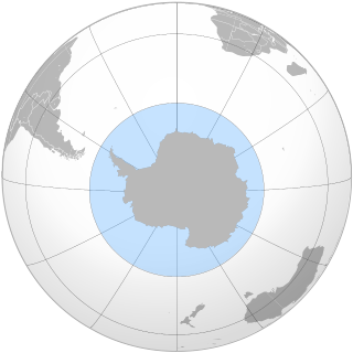
The Southern Ocean, also known as the Antarctic Ocean, comprises the southernmost waters of the world ocean, generally taken to be south of 60° S latitude and encircling Antarctica. With a size of 20,327,000 km2 (7,848,000 sq mi), it is regarded as the second-smallest of the five principal oceanic divisions: smaller than the Pacific, Atlantic, and Indian oceans but larger than the Arctic Ocean.
The Cosmonauts Sea was a proposed sea name as part of the Southern Ocean, off the Prince Olav Coast and Enderby Land, Antarctica, between about 30°E and 50°E. It would have an area of 699,000 square kilometres (270,000 sq mi). It would be bordered by two other proposals from a 2002 International Hydrographic Organization (IHO) draft, a Cooperation Sea to the east and a Riiser-Larsen Sea to the west.
Brine rejection is a process that occurs when salty water freezes. The salts do not fit in the crystal structure of water ice, so the salt is expelled.

Antarctic sea ice is the sea ice of the Southern Ocean. It extends from the far north in the winter and retreats to almost the coastline every summer. Sea ice is frozen seawater that is usually less than a few meters thick. This is the opposite of ice shelves, which are formed by glaciers; they float in the sea, and are up to a kilometre thick. There are two subdivisions of sea ice: fast ice, which are attached to land; and ice floes, which are not.
Open ocean convection is a process in which the mesoscale ocean circulation and large, strong winds mix layers of water at different depths. Fresher water lying over the saltier or warmer over the colder leads to the stratification of water, or its separation into layers. Strong winds cause evaporation, so the ocean surface cools, weakening the stratification. As a result, the surface waters are overturned and sink while the "warmer" waters rise to the surface, starting the process of convection. This process has a crucial role in the formation of both bottom and intermediate water and in the large-scale thermohaline circulation, which largely determines global climate. It is also an important phenomena that controls the intensity of the Atlantic Meridional Overturning Circulation (AMOC).
References
- ↑ David Holland (5 May 2003). "Background - Weddell Polynya". New York University. Retrieved 16 December 2014.
- ↑ D M Holland (1 June 2001). "Explaining the Weddell Polynya--a large ocean eddy shed at Maud Rise". Science. 292 (5522): 1697–700. Bibcode:2001Sci...292.1697H. doi:10.1126/science.1059322. PMID 11387470. S2CID 39712681.
- ↑ Cheon, Woo Geun; Gordon, Arnold L. (6 May 2019). "Open-ocean polynyas and deep convection in the Southern Ocean". Scientific Reports. 9 (1): 6935. Bibcode:2019NatSR...9.6935C. doi:10.1038/s41598-019-43466-2. PMC 6502842 . PMID 31061471.
- ↑ "The Weddell Polynya". University of Toronto/NASA. Retrieved 16 December 2014.
- ↑ Claire L. Parkinson; Joey C. Comiso & H. Jay Zwally (2014). "Nimbus-5 ESMR Polar Gridded Sea Ice Concentrations". National Snow and Ice Data Center. Retrieved 16 December 2014.
- ↑ "Arctic Sea Ice News and Analysis | Sea ice data updated daily with one-day lag".
- ↑ Ryan Whitwam (11 October 2017). "Giant Hole Opens in Antarctic Ice Pack, and No One Knows Why". ExtremeTech.
- ↑ Casimir de Lavergne, Jaime B. Palter, Eric D. Galbraith, Raffaele Bernardello & Irina Marinov (2 March 2014). "Cessation of deep convection in the open Southern Ocean under anthropogenic climate change" (PDF). Nature Climate Change. 4 (4): 278–282. doi:10.1038/nclimate2132.
{{cite journal}}: CS1 maint: multiple names: authors list (link) - ↑ Sarah Zielinski (3 March 2014). "Climate Change Felt in Deep Waters of Antarctica". Smithsonian.com. Retrieved 16 December 2014.
- ↑ Diana Francis, Clare Eayrs, Juan Cuesta, David Holland (24 April 2019). "Polar Cyclones at the Origin of the Reoccurrence of the Maud Rise Polynya in Austral Winter 2017". Journal of Geophysical Research: Atmospheres. JGR: Atmospheres. 124 (10): 5251–5267. Bibcode:2019JGRD..124.5251F. doi:10.1029/2019JD030618. S2CID 149497432.
{{cite journal}}: CS1 maint: multiple names: authors list (link) - ↑ B. Stonehouse (3 December 1967). "Penguins in high latitudes". Tuatara: Volume 15, Issue 3. Victoria University of Wellington. Retrieved 16 December 2014.
| | This Antarctica-related article is a stub. You can help Wikipedia by expanding it. |
| | This oceanography article is a stub. You can help Wikipedia by expanding it. |
| | This glaciology article is a stub. You can help Wikipedia by expanding it. |