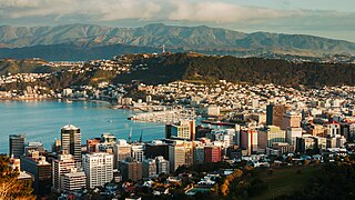
Wellington is the capital city of New Zealand. It is located at the south-western tip of the North Island, between Cook Strait and the Remutaka Range. Wellington is the third-largest city in New Zealand, and is the administrative centre of the Wellington Region. It is the world's southernmost capital of a sovereign state. Wellington features a temperate maritime climate, and is the world's windiest city by average wind speed.

New Zealand is divided into sixteen regions for local government purposes. Eleven are administered by regional councils, and five are administered by unitary authorities, which are territorial authorities that also perform the functions of regional councils. The Chatham Islands Council is not a region but is similar to a unitary authority, authorised under its own legislation.
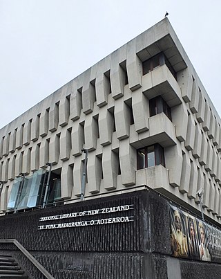
The National Library of New Zealand is charged with the obligation to "enrich the cultural and economic life of New Zealand and its interchanges with other nations". Under the Act, the library's duties include collecting, preserving and protecting New Zealand's documentary heritage, supporting other libraries in New Zealand, and collaborating with peer institutions abroad. The library headquarters is on the corner of Aitken and Molesworth Streets in Wellington, close to the New Zealand Parliament Buildings and the Court of Appeal.

Petone is a large suburb of Lower Hutt, Wellington. It stands at the southern end of the Hutt Valley, on the northern shore of Wellington Harbour.

Wellington International Airport is an international airport located in the suburb of Rongotai in Wellington. It lies 3 NM or 5.5 km south-east from the city centre. It is a hub for Air New Zealand and Sounds Air. Wellington International Airport Limited, a joint venture between Infratil and the Wellington City Council, operates the airport. Wellington is the third busiest airport in New Zealand after Auckland and Christchurch, handling a total of 3,455,858 passengers in the year ending June 2022, and the third busiest in terms of aircraft movements. The airport, in addition to linking many New Zealand destinations with national and regional carriers, also has links to major cities in eastern Australia. It is the home of some smaller general aviation businesses, including the Wellington Aero Club, which operates from the general aviation area on the western side of the runway.
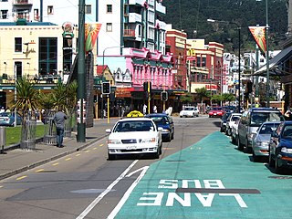
Te Aro is an inner-city suburb of Wellington, New Zealand. It comprises the southern part of the central business district including the majority of the city's entertainment district and covers the mostly flat area of city between The Terrace and Cambridge Terrace at the base of Mount Victoria.
Wellington Regional Council, branded as Greater Wellington Regional Council, is the regional council overseeing the Wellington Region of New Zealand's lower North Island. It is responsible for public transport under the brand Metlink, environmental and flood protection, and the region's water supply. As of 2023, it is the majority owner of CentrePort Wellington with a 77% shareholding.
The Transmission Gully Motorway is a 27-kilometre-long (17-mile), four-lane motorway north of Wellington, New Zealand; it is part of the State Highway 1 route. Construction began on 8 September 2014 and completion was originally scheduled for April 2020, but contractual negotiations as well as difficulties resulting from the COVID-19 pandemic caused delays. The motorway was officially opened on 30 March 2022 and opened to public traffic the following day.

Sir Edward Michael Coulson Fowler was a New Zealand architect and author who served as mayor of Wellington from 1974 to 1983.

Belmont Regional Park is a regional park located between Lower Hutt and Porirua, in the Wellington Region at the southern end of New Zealand's North Island. It is administered by Wellington Regional Council. It was the first park in New Zealand to include land for recreation, conservation and farming.
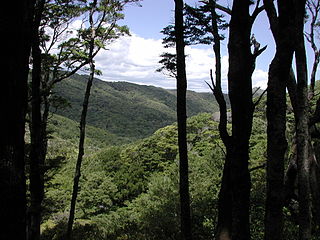
East Harbour Regional Park is a regional park stretching from Baring Head along the east side of the Wellington Harbour along the east side of Eastbourne. It is located in Lower Hutt City, in the Wellington Region of New Zealand's North Island.
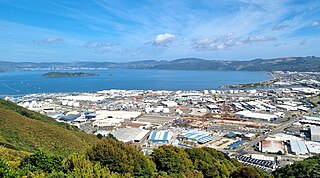
Seaview is an industrial suburb of the city of Lower Hutt, in Wellington, New Zealand. Situated on the eastern coast of the Hutt Valley, the suburb lies between Te Awa Kairangi / the Hutt River and Petone, and the bays of Eastbourne to the south. Seaview is a centre for bulk liquid fuel storage for the lower half of the North Island, and a site for heavy industry. It is also a base for support services for trucks and transportation businesses and the location of the wastewater treatment plant for drainage from the Hutt Valley. Seaview is home to the Port Road Drags, the longest-running street drag races in Australasia.
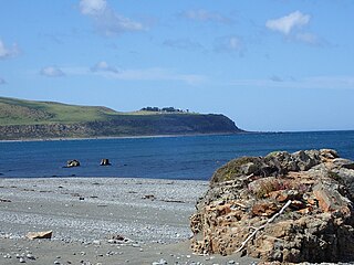
Baring Head is a headland, located between Wellington Harbour and Palliser Bay at the southern end of the North Island of New Zealand. It marks the southern end of Fitzroy Bay.
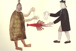
Wellington has been the capital of New Zealand since 1865. New Zealand's first capital city was Old Russell (Okiato) in 1840–41. Auckland was the second capital from 1841 until 1865, when Parliament was permanently moved to Wellington after an argument that persisted for a decade. As the members of parliament could not agree on the location of a more central capital, Wellington was decided on by three Australian commissioners.

Evans Bay is a large bay at the southern end of Wellington Harbour, New Zealand. Located between the Miramar Peninsula and Hataitai, it was the site of New Zealand's first patent slip and served as Wellington's international flying-boat terminal from 1938 until 1956. It is named after George Samuel Evans, an early Wellington settler.

Wellington Harbour Board was the body which formerly managed the shipping and commercial affairs of the port of Wellington in New Zealand. It was constituted in 1880 and was disestablished in 1989.

Helene Ruth Paula Ritchie is a former local body politician, registered psychologist and mediator, and a board member from Wellington, New Zealand. As Wellington's longest serving City Councillor of over 30 years, she led the Labour team to a majority position on the council. Later, she was the first female deputy mayor and chaired the Wellington Airport Authority and its successor for eight years.
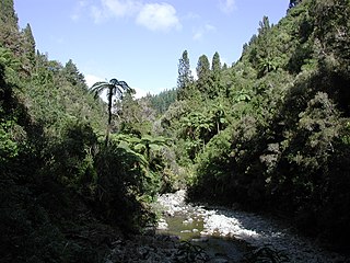
Akatarawa Forest is a regional park in the Upper Hutt within the Wellington Region at the southern tip of the North Island of New Zealand. It encompasses 15,000 hectares of native and plantation forest. It includes the headwaters of the Maungakotukutuku Steam, Akatarawa River West and the Whakatīkei River.

BNZ Harbour Quays was a large, award-winning office building on the waterfront in Wellington, New Zealand. It was built in 2009 and leased to the Bank of New Zealand, but suffered earthquake damage in the 2013 Seddon earthquake and the 2016 Kaikōura earthquake. The building was demolished in 2019.


